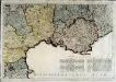
Maps of Languedoc-Roussillon

IX, uit: General-Karte von Mittel-Europa in 12 Blättern, im Masse 1:1.200.000 / entworfen, bearb. und hrsg. von Josef Schlacher
1 : 1200000 Annotatie: Blad 6 ontbreekt; Annotatie geografische gegevens: 21 maatstokken op blad 9; Legenda op blad 9 Wien : K.K. Militär Geografisches Institut
[Frankreich in 4 Blättern, Südöstliches Frankreich]
Hand-Atlas über alle Theile der Erde und über das Weltgebäude Stieler, Adolf Justus Perthes
Carte de la République française, 4
1 Blatt : 42 x 51 cm P.G. Chanlaire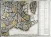
Carte de la France, 4
1 Blatt : 61 x 83 cm de Belleyme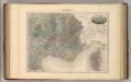
France S.E.
1 : 1615000 Migeon, J.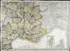
Carte de la France, 4
1 Blatt : mehrfarbig ; 61 x 82 cm de Belleyme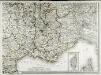
Carte de la France, 4
1 Blatt : 61 x 83 cm de Belleyme
Frankreich SO.
1 : 1700000 Handtke, Friedrich H.

France.
1 : 4400000 Vivien de St Martin, L.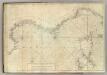
Carte De La Mer Mediterranee. III.
Roux, Joseph
France Flle. S.E.
1 : 1000000 Vivien St Martin, L.
Vorstellvng des Weges den Hannibal genom[m]en durch Gallien und über die Alpen bis in Italien
1 : 2650000 Alpy Baumgarten, Siegmund Jakob Glasser, I. F. Johann Justinus Gebauer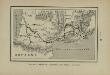
Marche des Visigoths en Gaule
Frankreich Gallien Westgoten Völkerwanderungszeit Völkerwanderung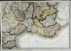
Carte de la république de France, no. 6
1 Blatt : 42 x 58 cm s.n.
Der Südliche Theil von Frankreich nebst einem Theile von Spanien
Stieler's Hand-Atlas Stieler, Adolf bei Justus Perthes
Der südliche Theil von Frankreich nebst einem Theile von Spanien

Le royaume de France, 5
1 Blatt : 48 x 42 cm Jaillot
[Frankreich in 4 Blättern, Blatt 4]
Handatlas über alle Theile der Erde und über das Weltgebäude Stieler, Adolf Justus Perthes
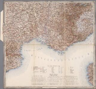
Postkarte von Frankreichs südoestlichen Departements oder von Languedoc, Provence, Delphinat und Savoyen
Dauphiné (Francie) Müller, Franz im von Reillyschen Landkarten und Kunstwerke Verschleiss Komptoir
Der Südliche Theil von Frankreich nebst einem Theile von Spanien
Hand-Atlas über alle Theile der Erde nach dem neuesten Zustande und über das Weltgebäude Stieler, Adolf bei Justus Perthes
[Frankreich, Blatt 4]
Adolf Stieler's Handatlas über alle Theile der Erde und über das Weltgebäude Stieler, Adolf Justus Perthes
Der Südliche Theil von Frankreich nebst einem Theile von Spanien
Hand-Atlas über alle Theile der Erde nach dem neuesten Zustande und über das Weltgebäude Stieler, Adolf bei Justus Perthes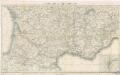
Reisekarte von Süd - Frankreich

Les royau.mes de Bourgogne, et d'Arles
1 Karte : Kupferdruck ; 39 x 49 cm, Bildgrösse 40 x 56 cm Duval chez l'auteur en l'isle du Palais sur le quay de l'Orloge au coin de la rüe de Harlay

Frankreich In 4 Blattern, Blatt 4.
1 : 1500000 Vogel, C.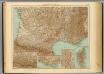
35-36. Francia sud.
1 : 1500000 Touring club italiano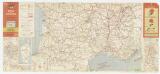
Etat des routes : hôtels, bonnes tables, mécaniciens, routes enneigées
1 : 1000000 Annotatie: Met aansluitende bijkaart van Corsica Paris : Services de Tourisme Michelin