Maps of Mogersdorf

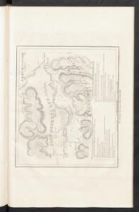
Bataille de St. Gotthard
Nouvel atlas physique politique et historique de l'Empire ottoman et des états limitrophes en Europe, en Asie et en Afrique, en quarante feuilles Hellert, J.J. Bellizard, Dufour et Cie
Gleichenberg
1 : 75000 Bad Gleichenberg
Gleichenberg.
from Spezialkarte der osterreichisch-ungarischen Monarchie.
Yugoslavia 1:100,000, Murska Sobota
Yugoslavia 1:100,000 , Series GSGS 4396. Great Britain. War Office. [London] : War Office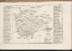
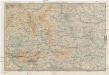
Eisemburger Com. Tab. II
Ungarn Komitat Vas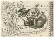
Stÿriae Ducatus Fertilisimi Nova Geographica Descriptio
1 : 200000 Mollova mapová sbírka Vischer, Georg Matthaeus Trost, Andreas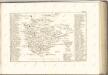

Štajnamanger
1 : 200000 Szombathely (Maďarsko) Kartografska radionica
Comitat Eisenburg
1 : 290000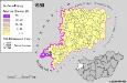
Slowenen im Komitat Vas 1980
Komitat Vas Slowenen, Siedlung Bottlik, Zsolt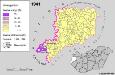
A szlovének arány és száma Vas megyében 1941-ben
Komitat Vas Slowenen, Siedlung Bottlik, Zsolt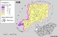
A szlovének arány és száma Vas megyében 1980-ban
Komitat Vas Slowenen, Siedlung Bottlik, Zsolt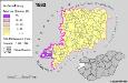
Slowenen im Komitat Vas 1880
Komitat Vas Slowenen, Siedlung Bottlik, Zsolt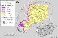
Slowenen im Komitat Vas 1941
Komitat Vas Slowenen, Siedlung Bottlik, Zsolt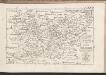
C. Castriferrei
Ungarn Komitat Vas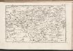
C. Szaladiensis. Tab. II
Ungarn Komitat Zala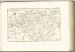

Steinamanger 161, uit: Special-Karte von Mittel-Europa / nach amtlichen Quellen bearbeitet von W. Liebenow
1 : 300000 titelvariant: W. Liebenow's Mittel-Europa; Annotatie: Titel boven de bladen: W. Liebenow's Mittel-Europa Johannes Wilhelm Liebenow 1822-1897 Frankfurt a. M. : Ludwig Ravenstein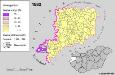
A szlovének arány és száma Vas megyében 1880-ban
Komitat Vas Slowenen, Siedlung Bottlik, Zsolt
Landschaftstypen und zugehörige Wirtschaftsformen
Mittelsteiermark Landschaftsgliederung, Wirtschaft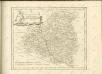

Vas vármegye
1 : 450000 Kenedics, József Görög, Demeter Görög
Verschiebung der Bevölkerung 1910-1920/23
Mittelsteiermark Bevölkerungsentwicklung
Lutzelfrau und Pudelmutter in der Oststeiermark und im Burgenland
Steiermark, Burgenland, Volkskunde Umschaden, Kurt ; Neunteufl, Walter
Comitatus Castri Ferrei
1 : 110000 Maďarsko Kenedics, Joseph Mansfeld, Johann Ernst
Wirtschaftskarte
Mittelsteiermark Wirtschaft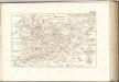

Der Noerdliche Theil von Untersteyermark oder der Graetzer Kreis
1 : 260000 Rakousko Kindermann, Joseph Karl Junker, Christoph bey Franz Xaver Miller
Sbírka map a diagramů použitých na mírových konferencích v Paříži v letech 1919 - 1920