Mappa catalogata
n/a


Titolo completo:n/a
Anno di illustrazione:1804
Data di pubblicazione:1804
Dimensione fisica:20 x 30 cm
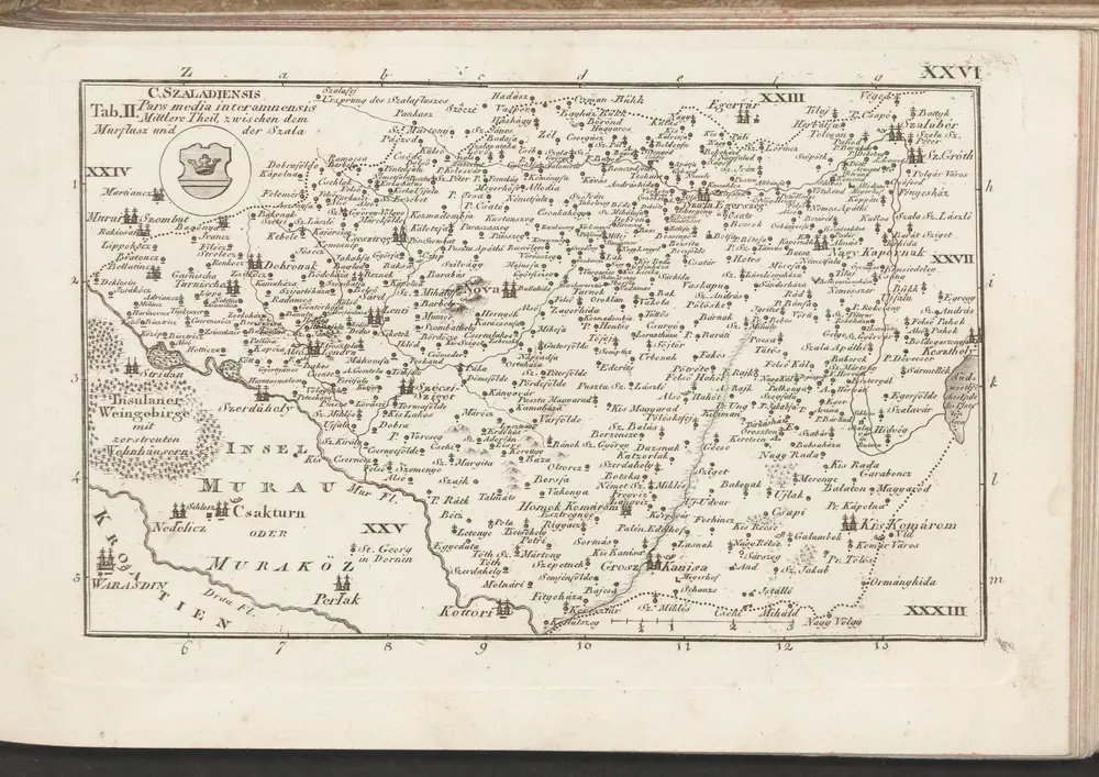
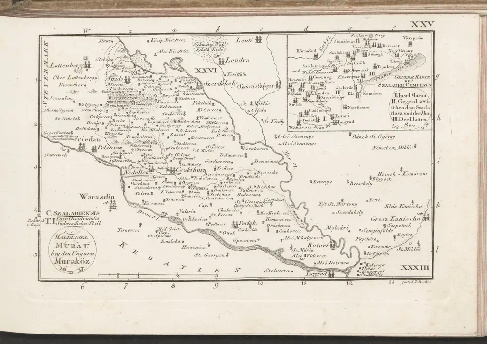
C. Szaladiensis. Tab. II
1804
n/a
1804
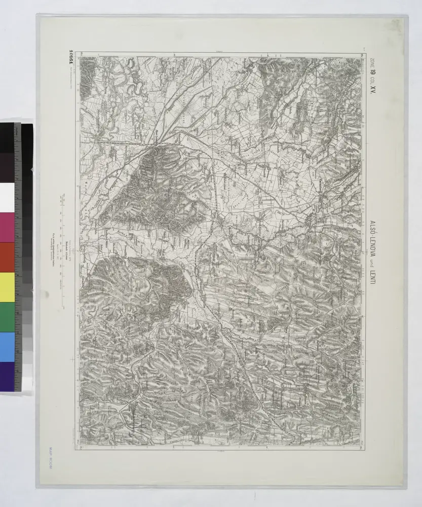
Also-Lendva und Lenti.
1914
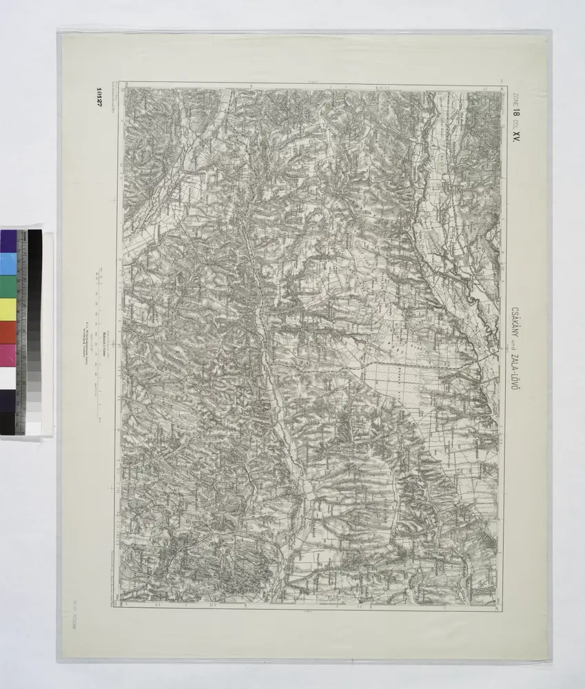
Czakany und Zala-Lovo (Ungarn).; Spezialkarte der osterreichisch-ungarischen Monarchie.
1907
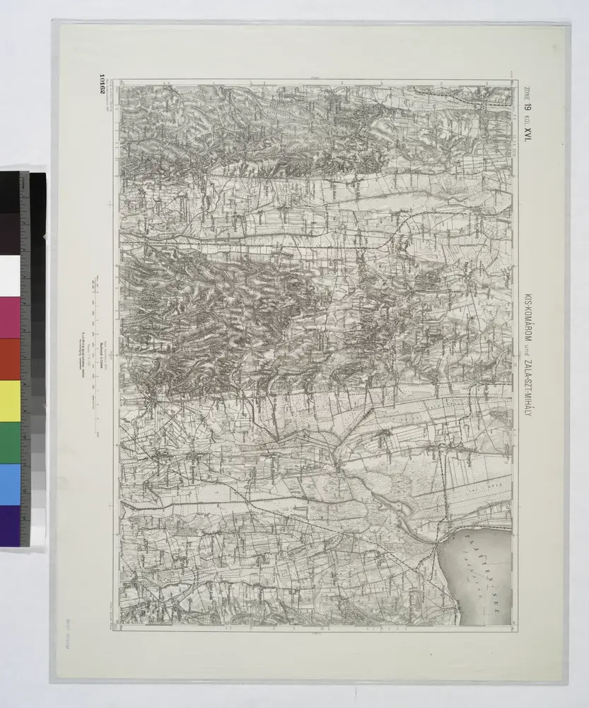
Kis-Komarom und Zala-Szt.-Mihaly.
1914
C. Szaladiensis. Tab. I
1804

Sumeg und Zala-Egerszeg.
1914
n/a
1804
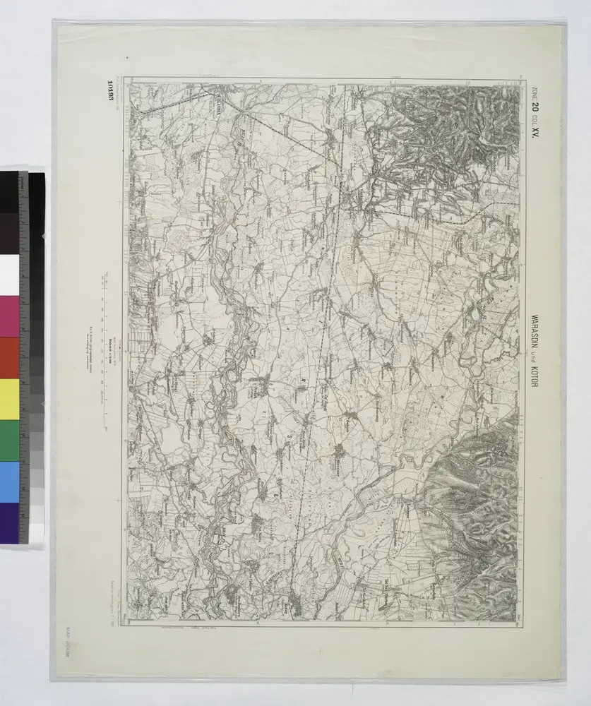
Warasdin und Kotor.; Spezialkarte der osterreichisch-ungarischen Monarchie.
1910
n/a
1804