Project
Community
News
My maps
Gecatalogiseerde kaart
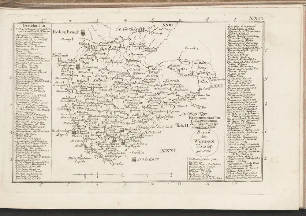
Eisemburger Com. Tab. II
View on external website
Volledige titel:
Eisemburger Com. Tab. II
Jaar illustratie:
1804
Pubdatum:
1804
Fysieke grootte:
20 x 30 cm
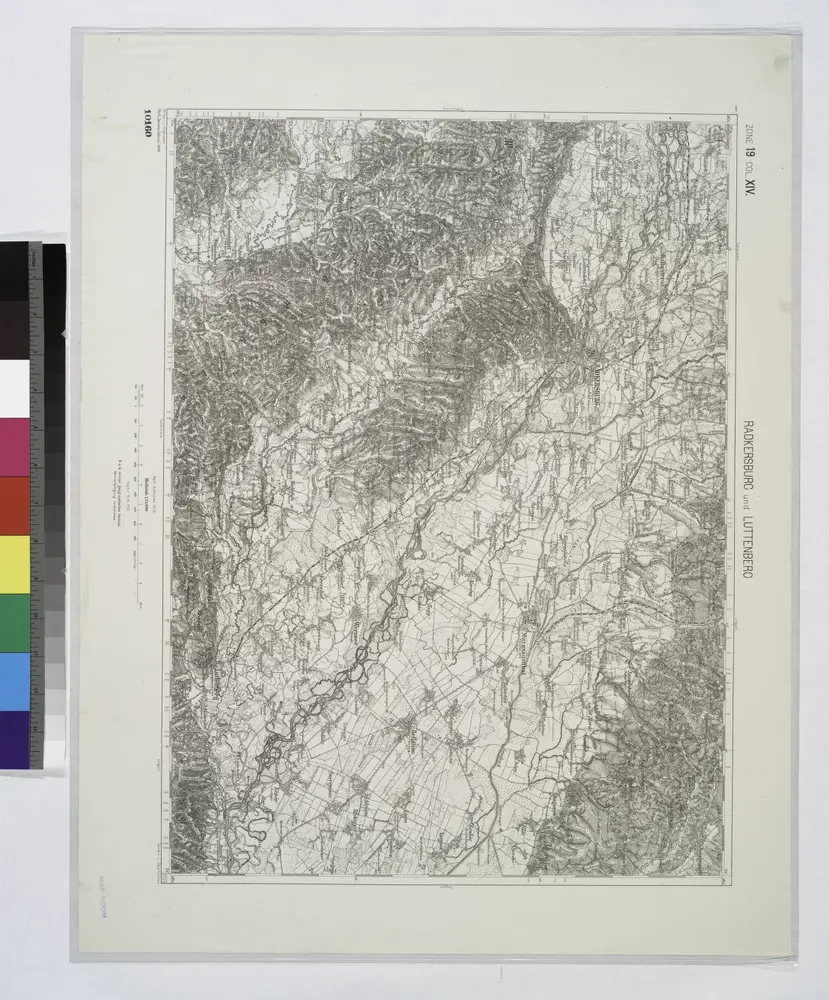
Radkersburg und Luttenberg.
1914
Eisemburger Com. Tab. II
1804
n/a
1804
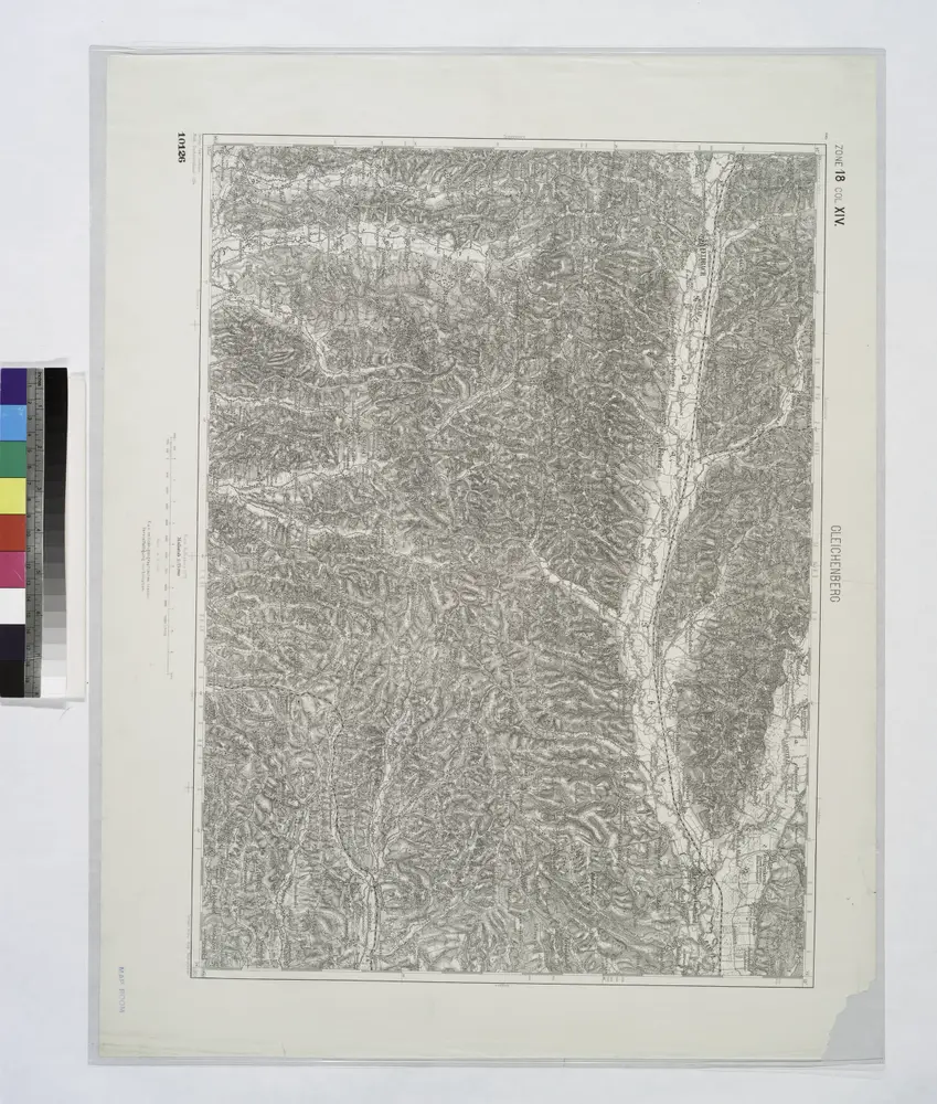
Gleichenberg.
1914
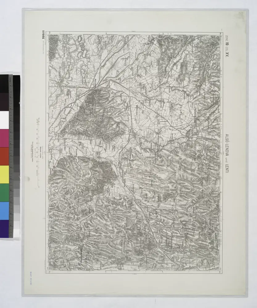
Also-Lendva und Lenti.
1914
Der mittlere Theil von Untersteyermark oder der Marburger Kreis
1809
Kindermann; Miller; Junker
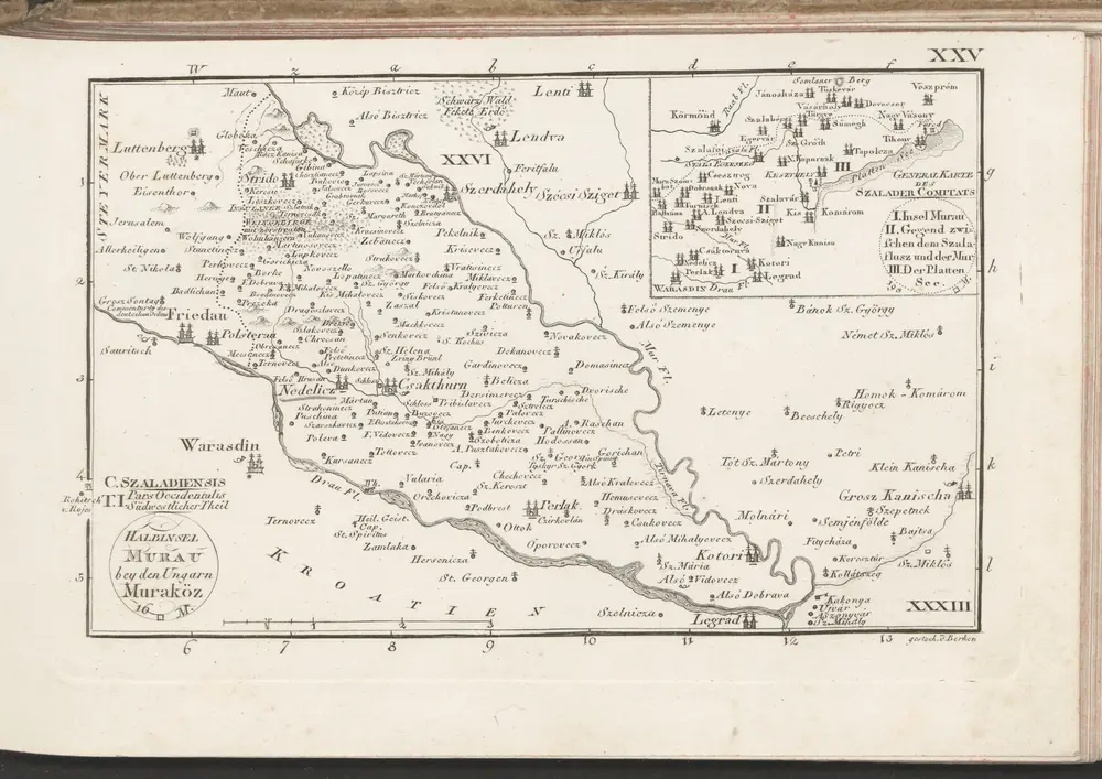
C. Szaladiensis. Tab. I
1804
n/a
1804
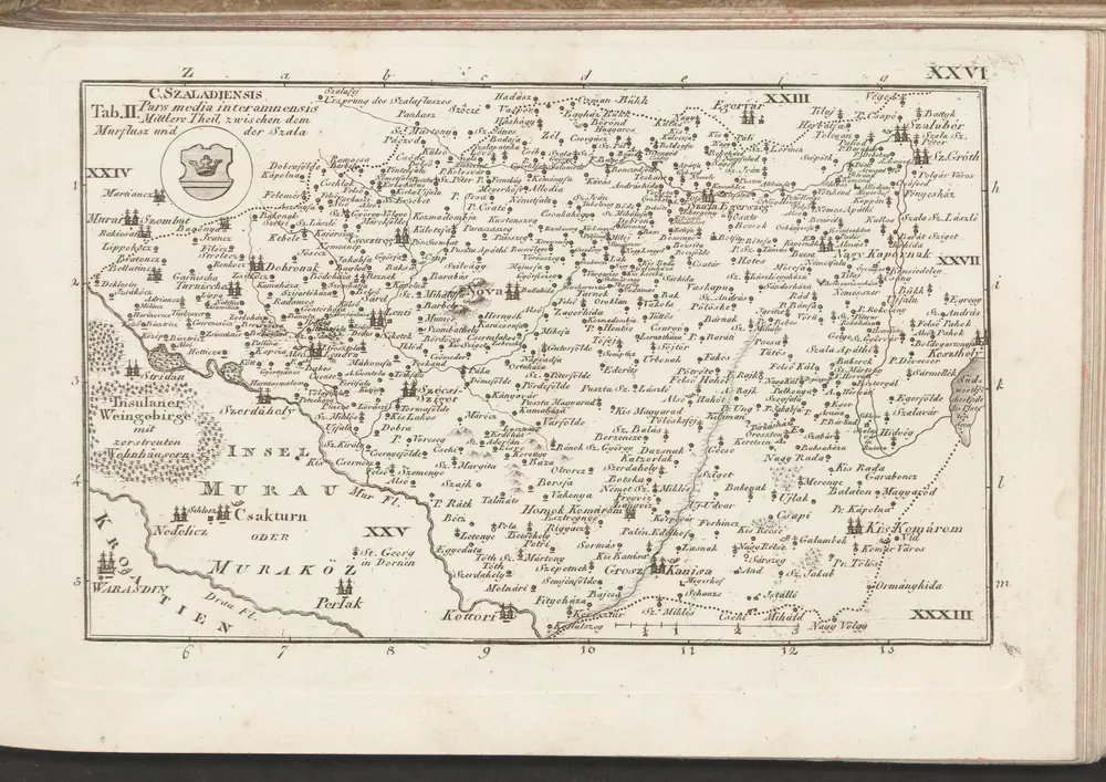
C. Szaladiensis. Tab. II
1804
n/a
1804
Geschiedenis