Maps of England

Great Britain
A new general atlas of modern geography, consisting of a complete collection of maps of the four quarters of the globe Wyld, James James Wyld
61-62. England and Wales. The World Atlas.
1 : 1250000 USSR (Union of Soviet Socialist Republics).
England
1 Karte : Kupferdruck ; 65 x 52 cm Mannert; Schneider; Rocque; Kitchin; Campbell; Cary bey Adam Gottl. Schneider und Weigel
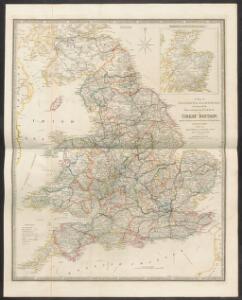
Composite: (Cary's England, Wales, and Scotland).
1 : 360000 Cary, John, ca. 1754-1835
Composite: England.
1 : 755000 Pinkerton, John, 1758-1826
Accuratissima Angliæ regni et Walliæ principatus descriptio
1 Karte : Kupferdruck ; 57 x 47 cm Wit ex officina I. Cóvens et C. Mortier
Accuratissima Angliæ regni et Walliæ principatus descriptio
1 Karte : Kupferdruck ; 57 x 47 cm Wit Frederick de Wit
Charte von England
Anglie Streit, Friedrich Wilhelm
Composite: England and Wales.
1 : 900000 Hughes, William
A new and correct map of the roads in England and Wales wherein are contained all the road waies and the principal cross roads, with the computed distances [...] &c.
1 : 1300000 ingraven by Sutton Nicholls London : printed and sold by H. Overton at the White Horse without Newgate
England, Wales.
1 : 2400000 Mitchell, Samuel Augustus
Ireland, Scotland.
1 : 2400000 Mitchell, Samuel Augustus
England, Wales.
1 : 2400000 Mitchell, Samuel Augustus Jr.
England, Wales.
1 : 2400000 Mitchell, Samuel Augustus
England, Wales.
1 : 2400000 Mitchell, Samuel Augustus
England and Wales.
1 : 1725000 Teesdale, Henry
England.
1 : 1760000 Mitchell, Samuel Augustus
England.
1 : 1760000 Mitchell, Samuel Augustus
County Map Of England, And Wales.
1 : 2400000 Mitchell, Samuel Augustus
England.
1 : 1900000 Radefeld, Carl Christian Franz, 1788-1874
[Recto], uit: England and Wales
1 : 1108000 [London] : Philip [etc.]

Ordnance survey map of Roman Britain
1 : 1000000 Velká Británie Ordnance Survey Office
A travelling mapp of England containing the principall roads which are laid down with the comensurated distances
1 : 1330000 [...] by Philip Lea London : sold by Philip Lea Globe maker at the Atlas and Hercules in Cheap side neer Fryday Street end
England.
1 : 1760000 Tanner, Henry S.
England.
1 : 1760000 Tanner, Henry S.
Cycling road-map of England & Wales
1 : 1038000 Anglie G. W. Bacon & Co.
England and Wales.
1 : 1550000 Rand McNally and Company
England And Wales.
1 : 1300000 Johnson, A.J.