Maps of Norway

Schweden und Norwegen auch Daenemark, Nördliches Blatt]
Hand-Atlas über alle Theile der Erde nach dem neuesten Zustande und über das Weltgebäude Stieler, Adolf bei Justus Perthes

Schweden und Norwegen auch Daenemark
Stieler's Hand-Atlas Stieler, Adolf bei Justus Perthes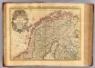
Courones du nord.
1 : 2500000 L'Isle, Guillaume de, 1675-1726
Statistikk 26-2b: Herreder, hvis Kornavl er tilstrækkelig til eget Brug
1 : 2400000
Statistikk kart 13-b: Norvège. Division ecclesiastique
1 : 2400000
Statistikk 26-7b: Udsæd af Poteter
1 : 2400000
Statistikk 26-7c: Faar. Antall Dyr pr 1000 Maal høstet Areal
1 : 2400000
Ost-Europa In 6 Blattern, Enthaltend: Norwegen, Schweden, Russland, Kaukasien Und Die Turkei .
1 : 3700000 Petermann, A.
Spesielle kart 129-4: Bilag nr 3 til opmaalingens budgetforslag for 1915-1916
1 : 2800000
Statistikk kart 4-2: Kart udvisende Folkemængens fordeling i Norge
1 : 2400000
Statistikk 26-9b: Avling reduceret til bygværdi pr. indbygger, fogderivis
1 : 2400000
Statistikk 26-6c: Hornkvæg. Middeltal pr Gaard
1 : 2400000
Statistikk kart 20-4: Fremstilling af den norske Fædrift. Faaret. Dyrenes antal pr 1000 maal afhøstet areal
1 : 2400000
Statistikk 26-3b: Fremstilling af Kongeriget Norges Landbrug. Agerbruget
1 : 2400000
Statistikk kart 21-2: Norvege. Pêches.
1 : 2400000
Statistikk kart 20-3: Fremstilling af den norske Fædrift. Gjeden. Dyrenes antal pr. 1000 maal afhøstet areal
1 : 2400000
Statistikk kart 20-2: Fremstilling af den Norske Fædrift. Hornkvæget. Dyrenes antal pr 1000 maal afhøstet areal
1 : 2400000
Statistikk kart 11-4: Division judiciaire
1 : 2400000
Northern Sweden and Frontier of Russia.
1 : 3380000 Sharpe, J.
Statistikk 26-10b: Eng i Procent af den dyrkede Jord, fogderivis
1 : 2400000
Statistikk 26-3c: Faar. Antal Dyr pr 1000 Maal høstet Areal
1 : 2400000
Statistikk kart 13-a: Norvège. Division ecclesiastique
1 : 2400000
Statistikk 26-2c: Hornkvæg. Antal Dyr pr 1000 Maal høstet Areal
1 : 2400000
Statistikk 26-9c: Husdyrene reduceret til Hornkvæg for hver Gaard
1 : 2400000
Statistikk kart 19-6: Fremstilling af Norges Agerbrug. Hovedsæden i hvert Herred
1 : 2400000
Statistikk 26-1b: Hovedsæden i hvert Herred
1 : 2400000
Statistikk kart 19-5: Fremstilling af Norges Agerbrug. Potetsavlen. Udsæd beregnet pr 1000 maal ager
1 : 2400000
Jordbunnskart
1 : 2000000 Juel Låg Norges Landbrukshøgskole | Norges geografiske oppmåling
![Schweden und Norwegen auch Daenemark, Nördliches Blatt]](https://images-2.georeferencer.com/images/iiif/177611754196/full/,300/0/native.jpg)

