Maps of Israel

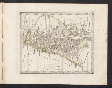
Palaestina
Schul-Atlas der alten Welt bei Justus Perthes
Palestine ou Terre Sainte.
1 : 610000 Lapie, M. (Pierre), 1779-1850
A map of Palestine or the Holy Land : with the division into tribes and provinces / by A.H. Dufour
1 : 1100000 Annotatie: Engraved for "Three years in the East". &a Dufour, Auguste Henri [S.l. : s.n.]
Terra Sancta : vita miraculis et passione Christi consecrata / autore N. Sanson Abbavilleo
1 : 3000000 Sanson, Nicolas [S.l. : s.n.]
Palästina
Volksschul-Atlas über alle Teile der Erde Lange, Henry Druck und Verlag von Georg Westermann
Aardrijkskundige, plaatsbeschrijvende en geschiedkundige kaart van Palestina of het Heilige land
1 : 281000 oorspronkelijk geteekend door J.T. Assheton [...] bijzonderlijk wat de teekening betreft naauwkeurig herz. en verb. door E. Maaskamp ; onder toezigt en medew. van [...] J. Clarisse Te Amsterdam : bij E. Maaskamp, thans het eigendom van J. C. van Kesteren, boekhandelaar en boekdrukker te Amsterdam
Schul-Atlas für die alte Erdbeschreibung : zur allgemeinen Schul-encyclopädie gehörig
J. H. Campe Zusammensetzung und Zeichnung von [...] Dufour, unter Leitung von Heusinger ; gestochen von Frentzel. Braunschweig : Schulbuchhandlung
Palestine
1 : 1000000 Colton, G.W.
't Land Kanaan benevens Gilead verdeelt onder de XII stammen Israëls waar in de gelegendheid en uitgestrektheid van ieder erfdeel word aangewezen
1 : 700000 door W.A. Bachiene J. van Jagen mapp. sculpsit, et figur. apposit. sculpturam curavit ; J.C. Philips fecit. Uitgegeven te Gorinchem : by Nicolaas Goetzee
Nova totivs Palestinae sev Terrae Sanctae descriptio pagella vna ita vt bibliorvm volvminibvs congrvat
1 : 755000 Palestina Jenichen, Balthasar Ausfeld, Johann Carl
Karte von Palaestina
1 : 1030000 Jeruzalém Klöden, Karl Friedrich von Mare, Carl bei August Rücker
Judaea sive Terra Sancta quae Israelitarum suas duodecim tribus distincta, secretis ab invicem regnis Juda, et Israel expressis in super sex ejusdem terrae provincijs
1 : 650000 ex conatibus geographicis Gulielmi Sanson [...] Amst[erdam] : ex officina R. & J. Ottens
Palestina

Palestine.
1 : 1000000 Colton, G.W.
Judaea seu Terra Sancta quae Hebraeorum sive Israelitarum in suas duodecim tribus divisa, secretis ab invicem regnis Juda, et Israel expressis insuper sex ultimi temporis ejusdem terrae provincijs
1 : 740000 ex conatibus geographicis Gulielmi Sanson [...] A Amsterdam : chez Pierre Schenk
Terre de Canaan á present la Palestine
1 : 1100000 Kanaán
Palaestina za času Krista Pána
1 : 1030000 Izrael Fáborský, Jan B. Dědictví sv. Cyrilla a Methodia
Palaestina za času Krista Pána
1 : 1030000 Izrael Fáborský, Jan B. Dědictví sv. Cyrilla a Methodia
Turkey in Asia (Biblical Regions) The Holy Land And Its Borders.
1 : 696960 Fullarton, A. & Co.
[Karte von Palästina]
1 : 500000 Palestina Leway, G.
Afbeelding van 't land van Israël, naar deszelfs natuurlyke gesteltheid : waar in alle de zeën, rivieren en beeken, gelyk ook de bergen en dalen, de vlaktens, de woestynen, enz. dezes lands, die in de H.S. genoemt zyn, worden aangewezen
1 : 750000 door W.A. Bachiene J. van Jagen sculp. ; J.C. Philips fecit. te Gorinchem : by Nicolaas Goetzee
Palestine.
1 : 1650000 Monin, C.V.
Bez titulu: Historický Atlas

Iudaea, seu Terra Sancta quae hebraeorum sive Israelitarum in suas duodecim tribus divisa, secretis ab invicem regnis Iuda, et Israel expressis insuper sex ultimi temporis ejusdem terrae provinciis
1 : 600000 Izrael Sanson, Guillaume Schenk, Pieter Pierre Schenk
Iudaea, seu Terra Sancta quae Hebraeorum sive Israelitarum in suas duodecim tribus divisa, secretis ab invicem regnis Iuda, et Israel expressis insuper sex ultimi temporis ejusdem terrae provinciis
1 : 600000 Izrael Sanson, Guillaume Schenk, Pieter Pierre Schenk
Palestine.
1 : 684288 Stanford, Edward
Palestina za doby soudců a králů

Kaart van 't land Kanaan / naar de beste waarnemingen tot verstand van Num. XXI:14-31 ontworpen door R. Schutte ; J. van Jagen sculps. 1766
1 : 800000 Annotatie: Waarschijnlijk blad uit zakatlas Schutte, Rutger; Jagen, J. van Te Amsterdam : by J. Loveringh
Palestina nynější