Maps of Smíchov

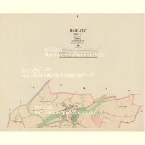
Radlitz (Radlic) - c6361-1-002 - Kaiserpflichtexemplar der Landkarten des stabilen Katasters
1 : 2880
Radlitz (Radlic) - c6361-1-001 - Kaiserpflichtexemplar der Landkarten des stabilen Katasters
1 : 2880
Auto-Praha : automobilní plán Velké Prahy a příručka pro automobilisty
1 : 50000
Orientační plán hlavního města Prahy s okolím

Orientační plán hlavního města Prahy s okolím

Orientační plán hlavního města Prahy s okolím
1 : 5000
Orientační plán Prahy a obcí sousedních List 20.

Orientační plán Prahy a obcí sousedních List 20.
1 : 5000
Okolí nádraží c.k. české výsadní dráhy západní
Smíchov (Praha, Česko) Nehasil, F. Bembé
Ginonitz (Ginonic) - c2920-1-004 - Kaiserpflichtexemplar der Landkarten des stabilen Katasters
1 : 2880
Ginonitz (Ginonic) - c2920-1-002 - Kaiserpflichtexemplar der Landkarten des stabilen Katasters
1 : 2880
Ginonitz (Ginonic) - c2920-1-003 - Kaiserpflichtexemplar der Landkarten des stabilen Katasters
1 : 2880
Ginonitz (Ginonic) - c2920-1-005 - Kaiserpflichtexemplar der Landkarten des stabilen Katasters
1 : 2880
Ginonitz (Ginonic) - c2920-1-001 - Kaiserpflichtexemplar der Landkarten des stabilen Katasters
1 : 2880
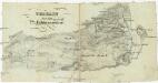
Plan des südlichen Moldauthal ́s bei Prag
Terrain für das 2te Feldmanoeuvre
1 : 60000 Praha (Česko)
Orientační plán sídel. hlav. města Prahy
1 : 12000 Libeň (Praha, Česko) M. Král
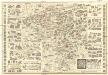
Bez titulu: Polohopisný plán královského hlavního města Prahy
Názorný plán Prahy
1 : 7700 Praha (Česko) Lauda, Ladislav Státní ústav pro učebné pomůcky škol průmyslových a odborných
Nejnovější a nejúplnější plán královského hlav. města Prahy, Karlína, Žižkova, Královských Vinohradů, Vršovic, Nuslí, Smíchova a nejbližšího okolí
1 : 12000 Karlín (Praha, Česko) Brož, Josef A. Storch syn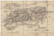
Croquis zur schriftlichen Ausarbeitung
1 : 13500 Bílá Hora (Praha, Česko)
Smichow - c7068-1-001 - Kaiserpflichtexemplar der Landkarten des stabilen Katasters
1 : 2880
Smichow - c7068-1-005 - Kaiserpflichtexemplar der Landkarten des stabilen Katasters
1 : 2880
Smichow - c7068-1-003 - Kaiserpflichtexemplar der Landkarten des stabilen Katasters
1 : 2880
Smichow - c7068-1-002 - Kaiserpflichtexemplar der Landkarten des stabilen Katasters
1 : 2880
Smichow - c7068-1-004 - Kaiserpflichtexemplar der Landkarten des stabilen Katasters
1 : 2880
Smíchov
1 : 5760
Smíchov

Potrubí a situace nové vodárny pražské (vyznačeno červeně)
1 : 14300 Praha (Česko)
Hluboczep (Hluboczepy) - c1885-1-004 - Kaiserpflichtexemplar der Landkarten des stabilen Katasters
1 : 2880
Hluboczep (Hluboczepy) - c1885-1-001 - Kaiserpflichtexemplar der Landkarten des stabilen Katasters
1 : 2880
Hluboczep (Hluboczepy) - c1885-1-003 - Kaiserpflichtexemplar der Landkarten des stabilen Katasters
1 : 2880