Maps of Smíchov

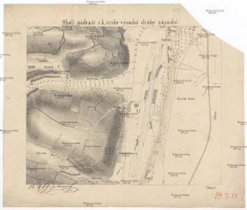
Okolí nádraží c.k. české výsadní dráhy západní
Smíchov (Praha, Česko) Nehasil, F. Bembé
Plan von Wischehrad
Vyšehrad (Praha, Česko) Bittner, Joseph Pluth, Caspar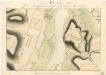
Plan von Wischohrad samt der gegenüberliegenden Gegend

Smíchov

Smichow - c7068-1-001 - Kaiserpflichtexemplar der Landkarten des stabilen Katasters
1 : 2880
Smichow - c7068-1-005 - Kaiserpflichtexemplar der Landkarten des stabilen Katasters
1 : 2880
Smichow - c7068-1-003 - Kaiserpflichtexemplar der Landkarten des stabilen Katasters
1 : 2880
Smichow - c7068-1-002 - Kaiserpflichtexemplar der Landkarten des stabilen Katasters
1 : 2880
Smichow - c7068-1-004 - Kaiserpflichtexemplar der Landkarten des stabilen Katasters
1 : 2880
Praha, hlavní město ČSR : Fastrův obrázkový plán a průvodce
1 : 10000
Plán hlavního města království českého Praha
[Smíchov a Košíře]
Košíře (Praha, Česko)
Plán výstavy
Košíře (Praha, Česko) Schulz, R. A. Medau, Karel Vilém
Smíchov : předměstí král. hlavního města Prahy

Orientační plán král. Hl. města Prahy

Orientační plán Prahy a obcí sousedních List 15.
1 : 5000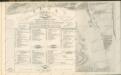
Plán královského hlavního města Prahy 1815

Orientační plán hlavního města Prahy s okolím

Radlitz (Radlic) - c6361-1-002 - Kaiserpflichtexemplar der Landkarten des stabilen Katasters
1 : 2880
Radlitz (Radlic) - c6361-1-001 - Kaiserpflichtexemplar der Landkarten des stabilen Katasters
1 : 2880
Orientační plán hlavního města Prahy s okolím
1 : 5000
Orientační plán Prahy a obcí sousedních List 20.

Orientační plán Prahy a obcí sousedních List 20.
1 : 5000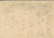
Polohopisný plán královského hlavního města Prahy : 1.Staré město, 2.Nové město, 3.Malá strana, 4.Hradčany, 5.Josefov, 6.Vyšehrad pak Smíchova, Karlína, král.Vinohradů, Žižkova a Nuslí, s udáním starých i nových čísel domů
1 : 4000
Smíchov
1 : 5760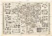
Názorný plán Prahy
1 : 7700 Praha (Česko) Lauda, Ladislav Státní ústav pro učebné pomůcky škol průmyslových a odborných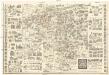
Názorný plán Prahy
1 : 7700 Praha (Česko) Lauda, Ladislav Státní ústav pro učebné pomůcky škol průmyslových a odborných
Plan von Prag
1 : 12000 Praha (Česko)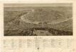
Praha