Maps of Lukov

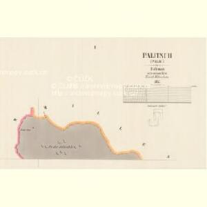
Palitsch (Palič) - c5621-1-003 - Kaiserpflichtexemplar der Landkarten des stabilen Katasters
1 : 2880
Palitsch (Palič) - c5621-1-001 - Kaiserpflichtexemplar der Landkarten des stabilen Katasters
1 : 2880
Palitsch (Palič) - c5621-1-002 - Kaiserpflichtexemplar der Landkarten des stabilen Katasters
1 : 2880
Lukow - c4309-1-003 - Kaiserpflichtexemplar der Landkarten des stabilen Katasters
1 : 2880
Lukow - c4309-1-002 - Kaiserpflichtexemplar der Landkarten des stabilen Katasters
1 : 2880
Lukow - c4309-1-004 - Kaiserpflichtexemplar der Landkarten des stabilen Katasters
1 : 2880
Lukow - c4309-1-001 - Kaiserpflichtexemplar der Landkarten des stabilen Katasters
1 : 2880
Lhotta - c3920-1-001 - Kaiserpflichtexemplar der Landkarten des stabilen Katasters
1 : 2880
Topographischer Plan zwischen Trebnitz, Millischau und den Kletschen Berg
1 : 15000 Bílka (Bořislav, Česko) Marssovicky
Geologische Karte des Böhmischen Mittelgebirges
1 : 25000 Kostomlaty pod Milešovkou (Česko : oblast) Hibsch, Josef Emanuel
Nedwieditsch (Nedwědic) - c4548-1-002 - Kaiserpflichtexemplar der Landkarten des stabilen Katasters
1 : 2880
Nedwieditsch (Nedwědic) - c4548-1-001 - Kaiserpflichtexemplar der Landkarten des stabilen Katasters
1 : 2880
Nedwieditsch (Nedwědic) - c4548-1-003 - Kaiserpflichtexemplar der Landkarten des stabilen Katasters
1 : 2880
Milleschau (Milessow) - c4650-1-004 - Kaiserpflichtexemplar der Landkarten des stabilen Katasters
1 : 2880
Milleschau (Milessow) - c4650-1-002 - Kaiserpflichtexemplar der Landkarten des stabilen Katasters
1 : 2880
Milleschau (Milessow) - c4650-1-005 - Kaiserpflichtexemplar der Landkarten des stabilen Katasters
1 : 2880
Milleschau (Milessow) - c4650-1-001 - Kaiserpflichtexemplar der Landkarten des stabilen Katasters
1 : 2880
Milleschau (Milessow) - c4650-1-003 - Kaiserpflichtexemplar der Landkarten des stabilen Katasters
1 : 2880
Milleschau (Milessow) - c4650-1-006 - Kaiserpflichtexemplar der Landkarten des stabilen Katasters
1 : 2880
Merzkles - c4875-1-002 - Kaiserpflichtexemplar der Landkarten des stabilen Katasters
1 : 2880
Merzkles - c4875-1-001 - Kaiserpflichtexemplar der Landkarten des stabilen Katasters
1 : 2880
[Kartenblatt]
1 : 25000 Lovosice (Česko : oblast) Reichsamt für Landesaufnahme
III. vojenské mapování 3752/3
1 : 25000
III. vojenské mapování 3752/3
1 : 25000

Bezirk Lobositz
1 : 72000 Lovosice-oblast (Česko) Josef Czerny
III. vojenské mapování 3752/3
1 : 25000
[České středohoří - západní část]
Most-oblast (Česko)
Teplitz, Bilin, Seidschitz und Sedlitz
1 : 220000 Bílina-oblast (Česko) Streit, Friedrich Wilhelm Müller, Leopold