Maps of Velemín
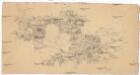
[České středohoří - západní část]
Most-oblast (Česko)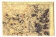

Karte der Umgebungen von Brüx, Dux und Oberleutensdorf
1 : 25000 Duchcov-oblast (Česko) Schulz, Josef
Geologická mapa okolí Bíliny
1 : 25000 Bořeň (České středohoří, Česko : hora) Hibsch, Josef Emanuel Státní geologický ústav Československé republiky
Geologische Karte des Böhmischen Mittelgebirges
1 : 25000 Kostomlaty pod Milešovkou (Česko : oblast) Hibsch, Josef Emanuel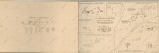
Atlas d'industrie de la république tchécoslovaque

III. vojenské mapování 3751/4
1 : 25000
[Kartenblatt]
1 : 25000 Bílina (Česko : oblast) Reichsamt für Landesaufnahme
[Kartenblatt]
1 : 25000 Bílina (Česko : oblast) Reichsamt für Landesaufnahme
Geologická mapa okolí Mostu
1 : 25000 Most (Česko : oblast) Hibsch, Josef Emanuel Purkyně, Cyrill Státní geologický ústav Československé republiky
Topographischer Plan zwischen Trebnitz, Millischau und den Kletschen Berg
1 : 15000 Bílka (Bořislav, Česko) Marssovicky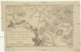
Militairische-Charte vom Mittel-Gebirge in Böheim zwischen Töplitz, Aussig, Bilin und Lowositz
1 : 35000 Bílina-oblast (Česko)
Unvollendete Topographische Carte von der Position zwischen Aussig und Bilin, und den gegenden gegen abend des Mittelgebürges bis an die Eger bey Laun
České středohoří (Česko : oblast)
Geologische und Gruben-Revier-Karte des Kohlenbeckens von Teplitz-Dux-Brüx
1 : 10000 Blatt 12 Wolf, Heinrich Lithografie u. Schnell-Pressen-Druck des k.k. Militär-geografischen Institutes
Brüx - c4845-1-013 - Kaiserpflichtexemplar der Landkarten des stabilen Katasters
1 : 2880
Brüx - c4845-1-006 - Kaiserpflichtexemplar der Landkarten des stabilen Katasters
1 : 2880
Brüx - c4845-1-010 - Kaiserpflichtexemplar der Landkarten des stabilen Katasters
1 : 2880
Brüx - c4845-1-012 - Kaiserpflichtexemplar der Landkarten des stabilen Katasters
1 : 2880
Brüx - c4845-1-009 - Kaiserpflichtexemplar der Landkarten des stabilen Katasters
1 : 2880
Brüx - c4845-1-003 - Kaiserpflichtexemplar der Landkarten des stabilen Katasters
1 : 2880
Brüx - c4845-1-001 - Kaiserpflichtexemplar der Landkarten des stabilen Katasters
1 : 2880
Brüx - c4845-1-002 - Kaiserpflichtexemplar der Landkarten des stabilen Katasters
1 : 2880
Brüx - c4845-1-011 - Kaiserpflichtexemplar der Landkarten des stabilen Katasters
1 : 2880
Brüx - c4845-1-007 - Kaiserpflichtexemplar der Landkarten des stabilen Katasters
1 : 2880
Brüx - c4845-1-004 - Kaiserpflichtexemplar der Landkarten des stabilen Katasters
1 : 2880
Brüx - c4845-1-005 - Kaiserpflichtexemplar der Landkarten des stabilen Katasters
1 : 2880
Brüx - c4845-1-008 - Kaiserpflichtexemplar der Landkarten des stabilen Katasters
1 : 2880
Geologische und Gruben-Revier-Karte des Kohlenbeckens von Teplitz-Dux-Brüx
1 : 10000 Blatt 8 Wolf, Heinrich Lithografie u. Schnell-Pressen-Druck des k.k. Militär-geografischen Institutes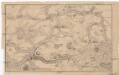
[Bílina a okolí]
Bílina-oblast (Česko)
![[České středohoří - západní část]](https://images-2.georeferencer.com/images/iiif/671838050566/full/,300/0/native.jpg)

