Maps of Kamýk

Kamaik - c3032-1-001 - Kaiserpflichtexemplar der Landkarten des stabilen Katasters
1 : 2880
Kamaik - c3032-1-003 - Kaiserpflichtexemplar der Landkarten des stabilen Katasters
1 : 2880
Kamaik - c3032-1-004 - Kaiserpflichtexemplar der Landkarten des stabilen Katasters
1 : 2880
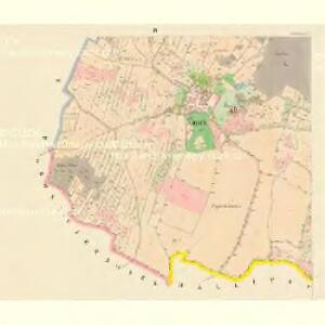
Kamaik - c3032-1-002 - Kaiserpflichtexemplar der Landkarten des stabilen Katasters
1 : 2880
Rzepnitz - c6697-1-002 - Kaiserpflichtexemplar der Landkarten des stabilen Katasters
1 : 2880
Rzepnitz - c6697-1-001 - Kaiserpflichtexemplar der Landkarten des stabilen Katasters
1 : 2880
Tlutzen - c7925-1-002 - Kaiserpflichtexemplar der Landkarten des stabilen Katasters
1 : 2880
Tlutzen - c7925-1-003 - Kaiserpflichtexemplar der Landkarten des stabilen Katasters
1 : 2880
Tlutzen - c7925-1-001 - Kaiserpflichtexemplar der Landkarten des stabilen Katasters
1 : 2880
Mallitschen - c4421-1-001 - Kaiserpflichtexemplar der Landkarten des stabilen Katasters
1 : 2880
Plan eines Theils des Mittel Gebirges zwischen Aussig und Lowositz in Böheim
Lovosice-oblast (Česko)
Hydrografische Uibersichtskarte der Flüsse, Bäche und sonstigen Gewässer im Königreiche Boehmen

Gross Czernosek (Welky Cernoseky) - c8440-1-002 - Kaiserpflichtexemplar der Landkarten des stabilen Katasters
1 : 2880
Gross Czernosek (Welky Cernoseky) - c8440-1-001 - Kaiserpflichtexemplar der Landkarten des stabilen Katasters
1 : 2880
Gross Czernosek (Welky Cernoseky) - c8440-1-004 - Kaiserpflichtexemplar der Landkarten des stabilen Katasters
1 : 2880
Gross Czernosek (Welky Cernoseky) - c8440-1-003 - Kaiserpflichtexemplar der Landkarten des stabilen Katasters
1 : 2880
Hlinay - c1874-1-002 - Kaiserpflichtexemplar der Landkarten des stabilen Katasters
1 : 2880
Hlinay - c1874-1-003 - Kaiserpflichtexemplar der Landkarten des stabilen Katasters
1 : 2880
Hlinay - c1874-1-001 - Kaiserpflichtexemplar der Landkarten des stabilen Katasters
1 : 2880
Mirzowitz - c4707-1-001 - Kaiserpflichtexemplar der Landkarten des stabilen Katasters
1 : 2880
Mirzowitz - c4707-1-002 - Kaiserpflichtexemplar der Landkarten des stabilen Katasters
1 : 2880

III. vojenské mapování 3752/3
1 : 25000
Bezirk Leitmeritz
1 : 36000 Litoměřice-oblast (Česko) Becker, H. H. Becker
Touristen-Karte des Aussiger Mittel- und Erzgebirgs-Vereines
1 : 75000 Krušné hory (Česko a Německo) Kroitzsch, Carl Mittel- und Erzgebirgesverein
Karte der Bezirkshauptmannschaft zugleich Strafgerichtsbezirk Leitmeritz
1 : 222500 Litoměřice-oblast (Česko) von dem Lehrpersonale der Leitmeritzer k.k. Hauptschule
Litoměřice a okolí
1 : 75000 Litoměřice (Česko : oblast) Vojenský zeměpisný ústav
Litoměřice
1 : 75000 Litoměřice-oblast (Česko) Vojenský zeměpisný ústav
Litoměřice
1 : 75000 Litoměřice (Česko : oblast) Vojenský zeměpisný ústav