Maps of Velké Žernoseky

Gross Czernosek (Welky Cernoseky) - c8440-1-002 - Kaiserpflichtexemplar der Landkarten des stabilen Katasters
1 : 2880
Gross Czernosek (Welky Cernoseky) - c8440-1-001 - Kaiserpflichtexemplar der Landkarten des stabilen Katasters
1 : 2880
Gross Czernosek (Welky Cernoseky) - c8440-1-004 - Kaiserpflichtexemplar der Landkarten des stabilen Katasters
1 : 2880
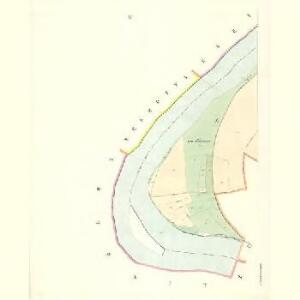
Gross Czernosek (Welky Cernoseky) - c8440-1-003 - Kaiserpflichtexemplar der Landkarten des stabilen Katasters
1 : 2880
Pistian - c5790-1-001 - Kaiserpflichtexemplar der Landkarten des stabilen Katasters
1 : 2880
Pistian - c5790-1-002 - Kaiserpflichtexemplar der Landkarten des stabilen Katasters
1 : 2880
Klein Czernosek - c4419-1-002 - Kaiserpflichtexemplar der Landkarten des stabilen Katasters
1 : 2880
Klein Czernosek - c4419-1-001 - Kaiserpflichtexemplar der Landkarten des stabilen Katasters
1 : 2880
Klein Czernosek - c4419-1-003 - Kaiserpflichtexemplar der Landkarten des stabilen Katasters
1 : 2880
Mallitschen - c4421-1-001 - Kaiserpflichtexemplar der Landkarten des stabilen Katasters
1 : 2880
Ebauché du combat qui s'est donné le 1. d'octobre. 1756. entre les troupes imp. et les Prussiens pres de Lobozitz en Boheme
Lovosice-oblast (Česko) Kotzii, Car. de
Gründlicher Entwurf des Treffens so zwischen der kaiserl. und preüssischen Armée den 1.ten 8bris A.o 1756 bey Lobositz in Königreich Böheimb vorgefallen
Lovosice-oblast (Česko) Croaten, F. W. Ign. Saltzer
Plan de la bataille de Lobositz le premier octobre Ao 1756
Lovosice (Česko) Trattner, Johann Thomas Jean Thomas Trattner
Plan de la bataille de Lobositz le premier octobre A. 1756
Lovosice (Česko) Trattner, Johann Thomas Jean Thomas Trattner
Das sächsische Lager
Lovosice-oblast (Česko)
Regni Bohemiae Circulus Litomericensis
1 : 250000 Litoměřice-oblast (Česko) Müller, Johann Christoph ab Homannianis Heredibus
Regni Bohemiae circulus Litomericensis
1 : 180000 Litoměřice-oblast (Česko) Müller, Johann Christoph ab Homannianis Heredibus
Regni Bohemiae Circulus Litomericensis
1 : 250000 Litoměřice-oblast (Česko) Müller, Johann Christoph ab Homannianis Heredibus
Regni Bohemiae circulus Litomericensis
1 : 180000 Litoměřice-oblast (Česko) Müller, Johann Christoph ab Homannianis Heredibus
Hydrografische Uibersichtskarte der Flüsse, Bäche und sonstigen Gewässer im Königreiche Boehmen

Abriß der Schlacht bey Lobositz, von dem 1. des Weinmonats 1756
Lovosice-oblast (Česko) Trattner, Johann Thomas Johann Thomas Trattner
Abriß der Schlacht bey Lobositz, von dem 1. des Weinmonats 1756
Lovosice-oblast (Česko) Trattner, Johann Thomas Johann Thomas Trattner
Treffen bey Lowositz, in Boehmen, welches der Koenig von Preussen gegen die kayserliche Armee, unter Anführung des Feldmarschals von Brown, den 1.ten October. 1756. gewonnen hat
1 : 50000 Lovosice-oblast (Česko)
Combat de Lowositz, en Bohéme, gagné par le roi de Prusse sur l'armée imperériale aux ordres du feldmaréchal de Brown, le 1er octobre, 1756
1 : 50000 Lovosice-oblast (Česko)
Lobositz - c4270-1-005 - Kaiserpflichtexemplar der Landkarten des stabilen Katasters
1 : 2880
Lobositz - c4270-1-001 - Kaiserpflichtexemplar der Landkarten des stabilen Katasters
1 : 2880
Lobositz - c4270-1-004 - Kaiserpflichtexemplar der Landkarten des stabilen Katasters
1 : 2880
Lobositz - c4270-1-003 - Kaiserpflichtexemplar der Landkarten des stabilen Katasters
1 : 2880
Lobositz - c4270-1-002 - Kaiserpflichtexemplar der Landkarten des stabilen Katasters
1 : 2880
Kamaik - c3032-1-001 - Kaiserpflichtexemplar der Landkarten des stabilen Katasters
1 : 2880
Kamaik - c3032-1-003 - Kaiserpflichtexemplar der Landkarten des stabilen Katasters
1 : 2880
Kamaik - c3032-1-004 - Kaiserpflichtexemplar der Landkarten des stabilen Katasters
1 : 2880