Maps of okres Litoměřice
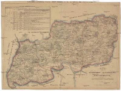
Karte der Bezirkshauptmannschaft zugleich Strafgerichtsbezirk Leitmeritz
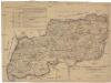
1 : 222500 Litoměřice-oblast (Česko) von dem Lehrpersonale der Leitmeritzer k.k. Hauptschule
Litoměřice a okolí
1 : 75000 Litoměřice (Česko : oblast) Vojenský zeměpisný ústav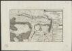
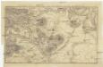
Plan de la battaille de Lobeschüz entre l'Armée Autrichienne et Prussienne sous les ordres de S. M. le Roi de Prusse et le Comte de Broune arrivée le 1. Octob. 1756
desin. par un volontair = entworfen in d. Armee v. einem Volontair [Leipzig] : [s.n.]
Soubor přehledných map pro plánování a statistiku: 3752 – Litoměřice

III. vojenské mapování 3752
1 : 75000
Bezirk Leitmeritz
1 : 36000 Litoměřice-oblast (Česko) Becker, H. H. Becker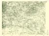
III. vojenské mapování 3752/4
1 : 25000
III. vojenské mapování 3752/4
1 : 25000
III. vojenské mapování 3752/4
1 : 25000

Bezirk Lobositz
1 : 72000 Lovosice-oblast (Česko) Josef Czerny
III. vojenské mapování 3752/3
1 : 25000
[Kartenblatt]
1 : 25000 Litoměřice (Česko : oblast) Reichsamt für Landesaufnahme
Plan der Gegend bey Lowositz in Böheim
Lovosice-oblast (Česko)
III. vojenské mapování 3752/3
1 : 25000
III. vojenské mapování 3752/3
1 : 25000
[Kartenblatt]
1 : 25000 Lovosice (Česko : oblast) Reichsamt für Landesaufnahme
Geologische Karte des Böhmischen Mittelgebirges
1 : 25000 Litoměřice (Česko : oblast) Hibsch, Josef Emanuel Seemann, Fritz Alfred Hölder
Ebauché du combat qui s'est donné le 1. d'octobre. 1756. entre les troupes imp. et les Prussiens pres de Lobozitz en Boheme
Lovosice-oblast (Česko) Kotzii, Car. de
Plan eines Theils des Mittel Gebirges zwischen Aussig und Lowositz in Böheim
Lovosice-oblast (Česko)
[Plan der Gegend zwischen Tursko und Theresienstadt]
1 : 61500 Litoměřice-oblast (Česko)
Karte des Politisches und Schulbezirkes Leitmeritz...

Topographischer Plan zwischen Trebnitz, Millischau und den Kletschen Berg
1 : 15000 Bílka (Bořislav, Česko) Marssovicky
Exerzier-Platz bei Theresienstadt im Jahre 1846
1 : 30800 Terezín-oblast (Litoměřice, Česko)
Plan de la Bataille de Lobositz le premier octobre Ao 1756
Mollova mapová sbírka Trattner, Johann Thomas von - dílna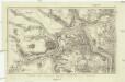
Plan der Gegend bey Linay in Böheim
1 : 32000 Hliňany (Řehlovice, Česko)
Karte des politischen Bezirkes Aussig