Maps of Czech Republic

Čechy
Čechy (Česko)
Königreich Böhmen
Čechy (Česko)
Strassenkarte von Böhmen
1 : 450000 Čechy (Česko)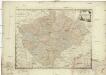
Karte von dem Königreiche Böheim
1 : 653000 Čechy (Česko) Reilly, Franz Johann Josef von Müller, Johann Christoph Franz Joh. Jos. von Reilly
Geognostische Charte von Böhmen
Česko Riepl, Franz Richard, Albert
Tabvla geographica inclyti Boemiae Regni
1 : 900000 Česko
Tabvla geographica inclyti Boemiae Regni
1 : 900000 Česko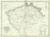
Statistisch topographische Finanz-Karte des Königreiches Boehmen
1 : 1000000 Čechy (Česko) Herz, Johann Gottlieb Haase Söhne
Mapa Království českého v 10 listech a v měřítku 1:200,000
1 : 200000 Čechy (Česko)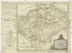
Karte von dem Königreiche Böheim
1 : 1104000 Česko Reilly, Franz Johann Josef von F.I.I. von Reilly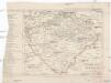
Eisenbahn-Karte von Boehmen
Čechy (Česko) Zdeněk, Jaroslav Šimáček, Josef Franz Řivnáč
Generální mapa Království českého
1 : 220000 Čechy (Česko) Wagner, Jan Eduard Mareš, František F. Kytka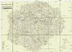
Strassen-Karte des Koenigreiches Boehmen
1 : 430000 Česko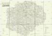
Strassen-Karte des Koenigreiches Boehmen
1 : 430000 Česko
[Čechy]
Čechy (Česko)
Geognostisch montanistische Geschäftskarte des Kőnigreich Bőhmen
1 : 750000 Česko Schmidt z Bergenholdu, Jan Ferdinand Mecséry de Tsoor, Karl Freiherr von
Geognostisch montanistische Geschäftskarte des Kőnigreich Bőhmen
1 : 750000 Česko Schmidt z Bergenholdu, Jan Ferdinand Mecséry de Tsoor, Karl Freiherr von
Geognostisch montanistische Geschäftskarte des Kőnigreich Bőhmen
1 : 750000 Česko Schmidt z Bergenholdu, Jan Ferdinand Mecséry de Tsoor, Karl Freiherr von
Přehledná mapa úprav vodních v Království českém
1 : 500000 Čechy (Česko) Meliorační svaz v Království českém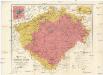
Uibersichtskarte des Königreiches Böhmen
1 : 576000 Jablonec nad Nisou (Česko : oblast) Wagner, Jan Eduard F. Kytka
Oro-hydrografische Karte von Böhmen
Čechy (Česko) Jelínek, Karel Langweil, Antonín K. André
Oro-hydrografische Karte von Böhmen
Čechy (Česko) Jelínek, Karel Langweil, Antonín
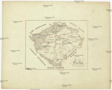
[Orografická mapa Čech]
Čechy (Česko) bei Eduard Hölzel
Příruční mapa Království českého
1 : 600000 Česko Wagner, Jan Eduard F. Kytka
Králowstwj české
Česko Wondra, Jos. Havlík, H.
Podrobná mapa Čech
1 : 400000 Liberec-oblast (Česko) Machát, František Kuchař, Karel V. Neubert a synové
Podrobná mapa Čech
1 : 400000 Liberec-oblast (Česko) Machát, František V. Neubert a synové
Podrobná mapa Čech
1 : 400000 Liberec-oblast (Česko) Machát, František V. Neubert a synové
Podrobná mapa Čech
1 : 400000 Liberec-oblast (Česko) Machát, František V. Neubert a synové