Maps of Metropolitan France
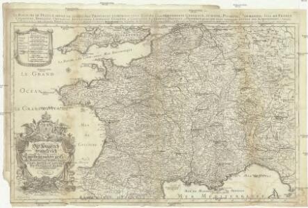
Das Königreich Franckreich eingetheilet nach der grösse alle Provinzien und derselben zugehörungen, worbey ein gutes theil von Teutschland, Hispanien, und Niederland
1 : 2050000 Francie Sanson, Nicolas Hipschmann, Sigmund Gabriel Johann Hoffman
Carte generale des Gaules.
1 : 3300000 Brue, Adrien Hubert, 1786-1832
Galliarum descriptio
1 Karte : Kupferdruck ; 48 x 66 cm Robert de Vaugondy; Sanson; Delamarche; Delahaye; Sanson chez le Sr. Delamarche géographe rue du Foin St. Jacques au collége de m.tre Gervais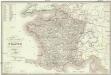
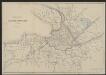
Carte itinéraire de la France
Francie Lorain, A. chez Dopter
Gallia Vetus Ad Iulii Caesaris commentaria. [Karte], in: Novus atlas absolutissimus, Bd. 4, S. 23.
1 Karte aus Atlas Janssonius Offizin
La France 1180 a 1223.
1 : 5800000 Houze, Antoine Philippe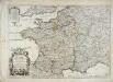
Le royaume de France
1 Karte : Kupferdruck ; 44 x 63 cm Jaillot; Cordier; Sanson; Basset; Basset chez Basset rüe St. Jacques au coin de celle des Mathurins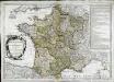
Le royaume de France
1 Karte : Kupferdruck ; 45 x 64 cm Janvier; Santini; Choffard chez Francois Santini rue S.te Justine pres la ditte eglise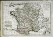
La France par gouvernements
1 Karte : Kupferdruck ; 21 x 31 cm Bonne; Perrier s.n.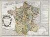
Le royaume de France
1 Karte : Kupferdruck ; 46 x 64 cm Janvier; Lattré; Choffard chés Lattré graveur rue St. Jacques près la fontaine Saint Severin à la ville de Bordeaux
Galliae regni potentiss: nova descriptio
1 Karte : Kupferdruck ; 32 x 49 cm Jolivet; Ortelius s.n.
Galliae regni potentiss: nova descriptio
1 Karte : Kupferdruck ; 32 x 49 cm Jolivet; Ortelius s.n.
Tabula Moderna Francie [Karte], in: [Clavdii Ptholomei Cosmographi ...], S. 257.
1 Karte aus Atlas Nicolaus Germanus [und Ptolemaeus, Claudius]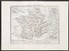
Gallia transalpina
1 : 3300000 Marzolla, Benedetto [Verlag nicht ermittelbar]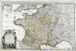
Le royaume de France
1 Karte auf 2 Blättern : Kupferdruck ; 55 x 87 cm Jaillot; Sanson chez J. Cóvens et C. Mortier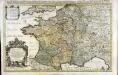
Le royaume de France
1 Karte auf 2 Blättern : Kupferdruck ; 53 x 86 cm Jaillot; Sanson chez H. Iaillot joignant les grands Augustins aux deux globes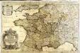
Das Königreich Franckreich
1 Karte auf 2 Blättern : Kupferdruck ; 54 x 87 cm Sanson; Hoffmann; Hipschmann zu finden bey Johann Hoffman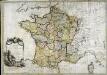
La France
1 Karte : Kupferdruck ; 54 x 77 cm Brion de la Tour; Le Campion; Le Campion chez les Campions freres rue St. Jacques à la ville de Rouen no. 8
Königreich Frankreich

Empire Francais et Royaume d'Italie en 1809.
1 : 6000000 Houze, Antoine Philippe
CHARTE von FRANKREICH nach der neuesten Eintheilung in 22. Militair-Divisionen 86. Departemente mit Beziehung auf die alte Eintheilung in Provinzen entworfen
Elba (Itálie)
Charte von Frankreich nach der neuesten Eintheilung in 22. Militair-Divisionen 86. Departemente mit Beziehung auf die alte Eintheilung in Provinzen entworfen
Elba (Itálie)
Nouvelle carte itinéraire de la France par départements et divisions militaires ...
From France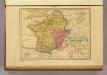
Carte des Gaules.
1 : 6000000 Malte-Brun, Conrad, 1775-1826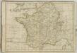
Gallia Vetus Ad Iulii Caesaris commentaria. [Karte], in: Gerardi Mercatoris et I. Hondii Newer Atlas, oder, Grosses Weltbuch, Bd. 2, S. 152.
1 Karte aus Atlas Mercator, Gerhard und Hondius, Jodocus Jansson, Jan
La France 843 a 987.
1 : 5800000 Houze, Antoine Philippe
La France 1643 a 1715.
1 : 6000000 Houze, Antoine Philippe
La France 1350 a 1364.
1 : 6000000 Houze, Antoine Philippe