Maps of Oderwitz

[Kartenblatt]
1 : 25000 Varnsdorf (Česko : oblast) Reichsamt für Landesaufnahme
Meßtischblatt 5054 : Zittau (Nord), 1942
1 : 250000 Zittau (Nord). - Aufn. 1928, hrsg. 1931, letzte Nachtr. 1937, Aus. - 1:25000. - Leipzig, 1942. - 1 Kt.
Meßtischblatt 88 : Zittau (Nord), 1934
1 : 250000 Zittau (Nord). - Umdr.-Ausg., aufgen. 1928, hrsg. 1931, einz. Nachtr. 1934. - 1:25000. - Leipzig, 1934. - 1 Kt.
Meßtischblatt 88 : Zittau (Nord), 1931
1 : 250000 Zittau (Nord). - Aufgen. 1928. - 1:25000. - Leipzig, 1931. - 1 Kt.
Meßtischblatt 88 : Oderwitz, 1913
1 : 250000 Oderwitz. - Aufgen. 1899, rev. 1906, hrsg. 1908, kurrentgest. 1913. - 1:25000. - Leipzig, 1913. - 1 Kt.
III. vojenské mapování 3653/2
1 : 25000
III. vojenské mapování 3653/2
1 : 25000
III. vojenské mapování 3653/2
1 : 25000

III. vojenské mapování 3653/2
1 : 25000
Orientierungs-plan der Stadt Warnsdorf

Orientierungs-Plan der Stadt Warnsdorf

Alt Warnsdorf - c8331-1-001 - Kaiserpflichtexemplar der Landkarten des stabilen Katasters
1 : 2880
Alt Warnsdorf - c8331-1-003 - Kaiserpflichtexemplar der Landkarten des stabilen Katasters
1 : 2880
Alt Warnsdorf - c8331-1-007 - Kaiserpflichtexemplar der Landkarten des stabilen Katasters
1 : 2880
Alt Warnsdorf - c8331-1-006 - Kaiserpflichtexemplar der Landkarten des stabilen Katasters
1 : 2880
Alt Warnsdorf - c8331-1-005 - Kaiserpflichtexemplar der Landkarten des stabilen Katasters
1 : 2880
Alt Warnsdorf - c8331-1-002 - Kaiserpflichtexemplar der Landkarten des stabilen Katasters
1 : 2880
Alt Warnsdorf - c8331-1-004 - Kaiserpflichtexemplar der Landkarten des stabilen Katasters
1 : 2880
Alt Warnsdorf - c8331-1-008 - Kaiserpflichtexemplar der Landkarten des stabilen Katasters
1 : 2880
Plan von Zittau

Alt Warnsdorf, Leitmeritz[er] Kr[eis]
1 : 2880 Litoměřice (Česko : oblast)
[Rumburk a okolí]
Horní Lužice (Německo) Kreibich, František Jakub Jindřich
Situations-Plan von Warnsdorf in sechs Gemeinden
1 : 10000 Varnsdorf (Česko) Palme, Alois Fiala, Franz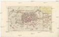
Grund-Riss der ruinirten Stadt Zittau
Žitava (Německo) in der Raspischen Buchhandlung
Die Statt Zittaw in Ober Lausitz, wie sie A°. 1632 vom Obr. Bolzen fortificirt worden, sampt der Belägerung A°. 1643
Žitava (Německo) Pezold, Daniel Mentzel, J. G.
Karte der Löbau-Zittauer Eisenbahn
1 : 57000 Lith. v. F.A. Renner
III. vojenské mapování 3653
1 : 75000
Varnsdorf
1 : 75000 Cvikov (Česko : oblast) Vojenský zeměpisný ústav
![[Kartenblatt]](https://images-2.georeferencer.com/images/iiif/108016542849/full/,300/0/native.jpg)

