Maps of Dejvice
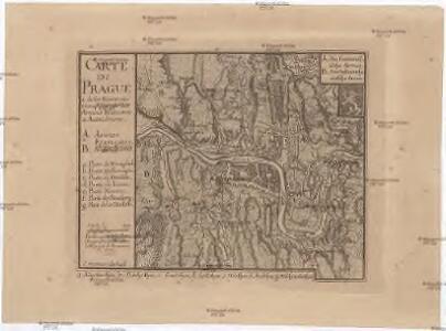
Carte de Prague
1 : 83500 Praha (Česko) Brequin Birckhart, C.
Plán královského hlavního města Velké Prahy s okolím
1 : 20000 Praha (Česko : oblast) Brož, Josef Šolc a Šimáček
Plán královského hlavního města Velké Prahy s okolím
1 : 20000 Praha (Česko) Brož, Josef B. Racová
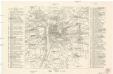
Orientační plán hlavního města Prahy
Praha (Česko) Brož, Josef Stein, Carl Průmyslová tiskárna
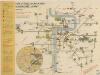
Die öffentlichen Verkehrsmittel der Hauptstadt Prag
Praha (Česko)
Prag und seine Umgebungen
Praha (Česko) Bittner, Joseph Kettner, C. J. G. Calvesche Buchhandlung
Nejnovější plán Prahy : připojen abecední seznam ulic k rychlému vyhledávání, seznam škol...
1 : 17500
Plan des environs de Prague : et des camps des deux armées dedié a Mgr. Le Prince de Soubise
1 : 20000 Le Rouge, Georges-Louis Le Rouge
Plan des environs de Prague et des camps des deux armées
1 : 20700 Praha (Česko) Le Rouge, Georges-Louis Soubise, Charles de Rohan le Rouge
Přehledná mapa velké Prahy
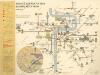
Plán sítě elektrických drah hlvního města Prahy

Prag und seine Umgebungen, nach den besten Hülfsmitteln dargestellt
1 : 42000 C. Kettner sculp. Prag : J. G. Calve'sche Buchhandlung
Orientační plán Prahy a obcí sousedních přehledka

Blocus de Prague
1 : 106600 Praha (Česko) Therbu Coentgen, Heinrich Hugo
Přehledná mapa Velké Prahy : [s průvodcem a popisem všech obcí v ní zahrnutých] : [odpolední výlety po okolí pražském]
1 : 34725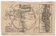
Grundriss der könig. böhmische[n] Haupt Stadt Prag
Praha (Česko)
Plán sběrného okruhu a dopravních spojů pro motorová vozidla

Veřejné dopravní prostředky hlavního města Prahy

Grundriss der König. Bohmischen Haupt Stadt Prag
Praha (Česko) Christoph Riegel Buchhändlen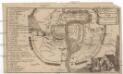
Plan der Merckwürdrgen [sic] Belagerung der Stadt Prag in Böhmen Anno 1743
Praha (Česko)
Praha : plán města
1 : 20000
Okolí Prahy
1 : 25000 Praha (Česko : oblast) Hurtig, Alfred Stát. komise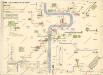
Plán sítě autobusů hl. m. Prahy
Plán význačných novostaveb pražských 1919-1934
Praha (Česko) Mánes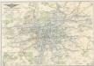
Plán sítě elektrických drah, trolejbusů a autobusů hlavního města Prahy

Plán král. hlav. města Prahy a obcí sousedních
1 : 12000 Brož, Josef, 1844-1930 nákladem A. Štorcha Syna
Velký příruční plán hlav. města Prahy
1 : 12000 Praha (Česko) Brož, Josef A. Storch syn
Plán král. hlav. města Prahy a obcí sousedních
1 : 12000 Praha (Česko) Brož, Josef A. Storch syn
Praha : orientační plán : Československá spartakiáda 1975
1 : 15000