Maps of West Indies

The West Indies and coast adjacent, reduced from the sheet map
1 : 16663680
215-216. Central America and West Indies. The World Atlas.
1 : 7500000 USSR (Union of Soviet Socialist Republics).
Carte du Golfe du Mexique et des Isles Antilles
1 : 10168000
INSVLÆ AMERICANÆ | IN OCEANO SEPTENTRIONALI, | cum Terris adiacentibus
[Amsterdam : Joan Blaeu]
Insulae Americanae In Oceano Septentrionali, cum Terris adiacentibus. [Karte], in: Novus atlas absolutissimus, Bd. 6, S. 219.
1 Karte aus Atlas Janssonius Offizin
Insulae Americanae In Oceano Septentrionali, cum Terris adiacentibus. [Karte], in: Theatrum orbis terrarum, sive, Atlas novus, Bd. 2, S. 312.
1 Karte aus Atlas Blaeu, Joan Blaeu, Willem Janszoon
Insulae Americanae In Oceano Septentrionali, cum Terris Adiacentibus. [Karte], in: Le théâtre du monde, ou, Nouvel atlas contenant les chartes et descriptions de tous les païs de la terre, Bd. 2, S. 308.
1 Karte aus Atlas Blaeu, Willem Janszoon und Blaeu, Joan Blaeu, Willem Janszoon
West India Islands.
1 : 13400000 Lizars, Daniel
Insulae Americanae In Oceano Septentrionali, cum Terris adiacentibus. [Karte], in: Gerardi Mercatoris et I. Hondii Newer Atlas, oder, Grosses Weltbuch, Bd. 2, S. 379.
1 Karte aus Atlas Mercator, Gerhard und Hondius, Jodocus Jansson, Jan
[West-Indien und Centro-America, nebst dem Meerbusen von Mexico]
Schul-Atlas über alle Theile der Erde nach dem neuesten Zustande, und über das Weltgebäude Stieler, Adolf Justus Perthes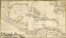
A NEW MAPP of the WEST INDIES, or the ISLANDS of AMERICA in the NORTH SEA; Together with the adjacent DOMINIONS; Explaining what belongs to SPAIN, ENGLAND, FRANCE, HOLLAND &C. As also the severall Tracts made by the Gallions and Flota from place to place,
This interesting map published in 1740 is a later edition of one published by Robert Morden, William Knight and Philip Lea. The colonising powers are indicated in words but colouring is mainly for decoration. Notes give an idea of shipping routes and practices, and in the Gulf of Mexico the number of fathoms in depth are said to be equal to the distance in leagues from the coast! The sketch at bottom left which forms part of the title cartouche shows a group of sailors presenting a pair of shoes to a native in exchange for a chest of gold coins. Morden, Robert. Cartographer.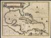
Insulae Americanae in Oceano Septentrionali, cum terris adiacentibus
1 : 1
A map of the West-Indies &c. Mexico or New Spain, also ye trade winds, and ye several tracts made by ye galeons and flota from place to place
1 : 18000000
Mappa Geographica, complectens I. Indiae Occidentalis Partem Mediam Circum Isthmum Panamensem II. Ipsumq[ue] Isthmum III. Ichnographiam praecipuorum locorum & portuum ad has terras pertinentium
West India Isles.
1 : 9100000 Cary, John, ca. 1754-1835
[West-Indien und Centro-America, nebst dem Meerbusen von Mexico]
Schul-Atlas über alle Theile der Erde nach dem neuesten Zustande, und über das Weltgebäude Stieler, Adolf bei Justus Perthes
West Indies.
1 : 7900000 Thomson, John
A map of the West-Indies &c. with the adjacent countries: also ye trade winds, and ye several tracts made by ye galeons and flota from place to place / by H. Moll, g., 1727.; A set of thirty-two new and correct maps of the principal parts of Europe, &c.: with the great or post-roads, and principal cross-roads, done in the year 1725, 1726 and 1727: all except four, viz. England, Scotland, Ireland, and a general map of Turky in Europe, which have been done and printed before ... / all done according to the latest observations, by Herman Moll, geographer.
from A set of thirty-two new and correct maps of the principal parts of Europe, &c. : with the great or post-roads, and principal cross-roads, done in the year 1725, 1726 and 1727 : all except four, viz. England, Scotland, Ireland, and a general map of Turky in Europe, which have been done and printed before ... / all done according to the latest observations, by Herman Moll, geographer. Moll, Herman,
Insulae Americanae in Oceano Septentrionali cum Terris adiacentibus
This is a map by Dutch mapmaker Joannes Janssonius published from 1636 in later editions of Gerhard Mercator's celebrated atlas. It is basically a chart rather than a map complete with rhumb lines (for sailing directions) and place names written at right angles to the coast as in early manuscript sea charts. The outline colouring does not accurately reflect the colonising powers but is mainly for decoration. It is partly based on a similar map by rival Dutch mapmaker Joannes Blaeu. Janssonius, Joannes. Cartographer.
West India Islands.
1 : 14500000 Darton, William
Archipelague du Mexique ou sont les Isles de Cuba, Espagnole, Jamaïque &c.
1 : 5000000 [par Pierre Mortier]
Pascaarte vande vaste cust en eylanden van Westindien, als mede de Virginis en Nieu-Nederland, van C. Droge tot C. Cod
1 : 2705000
Insulae Americanae In Oceano Septentrionali, cum Terris adiacentibus. [Karte], in: Novus Atlas, das ist, Weltbeschreibung, Bd. 2, S. 311.
1 Karte aus Atlas Blaeu, Joan Blaeu, Willem Janszoon
[144][147] Indiarum Occidentalium Tractus Littorales cum Insulis Caribicis ..., uit: Atlas sive Descriptio terrarum orbis
Annotatie: Gedigitaliseerde versie. Amsterdam. Heiloo : Picturae (vervaardiger), 2015. tiff-bestand. Gedigitaliseerd: 07-01-2015; Origineel: Universiteitsbibliotheek Vrije Universiteit (XL.05127.-) ; Netherlands; Titelpagina ontbreekt Wit, Frederik de Amsterdam : Frederick de Wit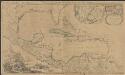
Archipelague du Mexique ou sont les Isles de Cuba, Espagnole, Jamaïque &c.
1 : 5000000 [par Pierre Mortier] A Amsterdam : nouvellement mis au jour par Covens & Mortier
Iles-Antilles ou Indes Occidentales.
1 : 9300000 Brue, Adrien Hubert, 1786-1832
Chart of the West Indies.
1 : 11750000 Carey, Mathew
Chart of the West Indies.
1 : 11750000 Carey, Mathew
Chart of the West Indies.
1 : 11000000 Carey, Mathew