Maps of Greece
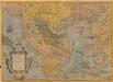
Graeciae Universae Secundum Hodiernum Situm Neoterica Descriptio. [Karte], in: Theatrum orbis terrarum, S. 95.
1 Karte aus Atlas Ortelius, Abraham
Graecia. [Karte], in: Novus Atlas, das ist, Weltbeschreibung, Bd. 3, S. 332.
1 Karte aus Atlas Blaeu, Joan Blaeu, Willem Janszoon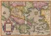
Graeciae Universae Secundum Hodiernum Situm Neoterica Descriptio. [Karte], in: Theatrum orbis terrarum, S. 252.
1 Karte aus Atlas Ortelius, Abraham
Nova Totius Graeciae descriptio. [Karte], in: Novus atlas absolutissimus, Bd. 5, S. 274.
1 Karte aus Atlas Janssonius Offizin
Graecia [Karte], in: Gerardi Mercatoris Atlas, sive, Cosmographicae meditationes de fabrica mundi et fabricati figura, S. 484.
1 Karte aus Atlas Mercator, Gerhard Montanus, Petrus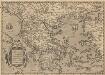
Graeciae Universae Secundum Hodiernum Situm Neoterica Descriptio. [Karte], in: Theatrum orbis terrarum, S. 347.
1 Karte aus Atlas Ortelius, Abraham Vrients, Jan Baptista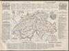
Graecia. [Karte], in: Le théâtre du monde, ou, Nouvel atlas contenant les chartes et descriptions de tous les païs de la terre, Bd. 3, S. 290.
1 Karte aus Atlas Blaeu, Willem Janszoon und Blaeu, Joan Blaeu, Willem Janszoon
Tableau historique de la Grece.
1 : 5500000 Duval, Henri
Graecia. [Karte], in: Theatrum orbis terrarum, sive, Atlas novus, Bd. 3, S. 282.
1 Karte aus Atlas Blaeu, Joan Blaeu, Willem Janszoon
Greece or the south part of Turky in Europe.
1 : 4700000 Moll, Herman, d. 1732
Graecia [Karte], in: Gerardi Mercatoris et I. Hondii Newer Atlas, oder, Grosses Weltbuch, Bd. 2, S. 327.
1 Karte aus Atlas Mercator, Gerhard und Hondius, Jodocus Jansson, Jan
Anbau und Januar-Isothermen
Balkanhalbinsel Pflanzenbau, Klima
GRÆCIA
Joh. et Corn. Blaeu exc.
Graecia cum terris adjacentibus
Griechenland
Anbau und Juli-Isothermen
Balkanhalbinsel Pflanzenbau, Klima
GRAECIAE et ARCHIPELAGI delineatio
Řecko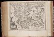
Graecia
1 : 2500000 Annotatie: Met opdracht door Joh. en Cornelius Blaeu aan Claudius Salmasius; Origineel is Blad 169 in atlas factice; Annotatie geografische gegevens: Met schaalstok Joan Blaeu 1597/98-1673; Cornelis Blaeu ca. 1610-1645 [Amsterdam : Joh. et Corn. Blaeu excudit]
Turecká říše w Ewropé, Řecko, Jonické ostrowy
1 : 6500000 Jónské ostrovy (Řecko) Merklas, Václav
Südliche Balkanstaaten
1 : 5000000 balkánské země Langenscheidtsche Buchdruckerei
Graecia vetus
1 : 7900000 Řecko Bonne, Rigobert André
99-100. Balkan Peninsula, Aegean Sea. The World Atlas.
1 : 2500000 USSR (Union of Soviet Socialist Republics).
Der Europäische Theil des Osmanischen Reichs oder die Europäische Türkey
Stieler's Hand-Atlas Stieler, Adolf bei Justus Perthes
Das alte Griechenland mit dessen vmliegenden Insvlen
Řecko
Südosteuropäische Halbinsel, Geologische Übersicht
Südosteuropa
Die Balkan-Halbinsel in 4 Blättern : Türkei, Rumänien, Griechenland, Serbien, Montenegro, Bulgarien
1 : 1500000 Vogel, C. (Carl), 1828-1897 Justus Perthes
Turkey In Europe.
1 : 10700000 Mitchell, Samuel Augustus
Turkey in Europe. Greece.
1 : 3500000 Schonberg & Co.
Türkei und Griechenland.
1 : 5000000 Osmanisches Reich / Europäischer Teil, Griechenland
Die Europaeische Türkei, Griechenland und die Jonischen Inseln
E. von Sydow's Schul-Atlas in sechs und dreissig Karten Sydow, Emil von bei Justus Perthes
![Graeciae Universae Secundum Hodiernum Situm Neoterica Descriptio. [Karte], in: Theatrum orbis terrarum, S. 95.](https://images-2.georeferencer.com/images/iiif/512537090779/full/,300/0/native.jpg)

