Maps of Jura

<<Das>> Wiflispurgergow
1 : 500000 1 Karte [von Johannes Stumpf] [Christoph Froschauer oder Johann Wolf], [Zürich]
Touristen-Karte der Schweiz
1 : 400000 Evropa Imfeld, X. Jura–Simplon-Bahn
Landtaflen
1 Atlas [von Johannes Stumpf] Christoffel Froschower, Zürych
Carte de Suisse suivant sa nouvelle division en XVIII cantons
1 Karte in 2 Bl. dressé par H. Mallet, Ing. Geographe [Verlag nicht ermittelbar], [Erscheinungsort nicht ermittelbar]
Carte du réseau téléphonique suisse
1 : 250000 Westblatt Schweizerische Telegraphen- und Telephonverwaltung H. & A. Kümmerly & Frey
Carte du réseau télégraphique Suisse
1 : 250000 Westblatt Schweizerische Telegraphen- und Telephonverwaltung Kartographische Anstalt LIPS
Carte topographique d'Allemagne contenant les cantons de Bern, et de Freyburg, les principautés de Neufchatel, et Vallangin, le territoire de Genève, et une partie comté de Bourgogne etc
1 : 210000 1 Karte fait par I. W. Iaeger chez l'Auteur., Francfort sur le Mein
<<Le>> canton de Vaud
1 : 390000 1 Karte dessiné par H. Keller ; gravé par J.J. Scheurmann [Orell Fussli et Comp.], [Zurich]
Carte des cantons de Genève, Vaud, Neuchâtel et Fribourg
1 : 250000 1 Karte Topogr. Anstalt von Wurster, Randegger und Co. Wurster, Zürich
<<Les>> Suisses, leurs alliés et leurs sujets
1 : 230000 1 Karte auf 4 Bl. par A.H. Iaillot, 1703 chez l'auteur joignant les grands Augustins aux deux globes, Paris
<<Les>> Suisses, leurs alliés et leurs sujets
1 : 230000 1 Karte auf 4 Bl. par Iaillot chez l'auteur joignant les Grands Augustins aux deux Globes, Paris
Carte de Suisse suivant sa nouvelle division en XVIII cantons formant la République Helvétique, 1
1 Blatt : chez F. Monty
Atlas der alten Eidgenossenschaft in 20 Karten: Kanton Bern
Originaltitel: Canton Bern sive Illustris Helvetiorum Respublica Bernensis cum Subditis suis et Confinibus. Zeichnung: Walser, Gabriel (1695-1776), reformierter Pfarrer, von Teufen AR Herausgeber: Homännische Erben
Karte des Kriegs-Schauplatzes der Schweiz
1 : 700000 2 Karten Verlag der Steiner'schen Buchhandlung, [Winterthur]
Mappa Geographica illustris Helvetiorum Republicae Bernensis cum adjacentibus pagorum et dynastiarum confiniis accurate delineata
1 : 460000 Mollova mapová sbírka Seutter, Matthäus Seutter, Albrecht Carl Seutter, Matthäus
Mappa Geographica illustris Helvetiorum Republicae Bernensis cum adjacentibus pagorum et dynastiarum confiniis accurate delineata
1 : 460000 Mollova mapová sbírka Seutter, Matthäus Seutter, Albrecht Carl Seutter, Matthäus
Atlas der Schweiz
1 : 450000 1 Atlas (18 Bl.) gez. u. gest. v. J. Scheurmann Orell Fussli, Zurich
<<Le>> canton de Vaud
1 : 390000 1 Karte dessiné par H. Keller ; gravé par J.J. Scheurmann Orell Fussli et Comp., Zurich
Mappa geographica illustris Helvetiorum reipublicæ Bernensis
1 Karte : Kupferdruck ; 47 x 55 cm Seutter; Lotter; Seutter Matthäus Seutter
Atlas de la Suisse
1 : 450000 1 Atlas (19 Bl.) dessiné par MM. H. Keller, Scheurmann, Pfyffer d'Altishofen, Osterwald, etc. ; gravé par M. Scheurmann Orell Füssli & Co., Zürich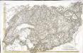
[Südwestschweiz]
1 Karte : Kupferdruck ; 43 x 70 cm s.n.
[Reisekarte der Schweiz]
1 : 500000 1 Karte auf 6 Bl. gezeichnet v. H. Keller ; gest. v. J.J. Scheurmann [Füssli & Comp.], [Zürich]
Officielle Eisenbahn-Karte der Schweiz
1 : 250000 Südwest-Blatt [s.n.]
Nova Helvetiae tabula geographica illustrissimis et potentissimis cantonibus et rebuspublicis reformatae religionis Tigurinae, Bernensi, Glaronensi, Basiliensi, Scaphusianae, Abbatis Cellanae
1 : 230000 1 Karte auf 4 Bl. dominis suis clementissimis humillime dicata a Ioh. Iacobo Scheuchzero Tigurino ; Ioh. Melch. Füsslin ornamenta pinx. ; Ioh. Henr. Huber et Eman. Schalch sculps. [Hofmeister], [Zürich]
Inclitæ Bernatvm vrbis, cvm omni ditionis svæ agro et provinciis delineatio chorographica
1 Karte auf 18 Blatt : Kupferdruck ; 128 x 187 cm Schöpf; Martin; Krumm; Jobin; Saueracher; Meyer Albrecht Meyer
Inclitæ Bernatvm vrbis, cvm omni ditionis svæ agro et provinciis delineatio chorographica
1 Karte auf 18 Blatt : Kupferdruck ; je 46 x 65 cm Schöpf; Martin; Krumm; Jobin; Saueracher Adelbert Saueracher
[Exactissima Helvetiae, Rhaetiae, Valesiae ... tabula]
1 : 850000 9 Karten [Kopie von Adrian Braakman] [chez Pierre Schenk et Adrian Braakman], [Amsterdam]
Canton Bern sive illustris Helvetiorum respvblica Bernensis
1 Karte : Kupferdruck ; 45 x 55 cm Walser; Dorn edentibus Hommanianis Heredibus
Canton Bern sive illustris Helvetiorum respvblica Bernensis
1 Karte : Kupferdruck ; 46 x 55 cm Walser; Dorn edentibus Hommanianis Heredibus


