Maps of Switzerland

Carte de la Suisse, ou l'on a marqué les routes suivies par Wil. Coxe
1 : 450000 1 Karte in 2 Teilen [par William Coxe] [Verlag nicht ermittelbar], [Erscheinungsort nicht ermittelbar]
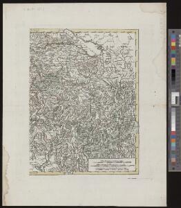
Neue Karte von der Schweiz oder Helvetien in die XIII Eidgenossenschaften, ihre Bundsverwandten und Unterthanen eingetheilt
1 Karte in 2 Bl nach den zuverlässigsten Nachrichten und neuesten astronomischen Beobachtungen, London 1778 bei W. Faden [, neu hrsg. von F.A. Schraembl] Schalbacher, Wien
Landtaflen
1 Atlas [von Johannes Stumpf] Christoffel Froschower, Zürych
Circvli Avstriaci Pars alterior comprehendens Comit. Tirolensem et Territoria Suevica
1 : 2600000 Mollova mapová sbírka Franz, Johann Michael Homann, Johann Baptista - dědici
<<Les>> Suisses, les alliés des Suisses et leurs sujets
1 Karte par N. Sanson d'Abbeville ; R. Cordier sculp. [Sanson], [Paris]
Historisch-Geographischer Atlas der Schweiz in 15 Blättern
1 : 770000 Eidgenossenschaft 1412 - 1481 Voegelin, Johann Conrad ; Meyer von Knonau, Gerold ; Wyss, Georg von ; Meyer von Knonau, Gerold Schulthess
Carte générale des trèze cantons de Suisse, Vallay, ligues Grise, Maison-Dieu & Valteline
1 : 725000 1 Karte A Paris au bout du pont neuf proche les Augustins
<<Die>> Helvetische Republik in Cantone und Districte eingetheilt
1 : 630000 1 Karte gedruckt bey Wilhelm Haas dem Sohne, Basel
<<Die>> Helvetische Republik in Cantone und Districte eingetheilt
1 : 630000 1 Karte gedruckt bey Wilhelm Haas dem Sohne, Basel
Abriss dess Schwizerlands und Gelegenheit der [i.e. des] Grawen Bund
1 : 1000000 1 Karte [Verlag nicht ermittelbar], [Frankfurt am Main]
<<La>> Suisse
1 : 1450000 1 Karte Emanuel Tournejsen ; M.B. Wachsmut sculpsit Emanuel Tournejsen, Basle
<<La>> Suisse
1 : 1300000 1 Karte chez R. & J. Wetstein et Guil. Smith, Amsterdam
Helvetia prima Rheni et V. nova tabula
1 : 750000 1 Karte [Sebastian Münster] [apud Henricum Petrum], [Basilea]
Historisch-Geographischer Atlas der Schweiz in 15 Blättern
1 : 770000 Helvetien 450 - 879 Voegelin, Johann Conrad ; Meyer von Knonau, Gerold ; Wyss, Georg von ; Meyer von Knonau, Gerold Schulthess
Helvetia
1 : 2700000 1 Karte [Petrus Bertius] [sumptibus et typis aeneis Iudoci Hondij], [Amsterodami]
<<La>> Suisse
1 : 1300000 1 Karte Pierre vander Aa Pierre vander Aa, Leide
Historisch-Geographischer Atlas der Schweiz in 15 Blättern
1 : 770000 Helvetien 1218 - 1331 Voegelin, Johann Conrad ; Meyer von Knonau, Gerold ; Wyss, Georg von ; Meyer von Knonau, Gerold Schulthess
Karte der Schweiz mit Angabe der Kantons- und der Bezirksgrenzen
1 : 1050000 1 Karte vom eidg. statistischen Bureau ; Lith. Gebr. Kümmerly Eidg. statist. Bureau, [Bern]
Innsbruck, Trient, Basel, Zürich
1 : 750000 Basilej (Švýcarsko : oblast) Hübl, E. K. u. k. Militärgeographisches Institut
Innsbruck, Trient, Basel, Zürich
1 : 750000 Basilej (Švýcarsko : oblast) K. k. militär-geographisches Institut
<<La>> repubblica Elvetica eve si veggono colle rispettive loro divisioni i cantoni di cui è stata composta dopo gli ultimi decreti
1 : 500000 1 Karte spatta dal sig. H.M. [i.e. Henri Mallet] ingeg.e geografo ; Gius.e Pezze inc. [Verlag nicht ermittelbar], [Erscheinungsort nicht ermittelbar]
Helvetiae conterminarumque terrarum antiqua descriptio
1 : 2000000 1 Karte [Stich von Girolamo Porro] ; [hrsg. von Giovanni Antonio Magini] [Verlag nicht ermittelbar], [Erscheinungsort nicht ermittelbar]
Carte générale de la Suisse
1 Karte dressée en 1787 d'apres les observations les plus récentes et les plus exactes, pour servir a la nouvelle édition très augmentée du dictionnaire de la Suisse chez BMC [i.e. Barde, Manget & Compagnie], Genève
Historischer Atlas der Schweiz
Politischer Zustand der Schweiz im Jahre 1300 Mandrot, Louis-Alphonse de Deutsche Buchhandlung von J. Kessmann
Helvetia prima Rheni et V. nova tabula
1 : 750000 1 Karte [Sebastian Münster] [apud Henricum Petrum], [Basilea]
Charte von Helvetien und Wallis
1 : 600000 1 Karte nach den neuesten und vorzüglichsten Hülfsmitteln neu entworfen von F. Götze im Verlage des Landes Industrie Comptoirs, Weimar
[La Suisse]
1 : 2900000 1 Karte [par J.H. Schneider?] [Schneider?], [Amsterdam?]
Helvetia
1 : 2700000 1 Karte [Petrus Bertius] [durch Matth. Beckern, in Verlegung Heinrich Lorentzen], [Franckfurt]
[Helvetia antiqua]
1 : 2300000 4 Karten [Johann Ulrich Müller] [Andrea], [Frankfurt a. M.]