Maps of Alaska

Regiones Sub Polo Arctico. [Karte], in: Theatrum orbis terrarum, sive, Atlas novus, Bd. 1, S. 31.
1 Karte aus Atlas Blaeu, Joan Blaeu, Willem Janszoon
Extreme Limits of Ice, 1998 - 1938, April - August
U.S. Navy
[140][143] Poli Arctici ..., uit: Atlas sive Descriptio terrarum orbis
Annotatie: Gedigitaliseerde versie. Amsterdam. Heiloo : Picturae (vervaardiger), 2015. tiff-bestand. Gedigitaliseerd: 07-01-2015; Origineel: Universiteitsbibliotheek Vrije Universiteit (XL.05127.-) ; Netherlands; Titelpagina ontbreekt Wit, Frederik de Amsterdam : Frederick de Wit
North Polar Regions.
1 : 22000000 Rand McNally and Company
Regiones Sub Polo Arctico. [Karte], in: Novus Atlas, das ist, Weltbeschreibung, Bd. 1, S. 19.
1 Karte aus Atlas Blaeu, Joan Blaeu, Willem Janszoon
L'empire de Russie, en Europe et en Asie
1 : 12640000 Rusko Bonne, Rigobert André
The Arctic regions
1 : 14673400 Arktida National Geographic Society
Northern Regions.
1 : 22176000 Colton, G.W.
Russie orientale.
1 : 13000000 Bonne, Rigobert, 1727-1794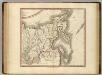
Russian Empire east.
1 : 9400000 Cary, John, ca. 1754-1835
Carte Generale de la Russie d'Asie ou Siberie.
1 : 14300000 Vivien de St Martin, L.
E. Siberia.
1 : 11000000 Society for the Diffusion of Useful Knowledge (Great Britain)
Carte de la côte N.O. del'Amerique et de la côte N.E. de l Asie reconnues en 1778 et 1779
1 : 13700000 Asie východní Bonne, Rigobert André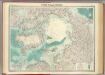
North Polar regions.
1 : 14000000 John Bartholomew and Son
Facsimile: Russian Chart of the Frozen Ocean and the Eastern Ocean.
1 : 9800000 Alaskan Boundary Tribunal
Nova Et Accurata Poli Arctici et terrarum Circum Iacentium Descriptio. [Karte], in: Novus atlas absolutissimus, Bd. 9, S. 55.
1 Karte aus Atlas Janssonius Offizin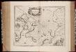
Regiones svb polo arctico / auctore Guiljelmo Blaeu
1 : 13500000 Annotatie: Met wapen; Met opdracht van Joh. Blaeu aan Guilielmus Backer de Corneliis; Origineel is Blad 147 in atlas factice; Annotatie geografische gegevens: Met 3 schaalstokken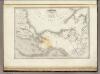
Amerique Boreale.
1 : 12000000 Montemont, A.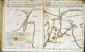
Esquisse d'une carte du cap.te Cook
2 Karten auf 1 Blatt : Kupferdruck ; 19 x 32 cm Cook; Barrington; Engel; Holzhalb s.n.
Chart of the Northern Passage between Asia & America
1 : 13500000 Neele, Samuel John John Thomson and Co.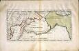
Carte der Entdekvngen zwischen Sibirien und America bis auf das Jahr 1780
1 Karte : Kupferdruck ; 18 x 40 cm Pallas s.n.
Nord Pol.
1 : 32000000 Meyer, Joseph, 1796-1856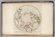
North Pole countries.
1 : 40000000 Carey, Mathew
North Pole countries.
1 : 40000000 Carey, Mathew
Countries situate about the North Pole.
1 : 41000000 Carey, Mathew
Map of the Countries situate about the North Pole.
1 : 40000000 Carey, Mathew
Map of the Countries situate about the North Pole.
1 : 40000000 Carey, Mathew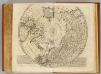
North Pole.
1 : 21500000 Bowen, Emanuel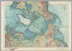
Arctic. Pergamon World Atlas.
1 : 20000000 Polish Army Topography Service
![Regiones Sub Polo Arctico. [Karte], in: Theatrum orbis terrarum, sive, Atlas novus, Bd. 1, S. 31.](https://images-2.georeferencer.com/images/iiif/924884552207/full/,300/0/native.jpg)

