Maps of Alaska

Chart of the Northern Passage between Asia & America
1 : 13500000 Neele, Samuel John John Thomson and Co.
Northern Passage.
1 : 18000000 Thomson, John
Facsimile: Spanish Admiralty World in Mercator (portion).
1 : 15200000 Alaskan Boundary Tribunal
Carta generale del Polo Artico.
1 : 22500000 Marzolla, Benedetto
Facsimile: Russian Chart of the Frozen Ocean and the Eastern Ocean.
1 : 9800000 Alaskan Boundary Tribunal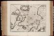
Nova et accvrata Poli Arctici et terrarum circum iacentium descriptio
1 : 17500000 Annotatie: Rechtsboven: IV; Origineel is Blad 148 in atlas factice Amstelodami : apud Ioannem Ianßonium
River Ice in Relation to Navigation, Average Annual Number of Days with Ice.
U.S. Navy
Ice Chart, Northern Hemisphere, April.
U.S. Navy
Ice Chart, Northern Hemisphere, October.
U.S. Navy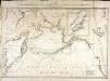
Carte des decouvertes faites par les Russes et par le capitaine anglois Jacques Cook dans la mer du Sud
1 Karte : Kupferdruck ; 52 x 79 cm Vil'brecht; Nabholz s.n.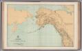
Facsimile: General Map. Parts of North America and Asia.
1 : 10340000 U.S. Coast and Geodetic Survey
Alaska.
1 : 7857000 Rand McNally and Company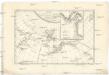
Carte de la côte N.O. del'Amerique et de la côte N.E. de l Asie reconnues en 1778 et 1779
1 : 13700000 Asie východní Bonne, Rigobert André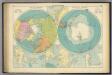
Polar Regions.
1 : 35000000 Philip, George
3. Terre polari.
1 : 45000000 Touring club italiano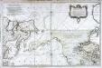
Carte réduite de l'ocean septentrional compris entre l'Asie et l'Amérique
1 Karte : Kupferdruck ; 54 x 84 cm Bellin s.n.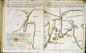
Esquisse d'une carte du cap.te Cook
2 Karten auf 1 Blatt : Kupferdruck ; 19 x 32 cm Cook; Barrington; Engel; Holzhalb s.n.
Canada - West. Pergamon World Atlas.
1 : 10000000 Polish Army Topography Service
Polar-Karte enthaltend: die Lander u. Meere vom Nord-Pol bis 50 degrees N.
1 : 29000000 Stieler, Adolf
Die allmaehlige Bildung des Russichen Reiches seit der MItte des XVten Jahrhundert's
1 : 40000000 Russland Expansion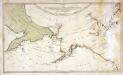
Karte von den n. w. amerikanischen und n. oe. asiatischen Küsten
1 Karte : Kupferdruck ; 38 x 66 cm Schrämbl; Roberts; Lackner zu finden in eigenem Verlage Schrämbl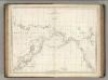
Chart of the Coasts of America and Asia.
1 : 19500000 La Perouse, Jean-Francois de Galaup, comte de, 1741-1788
Carte Generale de la Russie d'Asie ou Siberie.
1 : 14300000 Vivien de St Martin, L.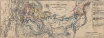
Das russische Reich nach seiner allmähligen Vergrösserung seit 1462
1 : 72000000 Russland / Asiatischer Teil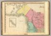
North America, N.W. Sheet..
1 : 7600000 Tanner, Henry S.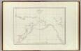
Cotes, l'Amerique, l'Asie.
1 : 25000000 La Perouse, Jean-Francois de Galaup, comte de, 1741-1788
Mapa pozemků dvora Borek
1 : 4801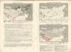
Sovětský svaz v mapách

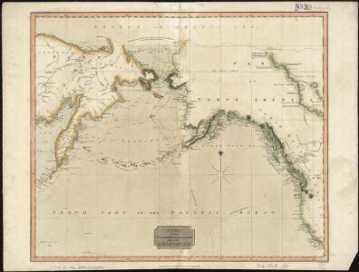
North western America showing the territory ceded by Russia to the United States.
1 : 12100000 United States Coast Survey