Maps of Alaska

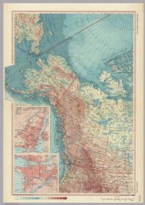
Canada - West. Pergamon World Atlas.
1 : 10000000 Polish Army Topography Service
Polar-Karte enthaltend: die Lander u. Meere vom Nord-Pol bis 50 degrees N.
1 : 29000000 Stieler, Adolf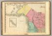
North America, N.W. Sheet..
1 : 7600000 Tanner, Henry S.
3. Terre polari.
1 : 45000000 Touring club italiano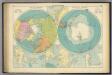
Polar Regions.
1 : 35000000 Philip, George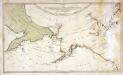
Karte von den n. w. amerikanischen und n. oe. asiatischen Küsten
1 Karte : Kupferdruck ; 38 x 66 cm Schrämbl; Roberts; Lackner zu finden in eigenem Verlage Schrämbl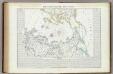
Carta generale del Polo Artico.
1 : 22500000 Marzolla, Benedetto
North western America showing the territory ceded by Russia to the United States.
1 : 12100000 United States Coast Survey
North western America showing the territory ceded by Russia to the United States.
1 : 12100000 United States Coast Survey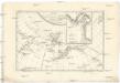
Carte de la côte N.O. del'Amerique et de la côte N.E. de l Asie reconnues en 1778 et 1779
1 : 13700000 Asie východní Bonne, Rigobert André
Chart of the Northern Passage between Asia & America
1 : 13500000 Neele, Samuel John John Thomson and Co.
Alaska.
1 : 7857000 Rand McNally and Company
Facsimile: Spanish Admiralty World in Mercator (portion).
1 : 15200000 Alaskan Boundary Tribunal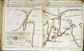
Esquisse d'une carte du cap.te Cook
2 Karten auf 1 Blatt : Kupferdruck ; 19 x 32 cm Cook; Barrington; Engel; Holzhalb s.n.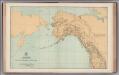
Facsimile: General Map. Parts of North America and Asia.
1 : 10340000 U.S. Coast and Geodetic Survey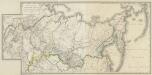
Generalʹnaja Karta Azijatskoj Rossii : po novějšemu razděleniju na Gubernii, Oblasti i primorskija Upravlenija, s pokazaniem putej Rossijskich morechodcev
1 : 7000000 Sočinena Korpusa Topografov Porutčikom Poznjakovym [S.l.] : Voenno-Topografičeskom Depo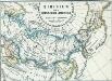
Sibirien und Russisch Amerika
1 : 70000000 Sibirien, Russisch-Amerika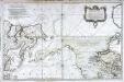
Carte réduite de l'ocean septentrional compris entre l'Asie et l'Amérique
1 Karte : Kupferdruck ; 54 x 84 cm Bellin s.n.
Facsimile: Russian Chart of the Frozen Ocean and the Eastern Ocean.
1 : 9800000 Alaskan Boundary Tribunal
North Polar Regions.
1 : 22000000 Rand McNally and Company
NW America.
1 : 11900000 Mitchell, Samuel Augustus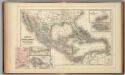
Mexico, Central America, West Indies.
1 : 12000000 Mitchell, Samuel Augustus
NW America.
1 : 11900000 Mitchell, Samuel Augustus Jr.
NW America.
1 : 11900000 Mitchell, Samuel Augustus
NW America.
1 : 11900000 Mitchell, Samuel Augustus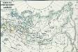
Russisches Eroberungsgebiet in Sibirien XVI. und XVII. Jahrh.
1 : 47000000 Sibirien, Eroberung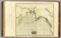
Northern Passage.
1 : 18000000 Thomson, John
The Arctic regions
1 : 14673400 Arktida National Geographic Society
N.W. coast America, N.E. coast Asia.
1 : 8700000 Cook, James, 1728-1779