Maps of Mediterranean Sea
Tabula Europae V. [Karte], in: Claud. Ptolemaeus. Geographia lat. cum mappis [...], S. 266.
1 Karte aus Atlas Münster, Sebastian [und Ptolemaeus, Claudius]
Quinta Europae Tabula [Retia, Vindelicia, Noricum, Pannonia Superior, Panonnia Inferior [...]] [Karte], in: Claudii Ptolemei viri Alexandrini mathematice discipline philosophi doctissimi geographie opus [...], S. 163.
1 Karte aus Atlas Waldseemüller, Martin [und Ptolemaeus, Claudius] Übelin, Georg
Carta geografica statistica e postale dell'Italia
From Whole
[LL.03949gk: 100/od/1943], uit: Kompas van Italië en Zuid-Oost Europa
1 : 3500000 Annotatie: Ook op de kaart: Tom Tas van Kompas; Vrijgegeven door W.B.N. [Wehrmachts Bereich in den Niederlanden] 30.10.'43; Grenzen van 1 sept. 1939; Op verso: incompleet gedeelte van wat waarschijnlijk poster is geweest, met tekst: Oranje Boot, half om half Den Haag : Kompas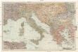
Italien und die Balkanstaaten
1 : 3000000 Itálie von Velhagen & Klasing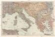
[Italien und die Balkanstaaten]
1 : 3000000 Itálie Velhagen & Klasing
Italien
1 : 5000000 1 Karte Top. Anstalt v. J. Wurster, Winterthur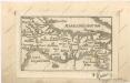
Soubor map

Tabula Moderna Et Nova Italie Ac Sicilie [Karte], in: Claudii Ptolemei viri Alexandrini mathematice discipline philosophi doctissimi geographie opus [...], S. 254.
1 Karte aus Atlas Waldseemüller, Martin [und Ptolemaeus, Claudius] Übelin, Georg
Prussian States.
1 : 5200000 Arrowsmith, Aaron; Lewis, Samuel
Map Of The Austrian Empire, Italian States. Turkey In Europe, And Greece.
1 : 7500000 Mitchell, Samuel Augustus
Quinta Europe Tabula [Karte], in: [Clavdii Ptholomei Cosmographi ...], S. 266.
1 Karte aus Atlas Nicolaus Germanus [und Ptolemaeus, Claudius]
Tabula Europae V. [Karte], in: Geographia universalis vetus et nova complectens Claudii Ptolemaei Alexandrini enarrationis libros VIII, S. 234.
1 Karte aus Atlas Münster, Sebastian [und Ptolemaeus, Claudius]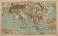
Italien und Balkanhalbinsel
1 : 9000000 Balkanhalbinsel, Italien
Italia XIIII. Nova Tabula [Karte], in: Geographia universalis vetus et nova complectens Claudii Ptolemaei Alexandrini enarrationis libros VIII, S. 341.
1 Karte aus Atlas Münster, Sebastian [und Ptolemaeus, Claudius]
Austrian Empire, Italy, Turkey in Europe, Greece.
1 : 7500000 Mitchell, Samuel Augustus
Austrian Empire, Italy, Turkey in Europe, Greece.
1 : 7500000 Mitchell, Samuel Augustus
Austrian Empire, Italy, Turkey in Europe, Greece.
1 : 7500000 Mitchell, Samuel Augustus Jr.
Austrian Empire, Italy, Turkey in Europe, Greece.
1 : 7500000 Mitchell, Samuel Augustus
Austrian Empire, Italy, Turkey in Europe, Greece.
1 : 7500000 Mitchell, Samuel Augustus
Italia XIIII. Nova Tabula [Karte], in: Claud. Ptolemaeus. Geographia lat. cum mappis [...], S. 395.
1 Karte aus Atlas Münster, Sebastian [und Ptolemaeus, Claudius]
Italien und Balkanhalbinsel
1 : 6000000 Balkanhalbinsel, Italien
[LL.07786gk: 100/od/1943], uit: Kompas van Italië en Zuid-Oost Europa
1 : 3500000 Annotatie: Ook op de kaart: Tom Tas van Kompas; Vrijgegeven door W.B.N. [Wehrmachts Bereich in den Niederlanden] 30.10.'43; Grenzen van 1 sept. 1939; Op verso: incompleet gedeelte van wat waarschijnlijk poster is geweest, met tekst: Oranje Boot, half om half Den Haag : Kompas
L'Italie distinguée suivant l'estendüe de tous les Estats, Royaumes, Republiques, Duchés, Pricipautés qui la partagent presentement [Karte], in: Atlas nouveau, contenant toutes les parties du monde [...], Bd. 2, S. 121.
1 Karte aus Atlas Sanson, Nicolas Jaillot, Alexis Hubert und Mortier, Pieter
Italy, Turkey, Greece, Europe.
Goodrich, S.G.
[Historisch-geographischer Atlas zu den allgemeinen Geschichtswerken von C. v. Rotteck, Pölitz u. Becker] : Italien eine Uebersicht seiner Völker und Staaten in der ältesten Zeit
von Julius Loewenberg Lithographie von B. Herder in Freiburg im Breisgau [Freiburg im Breisgau] : [Herder]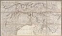
[2], uit: Carte de la partie septentrionale de l'Italie / par Chauchard
1 : 560000 Chauchard (capitaine) Paris : Dezauche
Théâtre des Victoires de l'Armée d'Italie aux Ordres Du Général Buonaparte
Longchamps, Jacques François des; Blondeau, A. N. Pointeau
Italia XIX. Nova Tabula. [Karte], in: Claud. Ptolemaeus. Geographia lat. cum mappis [...], S. 419.
1 Karte aus Atlas Münster, Sebastian [und Ptolemaeus, Claudius]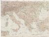
![Tabula Europae V. [Karte], in: Claud. Ptolemaeus. Geographia lat. cum mappis [...], S. 266.](https://images-2.georeferencer.com/images/iiif/499752749962/full/,300/0/native.jpg)

