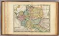
Maps of Ukraine

Lithuania. [Karte], in: Gerardi Mercatoris Atlas, sive, Cosmographicae meditationes de fabrica mundi et fabricati figura, S. 161.
1 Karte aus Atlas Mercator, Gerhard Montanus, Petrus
Lithuania. [Karte], in: Atlas, sive, Cosmographicae meditationes de fabrica mundi et fabricati figura, S. 156.
1 Karte aus Atlas Mercator, Gerhard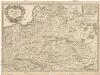
Estats de la couronne de Pologne
1 : 2600000 Evropa východní Sanson, Guillaume Cordier, Louis chez H. Jaillot
Mappa geographica ex novissimis observationibus repraesentans Regnum Poloniae et Magnum Ducatum Lithuaniae
1 : 2000000 cura et sumptibus Tobiae Conradi Lotter Aug[usta] Vind[elicorum] : sumptibus Tobiae Conradi Lotter
[Geschichtlich-geographische Entwickelung des Zuwachses und der Abnahme des polnischen Reiches vom Jahre 992 bis zum Jahre 1831, dargestellt in fünf Karten] : III. Karte von Polen von dem Aussterben der Jagellonen bis zur ersten Theilung, 1572-1772
1 : 4800000 entw. u. gez. durch F.A. von Witzleben [Berlin] : [Reimer]
[Geschichtlich-geographische Entwickelung des Zuwachses und der Abnahme des polnischen Reiches vom Jahre 992 bis zum Jahre 1831, dargestellt in fünf Karten] : II. Karte von Polen unter dem Jagellonen, 1386-1572
1 : 4800000 entw. u. gez. durch F.A. von Witzleben [Berlin] : [Reimer]
[Geschichtlich-geographische Entwickelung des Zuwachses und der Abnahme des polnischen Reiches vom Jahre 992 bis zum Jahre 1831, dargestellt in fünf Karten] : I. Karte von Polen unter den Piasten vom jahre, 932-1386
1 : 4800000 entw. u. gez. durch F.A. von Witzleben [Berlin] : [Reimer]
[Geschichtlich-geographische Entwickelung des Zuwachses und der Abnahme des polnischen Reiches vom Jahre 992 bis zum Jahre 1831, dargestellt in fünf Karten] : IV. Karte der 3 Theilungen Polens von 1773-1795
1 : 4800000 entw. u. gez. durch F.A. von Witzleben [Berlin] : [Reimer]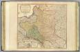
Poland, Prussia.
1 : 2300000 Faden, William, 1750?-1836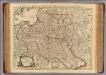
La Pologne.
1 : 2600000 L'Isle, Guillaume de, 1675-1726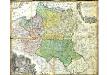
Mappa Geographica Regni Poloniae
Mayer, Tobias
[Geschichtlich-geographische Entwickelung des Zuwachses und der Abnahme des polnischen Reiches vom Jahre 992 bis zum Jahre 1831, dargestellt in fünf Karten] : V. Karte der Wiederherstellung Polens, 1807-1831
1 : 4800000 entw. u. gez. durch F.A. von Witzleben [Berlin] : [Reimer]
Nieuwe kaart van Polen, Pruissen, Lithauwen, Koerland en Samogitie
1 : 5000000 [S.l.] : [s.n.]
Mappa geographica ex novissimis observationibus repraesentans regnum Poloniae et magnum ducatum Lithuaniae
1 : 2740000 Litva Probst, Johann Michael Ioh. Michael Probst
Poland: Density
1 : 3000000 Series of maps on various aspects of Poland. Density. Number of inhabitants per square kilometre. War Office
Regni Poloniae Magniquae Ducatus Lithuaniae Nova et exacta tabula
1 : 3000000 Litva Homann, Johann Baptist Starowolski, Szymon a Ioh. Bapt. Homanno
Estats de la couronne de Pologne : presenté a monseigneur le duc de Bourgogne
1 : 1350000 par son [...] serviteur H. Jaillot A Amsterdam : che[z] Reinier & [Josua] Ottens
Poland: Poles (excluding Jews)
1 : 3000000 Series of maps on various aspects of Poland. Poles (excluding Jews). Kingdom of Poland (1897) an Galicia (1900). Distribution of Poles, showing minorities. War Office
G. Freytags Karte der westrussischen Kriegsschauplätze
1 : 2000000 Evropa východní Freytag, Gustav G. Freytag & Berndt
Mapa rozmieszczenia gleb na ziemiach polskich
1 : 6300000 Polen Geologie Arct, Michał
Polen nach dem Frieden von Oliva 1660
Polen Oliva / Friede
Mapa rozmieszczenia bogactw kopalnych na ziemiach polskich
1 : 6300000 Polen Geologie Arct, Michał
Regni Poloniae Magnique Ducat[us] Lithuaniae Nova et exacta Tabula
1 : 3000000 Homann, Johann Baptist
Mappa geographica regni Poloniae ex novissimis quot quot sunt mappis specialibus composita et ad LL. stereographica projectionis
1 : 2900000 Bělorusko Mayer, Tobias per Homannianos Heredes

Poland: Language. No.1
1 : 3000000 Series of maps on various aspects of Poland. Languages in 1910-1913. War Office

Regni Poloniae et ducatus Lithvaniae Voliniae, Podoliae Vcraniae Prvssiae, Livoniae et Cvrlandiae / descriptio emendata per F. de Wit Amstelodami
1 : 3000000 Annotatie: Rechtsboven: 14; Origineel is Blad 132 in atlas factice; Annotatie geografische gegevens: Met schaalstok: 15 Duytsche Mylen Frederick de Wit 1630-1706 [Amsterdam : F. de Wit]
Bez titulu: soubor map pag. 245
![Lithuania. [Karte], in: Gerardi Mercatoris Atlas, sive, Cosmographicae meditationes de fabrica mundi et fabricati figura, S. 161.](https://images-0.georeferencer.com/images/iiif/131733303959/full/,300/0/native.jpg)

