Maps of Ukraine

Lithuania. [Karte], in: Atlas, sive, Cosmographicae meditationes de fabrica mundi et fabricati figura, S. 156.
1 Karte aus Atlas Mercator, Gerhard
Lithuania. [Karte], in: Gerardi Mercatoris Atlas, sive, Cosmographicae meditationes de fabrica mundi et fabricati figura, S. 161.
1 Karte aus Atlas Mercator, Gerhard Montanus, Petrus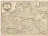
Estats de la couronne de Pologne
1 : 2600000 Evropa východní Sanson, Guillaume Cordier, Louis chez H. Jaillot
Mappa geographica ex novissimis observationibus repraesentans regnum Poloniae et magnum ducatum Lithuaniae
1 : 2740000 Litva Probst, Johann Michael Ioh. Michael Probst
Estats de la couronne de Pologne : presenté a monseigneur le duc de Bourgogne
1 : 1350000 par son [...] serviteur H. Jaillot A Amsterdam : che[z] Reinier & [Josua] Ottens

Mappa geographica ex novissimis observationibus repraesentans Regnum Poloniae et Magnum Ducatum Lithuaniae
1 : 2000000 cura et sumptibus Tobiae Conradi Lotter Aug[usta] Vind[elicorum] : sumptibus Tobiae Conradi Lotter
Mapa rozmieszczenia bogactw kopalnych na ziemiach polskich
1 : 6300000 Polen Geologie Arct, Michał
[Geschichtlich-geographische Entwickelung des Zuwachses und der Abnahme des polnischen Reiches vom Jahre 992 bis zum Jahre 1831, dargestellt in fünf Karten] : III. Karte von Polen von dem Aussterben der Jagellonen bis zur ersten Theilung, 1572-1772
1 : 4800000 entw. u. gez. durch F.A. von Witzleben [Berlin] : [Reimer]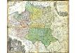
Mappa Geographica Regni Poloniae
Mayer, Tobias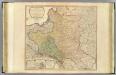
Poland, Prussia.
1 : 2300000 Faden, William, 1750?-1836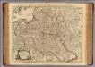
La Pologne.
1 : 2600000 L'Isle, Guillaume de, 1675-1726
[Geschichtlich-geographische Entwickelung des Zuwachses und der Abnahme des polnischen Reiches vom Jahre 992 bis zum Jahre 1831, dargestellt in fünf Karten] : I. Karte von Polen unter den Piasten vom jahre, 932-1386
1 : 4800000 entw. u. gez. durch F.A. von Witzleben [Berlin] : [Reimer]
Das alte und neue Polen
1 : 2690000 Polsko Michaelis, E. H. Edler. A. in Commission des geographischen dépots
Regni Poloniae et ducatus Lithuaniae Voliniae, Podoliae Ucraniae Prussiae et Curlandiae descriptio
1 : 2600000 1 Karte : Kupferdruck ; 49 x 57 cm Danckerts, Cornelis [Danckerts]
Osteuropa zur Zeit der drei Theilungen Polens.
Evropa východní Benecke Bormann, E. F. Tempsky
Bez titulu: soubor map pag. 245

[Geschichtlich-geographische Entwickelung des Zuwachses und der Abnahme des polnischen Reiches vom Jahre 992 bis zum Jahre 1831, dargestellt in fünf Karten] : IV. Karte der 3 Theilungen Polens von 1773-1795
1 : 4800000 entw. u. gez. durch F.A. von Witzleben [Berlin] : [Reimer]
Nieuwe kaart van Polen, Pruissen, Lithauwen, Koerland en Samogitie
1 : 5000000 [S.l.] : [s.n.]
[Geschichtlich-geographische Entwickelung des Zuwachses und der Abnahme des polnischen Reiches vom Jahre 992 bis zum Jahre 1831, dargestellt in fünf Karten] : II. Karte von Polen unter dem Jagellonen, 1386-1572
1 : 4800000 entw. u. gez. durch F.A. von Witzleben [Berlin] : [Reimer]
Mappa geographica regni Poloniae ex novissimis quot quot sunt mappis specialibus composita et ad LL. stereographica projectionis
1 : 2900000 Bělorusko Mayer, Tobias per Homannianos Heredes
Regni Poloniae Magnique Ducatus Lithuaniae Nova et exacta Tabula ad mentem Starovolcii descripta à Ioh. Bapt. Homanno Sac. Caes. Mai. Geographo
Polen, Litauen Homann, Johann Baptist
Poland: Density
1 : 3000000 Series of maps on various aspects of Poland. Density. Number of inhabitants per square kilometre. War Office
Mapa rozmieszczenia gleb na ziemiach polskich
1 : 6300000 Polen Geologie Arct, Michał
[Geschichtlich-geographische Entwickelung des Zuwachses und der Abnahme des polnischen Reiches vom Jahre 992 bis zum Jahre 1831, dargestellt in fünf Karten] : V. Karte der Wiederherstellung Polens, 1807-1831
1 : 4800000 entw. u. gez. durch F.A. von Witzleben [Berlin] : [Reimer]
Mappa geographica ex novissimis observationibus repraesentans Regnum Poloniae et magnum ducatum Lithuaniae
1 : 2800000 Evropa východní Lotter, Tobias Conrad sumptibus Tobiae Conradi Lotter
Mappa geographica Regnum Poloniae ex novissimis observationibus repraesentans Regnum Poloniae et Magnum ducatum Lithuniae
1 : 2700000 Evropa východní Lotter, Tobias Conrad T. C. Lotter
Mappa geographica Regnum Poloniae ex novissimis observationibus repraesentans Regnum Poloniae et Magnum ducatum Lithuniae
1 : 2800000 Evropa východní Lotter, Tobias Conrad T. C. Lotter
Mappa geographica Regnum Poloniae ex novissimis observationibus repraesentans Regnum Poloniae et Magnum ducatum Lithuniae
1 : 2800000 Evropa východní Lotter, Tobias Conrad T. C. Lotter
![Lithuania. [Karte], in: Atlas, sive, Cosmographicae meditationes de fabrica mundi et fabricati figura, S. 156.](https://images-0.georeferencer.com/images/iiif/975962778012/full/,300/0/native.jpg)

