Maps of Ukraine


Nieuwe kaart van Polen
1 : 18000000 te Amsterdam : bij T. Crajenschot
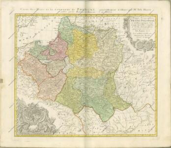
Mappa Geographica Regni Poloniae
Mayer, Tobias
Polen nach dem Frieden von Oliva 1660
Polen Oliva / Friede
La Pologne.
1 : 2600000 L'Isle, Guillaume de, 1675-1726
Poland, Prussia.
1 : 2300000 Faden, William, 1750?-1836
Mappa geographica regni Poloniae ex novissimis quot quot sunt mappis specialibus composita et ad LL. stereographica projectionis
1 : 2900000 Bělorusko Mayer, Tobias per Homannianos Heredes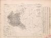
Poland: Poles
1 : 3000000 Series of maps on various aspects of Poland. Distribution of Poles showing minorities. War Office
[Geschichtlich-geographische Entwickelung des Zuwachses und der Abnahme des polnischen Reiches vom Jahre 992 bis zum Jahre 1831, dargestellt in fünf Karten] : II. Karte von Polen unter dem Jagellonen, 1386-1572
1 : 4800000 entw. u. gez. durch F.A. von Witzleben [Berlin] : [Reimer]
Poland: Lithuanians, Little Russians and Czechs
1 : 3000000 Series of maps on various aspects of Poland. Distribution of Lithuanians, Little Russians and Czechs, showing minorities. War Office
Die Teilungen Polens
1 : 15000000 Polen Teilungen Polens
Poland: Density
1 : 3000000 Series of maps on various aspects of Poland. Density. Number of inhabitants per square kilometre. War Office
[Geschichtlich-geographische Entwickelung des Zuwachses und der Abnahme des polnischen Reiches vom Jahre 992 bis zum Jahre 1831, dargestellt in fünf Karten] : IV. Karte der 3 Theilungen Polens von 1773-1795
1 : 4800000 entw. u. gez. durch F.A. von Witzleben [Berlin] : [Reimer]
Polen und Litthauen nach der Lubliner Union 1569 und dem Aussterben der Jagiellonen 1572
1 : 12000000 Polen-Litauen
Poland: Language. No.1
1 : 3000000 Series of maps on various aspects of Poland. Languages in 1910-1913. War Office
Mappa geographica ex novissimis observationibus repraesentans Regnum Poloniae et Magnum Ducatum Lithuaniae
1 : 2000000 cura et sumptibus Tobiae Conradi Lotter Aug[usta] Vind[elicorum] : sumptibus Tobiae Conradi Lotter
[Geschichtlich-geographische Entwickelung des Zuwachses und der Abnahme des polnischen Reiches vom Jahre 992 bis zum Jahre 1831, dargestellt in fünf Karten] : III. Karte von Polen von dem Aussterben der Jagellonen bis zur ersten Theilung, 1572-1772
1 : 4800000 entw. u. gez. durch F.A. von Witzleben [Berlin] : [Reimer]
Poland: Jews
1 : 3000000 Series of maps on various aspects of Poland. Distribution of Jewish minorities. War Office
Poland: Poles (excluding Jews)
1 : 3000000 Series of maps on various aspects of Poland. Poles (excluding Jews). Kingdom of Poland (1897) an Galicia (1900). Distribution of Poles, showing minorities. War Office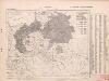
Poland: Germans and White Russians
1 : 3000000 Series of maps on various aspects of Poland. Poland. Germans and White Russians. Distribution of Germans and White Russians, showing minorities War Office
[Geschichtlich-geographische Entwickelung des Zuwachses und der Abnahme des polnischen Reiches vom Jahre 992 bis zum Jahre 1831, dargestellt in fünf Karten] : V. Karte der Wiederherstellung Polens, 1807-1831
1 : 4800000 entw. u. gez. durch F.A. von Witzleben [Berlin] : [Reimer]
[Geschichtlich-geographische Entwickelung des Zuwachses und der Abnahme des polnischen Reiches vom Jahre 992 bis zum Jahre 1831, dargestellt in fünf Karten] : I. Karte von Polen unter den Piasten vom jahre, 932-1386
1 : 4800000 entw. u. gez. durch F.A. von Witzleben [Berlin] : [Reimer]
Polen vom Anfange des XVIII Jahrhunderts bis zum Untergange der Republik 1795
1 : 5000000 Polen-Litauen, Teilungen Polens
Bez titulu: soubor map pag. 245

Volker und Reiche der Slaven zwischen Elbe und Don bis 1125.
1 : 5000000 Spruner von Merz, Karl
Polen und Litthauen unter den Jagjellonen 1386-1572.
1 : 5000000 Spruner von Merz, Karl
Nieuwe kaart van Polen, Pruissen, Lithauwen, Koerland en Samogitie
1 : 5000000 [S.l.] : [s.n.]
Mapa rozmieszczenia gleb na ziemiach polskich
1 : 6300000 Polen Geologie Arct, Michał
Polen nach der ersten Theilung 1772
1 : 20000000 Polen Teilung Polens <1772>