Maps of Israel

Situs Terrae Canaan, Sive Terrae Promissionis, Hodie Palestinae, S. S. Bibliorum intelligentiam exacte aperiens, per Christianum Adrichomium Delphum. [...] [Karte] , in: Atlas nouveau, contenant toutes les parties du monde [...], Bd. 2, S. 215.
1 Karte aus Atlas Sanson, Nicolas Jaillot, Alexis Hubert und Mortier, Pieter
Carta della Palestina sotto il dominio de' Romani.
1 : 805000 Marzolla, Benedetto
Palästina als Schauplatz der heiligen Geschichte
1 : 236000 Egypt Kocen, Blaž Eduard Hölzel
Palästina als Schauplatz der heiligen Geschichte
1 : 236000 Egypt Kocen, Blaž Eduard Hölzel
Palestina
1 : 236000 Egypt Kocen, Blaž Kovář, M. R. Eduard Hölzel
Carta della Palestina sotto il dominio de'Romani
1 : 680000 Marzolla, Benedetto [Verlag nicht ermittelbar]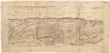
Sitvs terrae Canaan, sive Terrae promissionis, hodie Palaestinae, Ss. Bibliorvm intelligentiam exacte aperiens
Kanaán Sanson, Nicolas Adrichem, Christiaan van Pierre Mortier
Judaea sive Terra Sancta quae Israelitarum suas duodecim tribus distincta, secretis ab invicem regnis Juda, et Israel expressis in super sex ejusdem terrae provincijs
1 : 650000 ex conatibus geographicis Gulielmi Sanson [...] Amst[erdam] : ex officina R. & J. Ottens
Palestine sous la domination romaine.
1 : 800000 Brue, Adrien Hubert, 1786-1832

Kaart van 't land Kanaan / naar de beste waarnemingen tot verstand van Num. XXI:14-31 ontworpen door R. Schutte ; J. van Jagen sculps. 1766
1 : 800000 Annotatie: Waarschijnlijk blad uit zakatlas Schutte, Rutger; Jagen, J. van Te Amsterdam : by J. Loveringh
Palestine.
1 : 1027000 Johnson, A.J.
Judaea seu Terra Sancta quae Hebraeorum sive Israelitarum in suas duodecim tribus divisa, secretis ab invicem regnis Juda, et Israel expressis insuper sex ultimi temporis ejusdem terrae provincijs
1 : 740000 ex conatibus geographicis Gulielmi Sanson [...] A Amsterdam : chez Pierre Schenk
Palestine.
1 : 684288 Stanford, Edward
A map of Palestine or the Holy Land : with the division into tribes and provinces / by A.H. Dufour
1 : 1100000 Annotatie: Engraved for "Three years in the East". &a Dufour, Auguste Henri [S.l. : s.n.]
't Land Kanaan benevens Gilead verdeelt onder de XII stammen Israëls waar in de gelegendheid en uitgestrektheid van ieder erfdeel word aangewezen
1 : 700000 door W.A. Bachiene J. van Jagen mapp. sculpsit, et figur. apposit. sculpturam curavit ; J.C. Philips fecit. Uitgegeven te Gorinchem : by Nicolaas Goetzee
Afbeelding van 't land van Israël, naar deszelfs natuurlyke gesteltheid : waar in alle de zeën, rivieren en beeken, gelyk ook de bergen en dalen, de vlaktens, de woestynen, enz. dezes lands, die in de H.S. genoemt zyn, worden aangewezen
1 : 750000 door W.A. Bachiene J. van Jagen sculp. ; J.C. Philips fecit. te Gorinchem : by Nicolaas Goetzee
Homannův atlas světa
1 : 570000
Palestine.
1 : 1000000 Colton, G.W.
Aardrijkskundige, plaatsbeschrijvende en geschiedkundige kaart van Palestina of het Heilige land
1 : 281000 oorspronkelijk geteekend door J.T. Assheton [...] bijzonderlijk wat de teekening betreft naauwkeurig herz. en verb. door E. Maaskamp ; onder toezigt en medew. van [...] J. Clarisse Te Amsterdam : bij E. Maaskamp, thans het eigendom van J. C. van Kesteren, boekhandelaar en boekdrukker te Amsterdam
Palestine or Canaan
1 : 1
Palestine, Israelites.
Mitchell, Samuel Augustus
Palestine.
1 : 1000000 Colton, G.W.
Terre de Canaan á present la Palestine
1 : 1100000 Kanaán
Palestine
1 : 1000000 Colton, G.W.

Bez titulu: Historický Atlas
Sitvs terre sancte ivxta nvmerv[m] filior[um] Israel per apices sev pv[n]cta divisvs
Palestina
Palestine sous la domination romaine.
1 : 800000 Picquet, C.
![Situs Terrae Canaan, Sive Terrae Promissionis, Hodie Palestinae, S. S. Bibliorum intelligentiam exacte aperiens, per Christianum Adrichomium Delphum. [...] [Karte] , in: Atlas nouveau, contenant toutes les parties du monde [...], Bd. 2, S. 215.](https://images-2.georeferencer.com/images/iiif/056906165109/full/,300/0/native.jpg)

