Maps of Aube

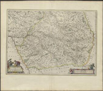
SENONOIS, | & | LA PARTIE MERIDIONALE | DE LA CHAMPAGNE
[Amsterdam : Joan Blaeu]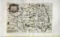
Campania et Bria
1 Karte : Kupferdruck ; 15 x 22 cm Lambert Andreae
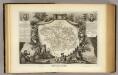
Partie méridionale de Champagne
1 Karte : Kupferdruck ; 46 x 62 cm L'Isle; Buache; Dezauche chez Dezauche au milieu de la rue des Noyers
Partie meridionale de Champagne
1 Karte : Kupferdruck ; 44 x 60 L'Isle; Condet chez J. Cóvens et C. Mortier
Carte de la province de Champagne partie méridionale
1 Karte : Kupferdruck ; 50 x 66 cm Delafosse chés l'auteur rue S. Martin
Partie méridionale du gouvernem.t général de Champagne
1 Karte : Kupferdruck ; 47 x 63 cm Robert de Vaugondy; Haussard s.n.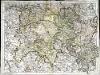
Partie meridionale de Champagne
1 Karte : Kupferdruck ; 45 x 61 cm L'Isle chez l'auteur sur le quai de l'Horloge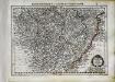
Champagne
1 Karte : Kupferdruck ; 17 x 24 cm Mercator Cloppenburgh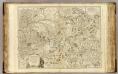
Champagne partie meridionale.
1 : 320000 Robert de Vaugondy, Gilles, 1688-1766
Champagne
1 Karte : Kupferdruck ; 36 x 48 cm Blaeu; Blaeu apud Guiljelmum et Ioannem Blaeu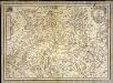
Carte generale de Champagne
1 Karte : Kupferdruck ; 35 x 49 cm Tassin C. Tassin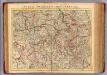
Champagne Meridionale.
1 : 336000 L'Isle, Guillaume de, 1675-1726
Carte dv pais de Champagne
Champagne-oblast (Francie) Templeux, Damien de Jean le Clerc
Champagne
1 : 505000 Champagne-oblast (Francie) apud Ioanem Ianßonium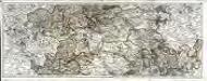
Carte du gouvernement de Champagne, 2
2 Blätter : 38 x 95 cm Bourgoin
Karte vom Kriegestheater der vereinigten preussischen und östreichischen Armeen in Frankreich in VI. Blättern, [Blatt 8 und 11]
2 Teile auf 2 Blättern : 48 x 38 cm Königl. preuss. Akademische Kunst- und Buchhandlung
Carte des dérivations d'eaux de sources
1 : 320000 [s.n.]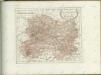

Département de l'Aube
1 Karte : Kupferdruck ; 33 x 41 cm Capitaine s.n.
Generalkarte von Zentraleuropa

Département de l'Aube
1 Karte : Kupferdruck ; 49 x 48 cm Houdan au bureau de l'atlas national de France rue Serpente no. 15 et au cabinet bibliographique rue de la vieille Monnoie no. 12
Tricasses
1 Karte : Kupferdruck ; 42 x 53 cm Sanson; Robert de Vaugondy ches le Sr. Robert geogr. ordin.re du roy quai de l'Horloge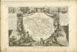

Sheet 5, uit: Stanford's large scale map of the seat of war / Stanford's Geographical Estab[lishmen]t
1 : 300000 Stanford's Geographical Establishment, Londen London : Stanford
Département de l'Aube
1 : 260000 Aube (Francie) P. G. Chanlaire et Dumez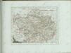
Dept. De L'Aube.
1 : 597000 Levasseur, Victor.
Raspoloženie vojujuščich armij pri otkrytii Napoleonom pochoda
Frankreich Befreiungskriege <1813-1815>
Chalons - sur Marne 124, uit: [W. Liebenow's Special-Karte von Mittel-Europa]
1 : 300000 titelvariant: W. Liebenow's Mittel-Europa; Annotatie: Titel boven de bladen: W. Liebenow's Mittel-Europa Johannes Wilhelm Liebenow 1822-1897 Hannover : Hermann Oppermann