Maps of Ukraine
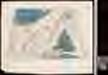
[Sarmatia Europae et Tauricam Chersonesum]
1 : 3900000 1 Karte : Holzschnitt ; 29 x 47 cm Ptolemaeus, Claudius [Gaspard Trechsel]
Raab's Karte der Eisenbahnen Russland's
1 : 4750000 Evropa východní Raab, G. F. Carl Flemming
Moscoviae imperivm
1 : 11000000 1 Karte : Kupferdruck ; 20 x 27 cm Bussemacher, Johannes formulis Jani Bussemecheri
Russia / J.C. Russell junr. delt. et sculp.
1 : 20000000 1 Karte : Kupferdruck ; 22 x 18 cm Russell, J.C. [Verlag nicht ermittelbar]
Wehrgeologische Übersichtskarte des Europäischen Rußlands
1 : 2500000 Rusko západní Generalstab des Heeres
Moscovia Sigmunds Freyherrns zu Herberstain / Neyperg und Guetenhag
1 : 6400000 1 Karte : Holzschnitt ; 27 x 38 cm Herberstein, Sigmund von durch Michael Zimmermann in S. Annenhof
Russland nach seinen kirchlichen Verhältnissen bis zum XVI. Jahrhundert
1 : 15000000 Russland Kirchengeschichte
Imperium Moscoviae
1 : 20000000 1 Karte : Kupferdruck ; 13 x 17 cm Weigel, Johann Christoph [Johann Christoph Weigel]
Poland.
from New & accurate description of the earth in all its empires, kingdoms and states
Osteuropa beim Regierungsantritte Peters des Gr. 1682
Osteuropa Peter I., Russland, Zar
Osteuropa beim Regierungsantritte Peters des Gr. 1682
Osteuropa Peter I., Russland, Zar
Russland 1462-1762
1 : 18000000 Russland
Osteuropa um das Jahr 1250
Osteuropa
Moschovia nuova tavola
1 : 11000000 1 Karte : Kupferdruck ; 19 x 24 cm Ptolemaeus, Claudius [Vincenzo Valgrisi]
Moschovia nuova tavola
1 : 11000000 1 Karte : Kupferdruck ; 19 x 24 cm Ptolemaeus, Claudius [Vincenzo Valgrisi]
Friedensdislokation im europäischen Russland
1 : 2800000 Evropa východní
Karta teatra Sěvernoj vojny. Perīod 1707 - 1709 gg.
Russland Nordischer Krieg <1700-1721>
[Východoevropské státy]
Evropa východní
Ruszland 1462-1762
1 : 15000000 Russland Expansion
Karte von Polen und den ehemals dazu gehörigen Provinzen
1 : 8200000 Bělorusko Sotzmann, Daniel Friedrich von D.F. Sotzmann
Plan von der Krim und der Nogdyschen und Kubanschen Tatarey
1 : 7420000 Krym (Ukrajina)
Die Slaven nördlich von der Donau um 900
1 : 21000000 Osteuropa Slawen
[Východní Evropa]
Evropa východní
Übersicht des österrechisch-russischen Kriegsschauplatzes

Russie occidentale, Pologne.
1 : 4060000 Picquet, C.
Osteuropa 1815
Osteuropa Kunz, Andreas ; Treiling, Thomas ; Moeschl, Joachim Robert
Vollstaendiger Kriegs-Schauplatz in Pohlen und Russland im Jahre 1812
1 : 2312000 Polsko im Kunst und Industrie Komptoir
[V]oll[st]and[i]ger Kriegs-Schauplatz in [P]o[h]len [und Rus]sland im Jahre [1]812
1 : 2312000 Polsko Kunst und Industrie Komptoir
![[Sarmatia Europae et Tauricam Chersonesum]](https://images-2.georeferencer.com/images/iiif/133066796075/full/,300/0/native.jpg)

