Maps of British Isles

Britannia prout divisa suit temporibus Anglo-Saxonvm, præsertim durante illorum Heptarchia
1 Karte : Kupferdruck ; 40 x 30 cm, Bildgrösse 41 x 53 cm Blaeu Joan Blaeu
(La Grande-Bretagne)
1 : 12000000 Bruyset, Jean-Marie; Schneider, J. H.
British Isles - railways & industrial.
1 : 2000000 John Bartholomew & Co.
British Isles - bathy-orographical.
1 : 2000000 John Bartholomew & Co.
British Isles - political.
1 : 2000000 John Bartholomew & Co.
British Isles.
1 : 2950000 Wauthier, J. M.
Plain map British Islands.
1 : 2950000 Wauthier, J. M.
A new map of Great Britain.
from The world described, or, A new and correct sett of maps : shewing the kingdoms and states in all the known parts of the earth, with the principal cities, and most considerable towns in the world ... / ... by Herman Moll, geographer ...
British Isles.
1 : 2661120 Letts, Son & Co.
Railway Map of the British Isles.
1 : 2217600 Fullarton, A. & Co.
The British Isles.
1 : 2700000 Society for the Diffusion of Useful Knowledge (Great Britain)
British Islands.
1 : 3484800 Burr, David H., 1803-1875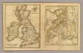
British Isles, Asia.
Adams, Daniel
British Isles.
1 : 1700000 Thomson, John
Brittischen Inseln.
1 : 10000000 Brudin, J. L.; Stieler, Adolf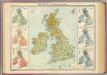
British Isles - vegetation & climate.
1 : 3000000 John Bartholomew & Co.
BRITANNIA | prout divisa suit temporibus | ANGLO-SAXONVM [...].
[Amsterdam : Joan Blaeu]
Les Britannique.
1 : 2850000 Migeon, J.
Iles Britanniques.
1 : 2500000 Brue, Adrien Hubert, 1786-1832
Firing ranges, UK
Great Britain War Office General Staff Geographical Section
RAF map of Danger Areas in the United Kingdom (Permanent sites)
Great Britain War Office General Staff Geographical Section Ordnance Survey
The British Isles. (with) inset map of the Shetland Islands.
1 : 3801600 Tallis, J. & F.
Great Britain, Ireland.
1 : 5500000 Huntington, Nathaniel G. (Nathaniel Gilbert), 1785-1848
British Isles.
1 : 6200000 Worcester, Joseph E.
Tabula novissima accuratissima regnorum Angliæ, Scotiæ Hiberniæ
1 Karte : Kupferdruck ; 56 x 48 cm Lotter Tobias Konrad Lotter
Tabula novissima accuratissima regnorum Angliæ, Scotiæ Hiberniæ
1 Karte : Kupferdruck ; 57 x 48 cm Seutter Matthäus Seutter
Carte du gouvernement militaire d'Angleterre
1 Karte : Kupferdruck ; 16 x 15 cm, Bildgrösse 35 x 46 cm Châtelain s.n.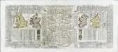
Nouvelle carte pour introduire a la geographie et a la genealogie des rois d'Angleterre et d'Ecosse
4 Karten auf 2 Blättern : Kupferdruck ; Bildgrösse 38 x 92 cm Châtelain s.n.
Insvlarvm britannicarvm acurata delineatio
1 Karte : Kupferdruck ; 37 x 49 cm Ortelius; Janssonius; Keere apud Ioannem Ianssonium


