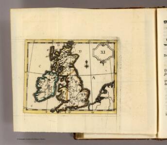
Maps of British Isles

(La Grande-Bretagne)
1 : 12000000 Bruyset, Jean-Marie; Schneider, J. H.
British Isles - railways & industrial.
1 : 2000000 John Bartholomew & Co.
British Isles - bathy-orographical.
1 : 2000000 John Bartholomew & Co.
British Isles - political.
1 : 2000000 John Bartholomew & Co.
British Isles.
1 : 2950000 Wauthier, J. M.
Plain map British Islands.
1 : 2950000 Wauthier, J. M.
British Isles.
1 : 2661120 Letts, Son & Co.
Railway Map of the British Isles.
1 : 2217600 Fullarton, A. & Co.
The British Isles.
1 : 2700000 Society for the Diffusion of Useful Knowledge (Great Britain)
British Islands.
1 : 3484800 Burr, David H., 1803-1875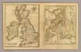
British Isles, Asia.
Adams, Daniel
British Isles.
1 : 1700000 Thomson, John
Brittischen Inseln.
1 : 10000000 Brudin, J. L.; Stieler, Adolf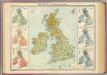
British Isles - vegetation & climate.
1 : 3000000 John Bartholomew & Co.
Britannia prout divisa suit temporibus Anglo-Saxonvm, præsertim durante illorum Heptarchia
1 Karte : Kupferdruck ; 40 x 30 cm, Bildgrösse 41 x 53 cm Blaeu Joan Blaeu
Les Britannique.
1 : 2850000 Migeon, J.
Iles Britanniques.
1 : 2500000 Brue, Adrien Hubert, 1786-1832
The British Isles. (with) inset map of the Shetland Islands.
1 : 3801600 Tallis, J. & F.
Great Britain, Ireland.
1 : 5500000 Huntington, Nathaniel G. (Nathaniel Gilbert), 1785-1848
British Isles.
1 : 6200000 Worcester, Joseph E.
Tabula novissima accuratissima regnorum Angliæ, Scotiæ Hiberniæ
1 Karte : Kupferdruck ; 56 x 48 cm Lotter Tobias Konrad Lotter
Tabula novissima accuratissima regnorum Angliæ, Scotiæ Hiberniæ
1 Karte : Kupferdruck ; 57 x 48 cm Seutter Matthäus Seutter
Carte du gouvernement militaire d'Angleterre
1 Karte : Kupferdruck ; 16 x 15 cm, Bildgrösse 35 x 46 cm Châtelain s.n.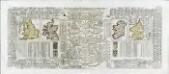
Nouvelle carte pour introduire a la geographie et a la genealogie des rois d'Angleterre et d'Ecosse
4 Karten auf 2 Blättern : Kupferdruck ; Bildgrösse 38 x 92 cm Châtelain s.n.
Insvlarvm britannicarvm acurata delineatio
1 Karte : Kupferdruck ; 37 x 49 cm Ortelius; Janssonius; Keere apud Ioannem Ianssonium
Novissima prae caeteris aliis accuratissima regnorum Angliae, Scotiae, Hiberniae tabula
1 : 1900000 auctore Petri Schenk Amstelodami : Petrus Schenk
British Isles railways.
1 : 1800000 Philip, George
United Kingdom.
1 : 4100000 Darton, William
Grossbritanien.
1 : 3900000 Haller von Hallerstein, Friedrich; Reichard, C. G.