Maps of Mratín

Indikační skica mapy stabilního katastru pro obec Nová Ves I.-VII.
1 : 2880
Neudorf - c5208-1-002 - Kaiserpflichtexemplar der Landkarten des stabilen Katasters
1 : 2880
Neudorf - c5208-1-001 - Kaiserpflichtexemplar der Landkarten des stabilen Katasters
1 : 2880
Girzitz - c2931-1-001 - Kaiserpflichtexemplar der Landkarten des stabilen Katasters
1 : 2880
Girzitz - c2931-1-003 - Kaiserpflichtexemplar der Landkarten des stabilen Katasters
1 : 2880
Girzitz - c2931-1-004 - Kaiserpflichtexemplar der Landkarten des stabilen Katasters
1 : 2880
Girzitz - c2931-1-002 - Kaiserpflichtexemplar der Landkarten des stabilen Katasters
1 : 2880
Mratin - c4870-1-002 - Kaiserpflichtexemplar der Landkarten des stabilen Katasters
1 : 2880
Mratin - c4870-1-004 - Kaiserpflichtexemplar der Landkarten des stabilen Katasters
1 : 2880
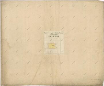
Mratin - c4870-1-001 - Kaiserpflichtexemplar der Landkarten des stabilen Katasters
1 : 2880
Mratin - c4870-1-003 - Kaiserpflichtexemplar der Landkarten des stabilen Katasters
1 : 2880
Situations Karte der Excellenz gräflich Nostitz'schen Domaine Pakoměřitz in Böhmen
1 : 20000 Neratovice-oblast (Česko) K.k. Hofbuchdruckerei von Gottlieb Haase Söhne
Mapa politického a školního okresu Karlínského

III. vojenské mapování 3953/1
1 : 25000
III. vojenské mapování 3953/1
1 : 25000
Plan der südlichen Gegend von Melnik
1 : 48000 Mělník-oblast (Česko) Schwihlik, Fr.

Gradkartenblatt
1 : 25000 Čechy (Česko) Czechák, Carl
Plan der Gegend zwischen Kletzan und Weltrus
1 : 47500 Klecany (Česko) Schwihlik, F.
Plan der Gegend zwischen Kletzan und Weltrus
1 : 48000 Klecany (Česko) Adam
Karte des Brandeiser Bezirkes im Prager Kreise
1 : 70000 Brandýs nad Labem-Stará Boleslav-oblast (Česko) Wagner, Jan Eduard Karl André
Karte des Karolinenthaler Bezirkes im Prager Kreise
1 : 72000 Karlín (Praha, Česko) Wagner, Jan Eduard in Commission bei Karl André
Karte des Karolinenthaler Bezirkes im Prager Kreise
1 : 72000 Karlín (Praha, Česko) Wagner, Jan Eduard Karl André
Karte des Karolinenthaler Bezirkes im Prager Kreise
1 : 72000 Karlín (Praha, Česko) Wagner, Jan Eduard in Commission bei Karl André
Karte des Karolinenthaler Bezirkes im Prager Kreise
1 : 72000 Karlín (Praha, Česko) Wagner, Jan Eduard in Commission bei Karl André
Karte des Karolinenthaler Bezirkes im Prager Kreise
1 : 72000 Karlín (Praha, Česko) Wagner, Jan Eduard in Commission bei Karl André
Podrobné mapy zemí Koruny české v měřítku 1:75.000 a mapa vzdáleností všech míst při silnici ležících
1 : 75000 Kostelec nad Labem (Česko : oblast) Bělohlav, Josef Kučera, Karel F. Topič
Podrobné mapy zemí Koruny české v měřítku 1:75.000 a mapa vzdáleností všech míst při silnici ležících - Mělník - Kostelec n. L. Průvodce statisticko-historický po všech místech na těchto mapách uvedených a rejstřík věcný názvů hor, potoků, řek, rybníků atd. Sešit 7. List 54,
1 : 75000
Soubor map okresů Pražského kraje