Maps of Zwiesel

Meßtischblatt 282 : Zwiesel, 1930
1 : 250000 Zwiesel. - Aufn. 1926, 1927, Ausg. 1930. - 1:25000. - Topograph. Zweigstelle d. Bayer. Landesvermess, 1930. - 1 Kt.
[Kartenblatt]
1 : 25000 Zwiesel (Německo) Reichsamt für Landesaufnahme
III. vojenské mapování 4350/4
1 : 25000
Podrobné mapy zemí Koruny české v měřítku 1:75.000 a mapa vzdáleností všech míst při silnici ležících - Železná Ruda - Dolní Rejštejn. Průvodce statisticko-historický po všech místech na těchto mapách uvedených a rejstřík věcný názvů hor, potoků, řek, rybníků atd. Sešit 40. List 24,
1 : 75000
Železná Ruda a Viechtach
1 : 75000 Německo Vojenský zeměpisný ústav
Eisenstein und Viechtach.
from Spezialkarte der osterreichisch-ungarischen Monarchie.
III. vojenské mapování 4350
1 : 75000
Mapa Šumavy
1 : 50000 Královský Hvozd (Česko) KČST
Eisenstein und Viechtach
1 : 75000 Železná Ruda (Česko : oblast) Brunner K. u. k. militär-geographisches Institut
Eisenstein und Viechtach
1 : 75000 Železná Ruda (Česko : oblast) K. u. k. Militärgeographisches Institut
Nová Mapa království Českého
1 : 200000 Čechy jihozápadní (Česko) Kotyška, Václav Hanf, Norbert Bursík & Kohout
Podrobná místopisná mapa Království Českého

Podrobná mapa Království českého
1 : 100000 Sušice (Klatovy, Česko : oblast) Srp, Jan Jaroslav Bursík
Mapa Železnorudska

Stadler Antheil, Prachiner Kr[eis]
1 : 2880 Prácheňsko (Česko)
Gradkartenblatt
1 : 25000 Železná Ruda-oblast (Česko) Bulla, Eduard
Stubenbach, Prachiner Kr[eis]
1 : 2880 Prácheňsko (Česko) K.k. Lithografische Institut des Grundsteuerkatasters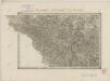
II. vojenské mapování 29
1 : 144000
Generální mapa okresních hejtmanství

165. Cham, uit: Topographische Uebersichtskarte des Deutschen Reiches / herausgegeben v. d. Kartogr. Abt. d. Königl. Preuß. Landesaufnahme
1 : 200000 titelvariant: Topogr. Übersichtskarte des Deutschen Reiches; Annotatie: Titel boven bladen ook: Topogr. Übersichtskarte des Deutschen Reiches; Annotatie geografische gegevens: Op elk blad twee maatstokken: 10 Kilometer = 5,5 cm; 1 geogr. Meile = 3,6 cm; Legenda onder op elk blad Königlich Preußische Landesaufnahme. Kartographische Abtheilung [S.l : Königlich Preußische Landesaufnahme, Kartographische Abtheilung]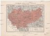
Generální mapa okresního hejtmanství Prachatického
1 : 220000 Prachatice-oblast (Česko) Wagner, Jan Eduard F. Kytka
Proponit exteriores Præfecturas Dicasterio Straubingensi Subjectas cum limitibus Regni Bohemiæ adjacentis
1 : 150000 Mollova mapová sbírka Buna, Wilhelm C. Broenner, Heinrich Ludwig
Eine Böhmenwald-Grenzkarte vom Jahre 1514
Šumava-oblast Schrötter, Georg Instituts für ostbairische Heimatforschung
Generální mapa Protektorátu Čechy a Morava

Prachiner Kreis
Prácheňsko (Česko) Berndt, Johann Christoph
[Prachiner Kreis]
Prácheňsko (Česko) Berndt, Johann Christoph
Prachiner Kreis
Prácheňsko (Česko) Berndt, Johann Christoph
Prachiner Kreis
Prácheňsko (Česko) Berndt, Johann Christoph
Prachiner Kreis
Prácheňsko (Česko) Berndt, Johann Christoph


