Maps of Brazilian Highlands

Paraguay, pays adjacants.
1 : 8600000 Bonne, Rigobert, 1727-1794
Paraguay, Rio de la Plata, &c.
1 : 9500000 Bowen, Emanuel

Brazil.
1 : 9700000 Carey, Mathew
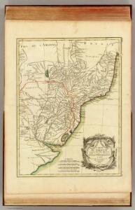
Map of Brazil.
1 : 9500000 Carey, Mathew
Amerique Meridionale [b]
1 : 6300000 Hoja del medio del más importante y detallado mapa francés sobre Suramérica de mediados del siglo XVIII, elaborado por Jean Baptiste Bourguignon D’Anville, una de las autoridades cartográficas más trascendentales e influyentes de su tiempo. Esta parte del mapa corresponde a parte de los actuales Perú, Bolivia, Brasil, Argentina, Chile, Uruguay y Paraguay. Cuando D’Anville publicó su mapa, los límites entre el imperio Español y el imperio Portugués en Suramérica eran problemáticos y confusos, los españoles tenían dominio sobre regiones supuestamente portuguesas y viceversa: desde 1680 los portugueses habían fundado la Colonia do Santíssimo Sacramento (actual ciudad de Colonia, en Uruguay) frente a Buenos Aires en la orilla opuesta del río de la Plata, mientras que los españoles habían construido en 1737 el presidio de Jesús María José (actual ciudad de Rio Grande, en Brasil), en territorio portugués. Estos y otros casos venían provocando de disputas entre los dos imperios, hasta que el Tratado de Madrid de 1750, mediante el cual los dos imperios intercambiaron los territorios, colonias, misiones o fuertes situados en zonas contrarias: Portugal entregaba a España la Colonia del Sacramento (art. XIII) y recibía a cambio los territorios del Sur, el nacimiento del río Ibicuí, las misiones, el margen derecho del río Guaporé y cedía el territorio occidental del río Japurá al Amazonas y la navegación del río Içá (art. XIV). Además se establecía que en caso de guerra entre Portugal y España en Europa, sus vasallos de América del Sur permanecerían en paz (art. XXI). Este mapa de D’Anville de 1748 fue uno de los principales usados durante la negociación del tratado. Algunos investigadores han demostrado que diplomáticos portugueses y españoles se entrevistaron en Paris con D’Anville antes de 1748, buscando con ello influir en los contenidos del mapa. Anville, Jean Baptiste Bourguignon d' (1697-1782) Delahaye, Guillaume-Nicolas (1727-1802)
Paraguay, Ó Prov. De Rio De La Plata cum regionibus adiacentibus Tucuman et S.ta Cruz De La Sierra. [Karte], in: Gerardi Mercatoris et I. Hondii Newer Atlas, oder, Grosses Weltbuch, Bd. 2, S. 413.
1 Karte aus Atlas Mercator, Gerhard und Hondius, Jodocus Jansson, Jan
Bolivia, Chili, United Provinces.
1 : 7700000 Lizars, Daniel
Composite: Brazil, Paraguay, and Uruguay.
1 : 5020000 Rand McNally and Company
La Plata - Chili (sic) and Southern Brazil.
1 : 8400000 Sharpe, J.
Paskaert van Brasilia van Pernambuco tot C. de S. Antonio
1 Karte : Kupferdruck ; 43 x 53 cm Doncker bÿ Hendrick Doncker

PARAGVAY, Ó | PROV. DE RIO DE LA PLATA | cum regionibus adiacentibus | TVCVMAN | et | STA. CRVZ DE LA SIERRA.
AMSTELODAMI, | Guiljelmus Blaeuw | excudit.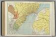
Brazil, Paraguay, and Uruguay (southern half).
1 : 5020000 Rand McNally and Company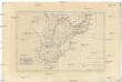
Brésil et pays des Amazones, avec le gouvernement de Buenos-Aires
1 : 10700000 Amazonka-oblast Bonne, Rigobert André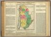
Map Of The United Provinces Of South America.
1 : 10771200 Lea, I.
United Provinces.
1 : 12038400 Lucas, Fielding Jr.
South America 4.
1 : 6969600 Letts, Son & Co.
S. Brazil, Paraguay, Uruguay.
1 : 6630000 Society for the Diffusion of Useful Knowledge (Great Britain)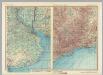
Rio De La Plata. Brazil - Sao Paulo - Rio De Janeiro. Pergamon World Atlas.
1 : 2500000 Polish Army Topography Service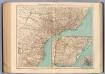
157-58. Brasile Meridionale, Uruguay.
1 : 3000000 Touring club italiano
Brasil du Sud.
1 : 6000000 Vivien St Martin, L.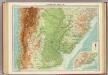
Argentina, Chile, &c.
1 : 5000000 John Bartholomew & Co.
Paraquariae provinciae Soc. Iesu cum adjacentibus novissima descriptio
1 : 5000000 Jižní Amerika Seutter, Matthäus Tamburini, Michelangelo Matthäus Seutter
L. Das kaiserthum Brasilien. Provinz 13-14, 15, 19. Q. Die Rep. Montevideo
1 : 2000000 Schlieben, Wilhelm Ernst August von (1781 - 1839)
[Süd-Amerika in 6 Blättern, Blatt 4]
Adolf Stieler's Handatlas über alle Theile der Erde und über das Weltgebäude Stieler, Adolf Justus Perthes
[Carte du Bassin de la Plata]
1 : 2000000 Description géographique et statistique de la Confédération Argentine Martin de Moussy, Victor Librairie de Firmin Didot frères, fils et Cie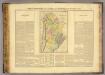
Buenos-Ayres.
1 : 10700000 Buchon, J. A. C.; Carey, H. C.; Lea, I.
A map of Brazil, now called New Portugal
1 : 9600000 Carey, Mathew, 1760-1839 M. Carey