Maps of South Region
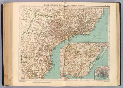
157-58. Brasile Meridionale, Uruguay.
1 : 3000000 Touring club italiano
Brazil, Paraguay, and Uruguay (southern half).
1 : 5020000 Rand McNally and Company
Brésil et pays des Amazones, avec le gouvernement de Buenos-Aires
1 : 10700000 Amazonka-oblast Bonne, Rigobert André
South America 4.
1 : 6969600 Letts, Son & Co.
S. Brazil, Paraguay, Uruguay.
1 : 6630000 Society for the Diffusion of Useful Knowledge (Great Britain)
L. Das kaiserthum Brasilien. Provinz 13-14, 15, 19. Q. Die Rep. Montevideo
1 : 2000000 Schlieben, Wilhelm Ernst August von (1781 - 1839)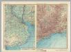
Rio De La Plata. Brazil - Sao Paulo - Rio De Janeiro. Pergamon World Atlas.
1 : 2500000 Polish Army Topography Service
South America 6.
1 : 2800000 Arrowsmith, Aaron
Charte eines Theils von Paraguay und der Provinz Buenos-Ayres
Paraguay Azara, Félix de
Novus Brasiliae Typus [Karte] [Baya de todos os Sanctos] [Nebenkarte], in: Novus Atlas, das ist, Weltbeschreibung, Bd. 2, S. 343.
1 Karte aus Atlas Blaeu, Joan Blaeu, Willem Janszoon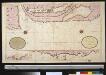
Een gedeelte van de kust van Brazilia tussen I. St. Catharina en C. St. Anthonio
Uruguay Gerard van Keulen
Carta geografica del Estado Oriental del Uruguay y posesiones adyacentes / trazada segun los documentos mas recientes y exactos ; publicada bajo la direccion del Sr. A. Roger, consul de Francia ; dedicada al Exmo.Sr. Presidente Gnal. D. Fructuoso Rivera
1 Mapa, b/n. Esquarterat i entelat Roger, A.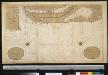
De kust van Brazilia tussen I. St. Catharina en C. St. Anthonio
Uruguay Gerard van Keulen
Estado de Sao Paulo, mappa geologico physico politico e economico
1 : 1000000 Paris : Girard et Barrère
Carte Historique de la Province des Missions et des Établissements des Jésuites sur le Parana et l'Uruguay
1 : 2000000 Description géographique et statistique de la Confédération Argentine Martin de Moussy, Victor Librairie de Firmin Didot frères, fils et Cie
Carte hist., Prov. des Missions, etabl. Jesuites, Parana et l'Uruguay, 1575- 1768.
1 : 1870000 Martin de Moussy, V. (Victor), 1810-1869
Carta de progresso da Commissao Geographica e Geologica de S. Paulo
1 : 2000000 Comissão Geográfica e Geológica. São Paulo, Brésil [São Paulo] : Commissão Geográphica e Geológica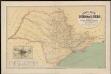
Carta geral do estado de Sao Paulo. Organizada pela Commissao Geographica e Geologica
1 : 1000000 Comissão Geográfica e Geológica. São Paulo, Brésil São Paulo : Weiszflog Irmãos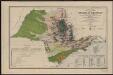
Carta geral do estado de Sao Paulo. Com indicaçoes sobre a agricultura, commercio, instrucçao publica, industria e colonisaçao
1 : 2000000 Comissão Geográfica e Geológica. São Paulo, Brésil [São Paulo] : Commissão Geográphica e Geológica
Partie du Bresil. Amer. Merid. 27.
1 : 1641836 Vandermaelen, Philippe, 1795-1869
Partie du Bresil. Amer. Merid. 28.
1 : 1641836 Vandermaelen, Philippe, 1795-1869
Partie du Bresil. Amer. Merid. 32.
1 : 1641836 Vandermaelen, Philippe, 1795-1869
Partie du Bresil. Amer. Merid. 35.
1 : 1641836 Vandermaelen, Philippe, 1795-1869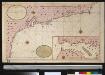
Een gedeelte van de kust van Brazilia tussen C. St. Thome en I. St. Catharina
Brazil Gerard van Keulen
Nuevo Mapa de la Republica Oriental del Uruguay
1 : 600000 Paris : Forest
Plan topographique de la république orientale de l'Uruguay
1 : 2650000
Mapa de la Republica del Paraguay.
1 : 1490000 Paz Soldan, Mariano Felipe, 1821-1886
Mapa de la Republica Oriental del Uruguay.
1 : 1900000 Paz Soldan, Mariano Felipe, 1821-1886
Partie, la Plata. Amer. Merid. 31.
1 : 1641836 Vandermaelen, Philippe, 1795-1869