Maps of Puducherry
(Carte de l'Inde. Southern section).
1 : 3100000 Anville, Jean Baptiste Bourguignon d, 1697-1782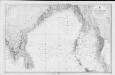
Bay of Bengal
Indian Ocean. Bay of Bengal. Compiled from the latest Government Surveys, 1880. London : Admiralty
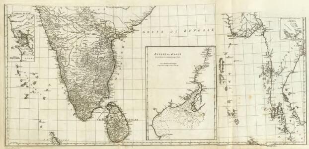
Sinus Gangeticus; Vulgo Golfo De Bengala Nova descriptio. [Karte], in: Het vijfde Deel Des Grooten Atlas : Vervatende De Water-Weereld, S. 92.
1 Karte aus Atlas Jansson, Jan Jansson, Jan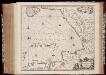
Sinus Gangeticus; vulgo Golfo de Bengala nova descriptio
1 : 4500000 Annotatie: Zeekaart; Kaart uitg. in de periode vanaf ca. 1650 tot ca. 1680; Origineel is Blad 190 in atlas factice; Annotatie geografische gegevens: Schaalstokken op de kaart: 45 Milliaria Germanica communia (=7,5 cm), en: 60 Milliaria Gallica communia (=7,5 cm); Westen boven Johannes Janssonius 1588-1664 [Amstelodami] : [Apud Ioannem Ianssonium]
Sinus Gangeticus: Vulgo Golfo De Bengala Nova descriptio. [Karte], in: Novus atlas absolutissimus, Bd. 9, S. 115.
1 Karte aus Atlas Janssonius Offizin
The East Indies, with the roads (southern section).
1 : 2600000 Jefferys, Thomas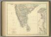
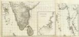
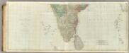
India (southern sheet).
1 : 4457000 Johnston, Alexander Keith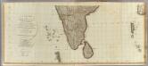
Hindoostan (south)
1 : 2500000 Robert Laurie & James Whittle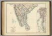
India (southern sheet).
1 : 4457000 Johnston, Alexander Keith
Inde Medionale.
1 : 5000000 Vivien St Martin, L.
Peninsula Indiae citra Gangem hoc est orae celeberrimae Malabar & Coromandel cum adjacente insula non minus celebratissima Ceylon
1 : 3000000 Indie studio Homannianorum Heredum
Peninsula INDIAE citra Gangem, hoc est Orae celeberrimae MALABAR & COROMANDEL Cum adjacente Insula non minus celebratissima CEYLON
1 : 3000000 Ganga-oblast (Indie a Bangladéš) Delisle, Guillaume studio Homannianorum Heredum
Peninsula INDIAE citra Gangem hoc est Orae celeberrimae MALABAR & COROMANDEL Cum adjacente Insula non minus celebratissima CEYLON
1 : 3000000 Ganga-oblast (Indie a Bangladéš) Delisle, Guillaume studio Homannianorum Heredum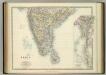
India (southern sheet).
1 : 4457000 Johnston, W. & A.K.
S. Hindostan.
1 : 3000000 Thomson, John
140-141. South India, Ceylon, Burma. The World Atlas.
1 : 5000000 USSR (Union of Soviet Socialist Republics).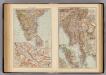
India South, Burma, Malay Peninsula.
1 : 6000000 Andree, Richard; Times (London, England)
The Southern Railway

Peninsula Indiæ citra Gangem, hoc est, orae celeberrimae Malabar & Coromandel cum adjacente insula non minus celebratissima Ceylon
1 Karte : Kupferdruck ; 53 x 47 cm L'Isle Homännische Erben
Carte des Côtes de Malabar et de Coromandel
1 : 3800000 presentée au Roy par [...] G. Delisle Amsterdam : chez Pierre Schenk, l'entr
Composite: India peninsula.
1 : 1300000 Faden, William, 1750?-1836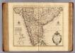
Malabar, Coromandel, cotes.
1 : 4000000 L'Isle, Guillaume de, 1675-1726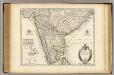
Malabar, Coromandel, costes.
1 : 4000000 L'Isle, Guillaume de, 1675-1726
India - southern section.
1 : 4000000 John Bartholomew & Co.
The Carnatic, Etc.
1 : 3380000 Sharpe, J.
Sheet D [South India], uit: Road map of India
1 : 2027520 titelvariant: North West India; Central & North India; North East India; South India; Annotatie geografische gegevens: De bladen overlappen elkaar gedeeltelijk; Elk blad met bladoverzicht van de hele serie [S.l. : India Tyre & Rubber Company]
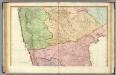
Charte der Provinz oder Audiencia von Lima oder des alten Königreichs Peru
Lima-oblast (Peru) Schmidt, Johann Marius Friedrich Franz
Ostindisches Missionsgebiet der evan.miss.gesellschaft in Basel