Maps of Lac-Juillet
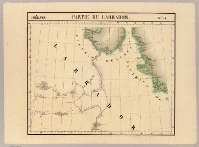
Partie du Labrador. Amer. Sep. 28.
1 : 1641836 Vandermaelen, Philippe, 1795-1869
Karten-Skizze des Treibeises bei Newfundland während der Zeit vom 11. März bis zum 5. Mai 1891, nach den Berichten, welche bis zum 20. Mai eingegangen sind
Newfoundland (Kanada : ostrov)
Karten-Skizze des Treibeises bei Newfundland während der Zeit von Anfang Mai bis Ende Juni, nach den Berichten, welche bis zum 8ten Juli eingegangen sind
Newfoundland (Kanada : ostrov)
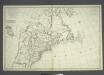
A new map of the province of Quebec in North America, drawn from the best authorities
1 : 6500000
188-189. Canada, East. The World Atlas.
1 : 5000000 USSR (Union of Soviet Socialist Republics).
EXTREMA AMERICÆ | Versus Boream, ubi | TERRA NOVA | NOVA FRANCIA, Adjacentiaq.
Amstelaedami Io. Blaeu Exc.
Paskaert van de Noordelijckste kuste van America van Groenland door de Straet Davis en de Straet Hudson tot Terra Neuf
1 : 8000000 Colom, Jacob Aertsz Colom, Jacob Aertsz
British Provinces of North America.
1 : 10000000 Cornell, S. S. (Sarah S.)
North-eastern Canada.
1 : 5000000 John Bartholomew and Son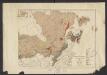
Geology. East sheet
1 : 6336000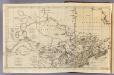
Canada, N. pt. Louisiana.
1 : 7700000 Jefferys, Thomas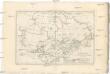
Canada
1 : 10120000 Kanada Bonne, Rigobert André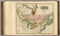
Canada, Nova Scotia.
1 : 4800000 Thomson, John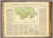
Possessions anglaises.
1 : 4700000 Buchon, J. A. C.; Carey, H. C.; Lea, I.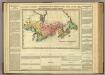
Map Of Upper And Lower Canada.
1 : 2217600 Lea, I.
Canada.
1 : 11088000 Lucas, Fielding Jr.
(Vereinigte Staate)n v. Nordamerika II.
1 : 8000000 Berghaus, Heinrich; Flemming, Carl; Sohr, Karl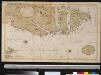
Oud Groenland van Staaten Hoek of C. Farawel tot de Visch Baij of Straet Davids int groot
Greenland Gerard van Keulen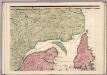
A Map of the British Empire in America. (Sheet 3).
1 : 2000000 Popple, Henry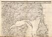
A Map of the British Empire in America. (Sheet 3).
1 : 2000000 Popple, Henry
New York City.
1 : 36000 Bien, Joseph Rudolf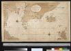
Nieuwe afteekening van de Straat Davits van Hitland tot aen de Straet Davids
Atlantic Ocean Gerard van Keulen
[142][145] Septemtrionaliora Americae à Groenlandia, ..., uit: Atlas sive Descriptio terrarum orbis
Annotatie: Gedigitaliseerde versie. Amsterdam. Heiloo : Picturae (vervaardiger), 2015. tiff-bestand. Gedigitaliseerd: 07-01-2015; Origineel: Universiteitsbibliotheek Vrije Universiteit (XL.05127.-) ; Netherlands; Titelpagina ontbreekt Wit, Frederik de Amsterdam : Frederick de Wit
North America 2.
1 : 4470000 Arrowsmith, Aaron
Tierra nveva.
from Charts and maps Sesssa?: [Venice]; Ruscelli, Girolamo; Gastaldi, Giacomo,
The north west part of America / by Robt. Morden.; Geography rectified, or, A description of the world: in all its kingdoms, provinces, countries, islands, cities, towns, seas, rivers, bayes, capes, ports: their antient and present names, inhabitants, situations, histories, customs, governments, &c.: as also their commodities, coins, weights, and measures, compared with those at London: illustrated with above sixty new maps: the whole work performed according to the more accurate discoveries of modern authors / by Robert Morden.
from Geography rectified, or, A description of the world : in all its kingdoms, provinces, countries, islands, cities, towns, seas, rivers, bayes, capes, ports : their antient and present names, inhabitants, situations, histories, customs, governments, &c. : as also their commodities, coins, weights, and measures, compared with those at London : illustrated with above sixty new maps : the whole work performed according to the more accurate discoveries of modern authors / by Robert Morden. Morden, Robert; Cockerill, Thomas,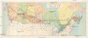
Canadian national railways
1 : 4730000 Kanada
Pulp & paper map of Canada
1 : 6270000 Kanada Department of the Interior
Greenland, Labrador.
1 : 15000000 Peterson, Augusts