Maps of Gjoa Haven
Decouvertes Boreales. Amer. Sep. 8.
1 : 1641836 Vandermaelen, Philippe, 1795-1869
Sir John Franklin's arctic discoveries, between Baffin Bay & Cape Bathurst
1 : 2900000 Arktida Arrowsmith, John John Arrowsmith
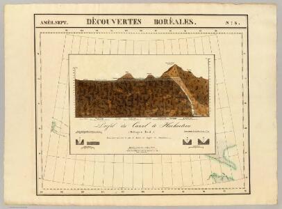
Mackenzie.
1 : 5892000 Rand McNally and Company
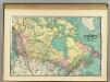
Atlas of Canada. No. 4, Geology, west sheet
1 : 6336000 Canada. Ministère de l'intérieur [Ottawa] : Canada, Department of the Interior
West-Canada und Britisch Columbia
Adolf Stieler's Handatlas über alle Theile der Erde und über das Weltgebäude Stieler, Adolf Justus Perthes
A Map Of The United States Of Mexico.
1 : 5195520 Tanner, Henry S.
Partie, Russie d'Asie. Asie 11.
1 : 1641836 Vandermaelen, Philippe, 1795-1869
Map of the Missouri; of the higher parts of the Mississippi.
1 : 8500000 Tardieu, P.F.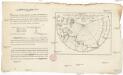
Vorstellung des Meers in Norden von Asien und America, nebst der Berechnung von dessen Grösse und Ausdehnung
Asie severní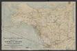
Map of Canadian Pacific Railway and connections showing routes to the Yukon gold fields, Alaska, Klondike : and the Northwestern mining territories of Canada
1 : 6336000 Chicago [Ill.] : Poole Bros.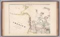
Facsimile: Arrowsmith's America (portion).
1 : 10220000 Arrowsmith, Aaron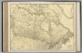
Canada.
1 : 8554000 Rand McNally and Company
[Nebenkarte : Tschukotka]
British America.
1 : 11500000 Rand McNally and Company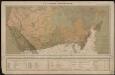
Le Canada catholique
1 : 6300000 [Lyon : Oeuvre de la propagation de la foi]
Uebersichts-Karte der ethnographischen Verhältnisse von Asien und von den angrenzenden Theilen Europa'sbearbeitet und herausgegeben mit Unterstützung der kaiserlichen Akademie der Wissenschaften in Wien von Vinzenz v. Haardt
Hartenthurn, Vincenz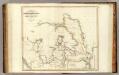
Arctic Regions.
1 : 19000000 Thomson, John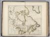
British Possessions in North America.
1 : 9100000 Carey, Mathew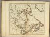
British Possessions in North America.
1 : 9000000 Carey, Mathew
British Possessions in North America.
1 : 6969600 Carey, Mathew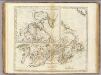
British Possessions in North America.
1 : 7603200 Carey, Mathew
British Possessions in North America.
1 : 7286400 Lewis, Samuel
British Possessions in North America.
1 : 7603200 Carey, Mathew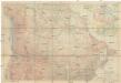
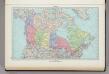
Canada
1 : 5892480 Kanada National Geographic Society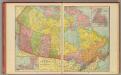
Canada.
1 : 10500000 Cram, George Franklin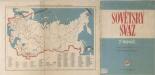
Sovětský svaz v mapách

North America : Showing the Origin & Progress of the Storm of March 14-17, 1859
1 : 15000000 This map is one of the earliest weather maps of the United States, which traced an 1859 storm across the continent. Manuscript annotations in red ink show dates and positions of the storm front. The base map was prepared for the Boston Society of Natural History by William C. Cleveland; and shows isothermal lines of mean temperatures. The lower right margin reads: "American Photo-Lithographic Co., Osborne's Process." Lapham, Increase Allen
Nástěnná mapa Asie
187. Canada, Political. The World Atlas.
1 : 15000000 USSR (Union of Soviet Socialist Republics).
Louisiana.
1 : 21000000 Lewis, Samuel