Maps of United States

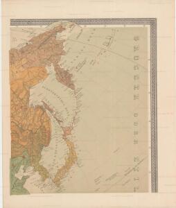
Uebersichts-Karte der ethnographischen Verhältnisse von Asien und von den angrenzenden Theilen Europa'sbearbeitet und herausgegeben mit Unterstützung der kaiserlichen Akademie der Wissenschaften in Wien von Vinzenz v. Haardt
Hartenthurn, Vincenz
Di-gyiu Du, Ng Da-tsiu Di-du[地舆图、五大洲地图]
Di-gyiu Du, Ng Da-tsiu Di-du[地舆图、五大洲地图] 1853年,Martin, W. A. P. (William Alexander Parsons) 美国长老会传教士丁韪良用罗马拼音标注宁波方言编写的世界地理著作,对地球和各大洲进行介绍。内有东西半球图、亚洲图、欧洲图、非洲图、北美洲图、南美洲图、地中海附近图、清内地十八省图、浙江省图、宁波附近图等。 10图,墨刻本,罗马拼音标注宁波方言,图幅不一,约39 x 49.5 cm Harvard-Yenching | Rare Book | TA 2370 92,Hollis Number:008156153
萬國通鑑:北亞美利加
美国传教士撰的向中国人介绍世界地理概况的著作,后有世界地图册1份,共13幅世界、大洲和区域地图,其中一幅题为《中國地圖》的清朝内地地图。 Sheffield, Devello Zelotos 謝衛樓 福州 : 美華書局
North America : Showing the Origin & Progress of the Storm of March 14-17, 1859
1 : 15000000 This map is one of the earliest weather maps of the United States, which traced an 1859 storm across the continent. Manuscript annotations in red ink show dates and positions of the storm front. The base map was prepared for the Boston Society of Natural History by William C. Cleveland; and shows isothermal lines of mean temperatures. The lower right margin reads: "American Photo-Lithographic Co., Osborne's Process." Lapham, Increase Allen
Facsimile: Hudsons Bay Company Map of North America.
1 : 15300000 Hudson's Bay Company
Maris Pacifici, America.
Schoner, Johann
Composite: Map of Louisiana and Mexico.
1 : 4300000 Tardieu, P.F.
North part of America, 1625.
1 : 40000000 Briggs, Henry
Louisiana.
1 : 21000000 Lewis, Samuel
Louisiana.
1 : 21000000 Lewis, Samuel

Composite: Vereinigte Staaten v. Nordamerika.
1 : 8000000 Berghaus, Heinrich; Flemming, Carl; Sohr, Karl
Mitchell's new national map exhibiting the United States : with the north American British provinces, Sandwich Islands, Mexico and Central America, together with Cuba and other West India Islands
1 : 2500000 Williams, W. (Wellington) S. Augustus Mitchell
Ornamental Map Of The United States & Mexico.
1 : 13000000 Ensigns & Thayer
Carte De La Cote De L'Amerique.
1 : 5555555 Duflot de Mofras, Eugene
Verein-Staaten von Nord-America, Mexico, Yucatan u.A.
Hand-Atlas über alle Theile der Erde und über das Weltgebäude Stieler, Adolf Justus Perthes
North America, 1722.
1 : 25000000 Wells, Edward
Map Of The United States Of America.
1 : 3801600 Colton, J. H.
[Map of Spanish Louisiana and the American colonies]
from Whole
Map Atlantic Coast Line.
1 : 12503000 Atlantic Coast Line Railroad Company
Verein-Staaten Von Nord-America, Mexico, Yucatan U. A.
1 : 13400000 Stulpnagel, F.v.
The course of the River St. Laurence : from Lake Ontario, to Manicouagan Point ; United States of America.
from St. Lawrence River
Map of the United States and Mexico: including Oregon, Texas and the Californias.
from Parts s.n.: [New York?],
Facsimile: Walch's North America (portion).
1 : 13000000 Walch, Joh.
[Vereinigte Staaten von Nord-Amerka und Mexico]
E. von Sydow's Schul-Atlas in sechs und dreissig Karten Sydow, Emil von bei Justus Perthes
Topographical map of the United States.
1 : 9500000 Andreas, A. T. (Alfred Theodore), 1839-1900
[Verein-Staaten von Nord-America, Mexico, Yucatan u.A.]
Handatlas über alle Theile der Erde und über das Weltgebäude Stieler, Adolf Justus Perthes
Vereinigte Staaten von Nord-America und Mexico
Schul-Atlas über alle Theile der Erde nach dem neuesten Zustande, und über das Weltgebäude Stieler, Adolf Justus Perthes
Map Of The United States And Mexico.
1 : 3540000 Stanford, Edward