Maps of Balkan Pen.

Turkey in Europe.
1 : 4000000 Colton, G.W.
Turkey in Europe.
1 : 3000000 Colton, G.W.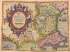
Romaniae, (quae olim Thracia dicta) Vicinarumque Regionum, Uti Bulgariae, Walachiae, Syrfiae, Etc. Descriptio. [Karte], in: Theatrum orbis terrarum, S. 283.
1 Karte aus Atlas Ortelius, Abraham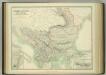
Turkey in Europe.
1 : 2533000 Johnston, W. & A.K.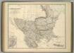
Turkey in Europe.
1 : 2533000 Johnston, Alexander Keith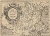
Romaniae, (quae olim Thracia dicta) Vicinarumque Regionum, Uti Bulgariae, Walachiae, Syrfiae, Etc. Descriptio. [Karte], in: Theatrum orbis terrarum, S. 378.
1 Karte aus Atlas Ortelius, Abraham Vrients, Jan Baptista
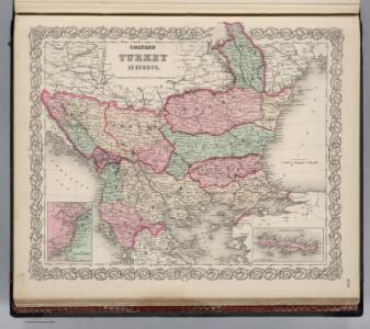
Turkey in Europe.
1 : 4000000 Colton, G.W.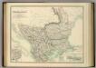
Turkey in Europe.
1 : 2533000 Johnston, Alexander Keith
Nona Europe Tabula [Karte], in: [Clavdii Ptholomei Cosmographi ...], S. 281.
1 Karte aus Atlas Nicolaus Germanus [und Ptolemaeus, Claudius]
[Nona Europe tabula] [Karte], in: Clavdii Ptholomei Viri Alexandrini Cosmographie, S. 155.
1 Karte aus Atlas Nicolaus Germanus [und Ptolemaeus, Claudius]
Map of the Balkan States
Balkanhalbinsel
[Ost-Europa in 6 Blättern, Blatt 5]
Handatlas über alle Theile der Erde und über das Weltgebäude Stieler, Adolf Justus Perthes
Europaeische Türkey und Griechenland
1 : 4200000 Jónské ostrovy (Řecko) Theinert, A. Fleming, C. C. Fleming
Turkey in Europe.
1 : 5790000 Finley, Anthony
Turkey In Europe.
1 : 3600000 Colton, G.W.
Turkey In Europe.
1 : 5850000 Tanner, Henry S.
Turkey In Europe.
1 : 5850000 Tanner, Henry S.
[Ost-Europa in 6 Blättern, Enthaltend: Norwegen, Schweden, Russland, Kaukasien und die Türkei, Blatt 5]
Hand-Atlas über alle Theile der Erde und über das Weltgebäude Stieler, Adolf Justus Perthes
Hungary, European Turkey.
1 : 3100000 Playfair, Principal
Ost-Europa, No. 5: Sud-West-Russland & die Turkei.
1 : 3700000 Petermann, A.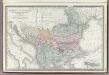
Turkey in Europe.
1 : 3300000 Rand McNally and Company
Carte ethnographique de la Turquie d'Europe
Dunaj (Rumunsko a Ukrajina : řeka : delta) Lejean, G. Petermann, August Justus Perthes
[Ost-Europa, Blatt 5]
Adolf Stieler's Handatlas über alle Theile der Erde und über das Weltgebäude Stieler, Adolf Justus Perthes
Turkey in Europe.
1 : 3850000 Mitchell, Samuel Augustus
Schul-Atlas für die alte Erdbeschreibung : zur allgemeinen Schul-encyclopädie gehörig
J. H. Campe Zusammensetzung und Zeichnung von [...] Dufour, unter Leitung von Heusinger ; gestochen von Frentzel. Braunschweig : Schulbuchhandlung
Nona Europe Tabula [Iazyges Metanastes, Datia, Misia Infer. Misia Superior, Dardania, Tracia] [Karte], in: Claudii Ptolemei viri Alexandrini mathematice discipline philosophi doctissimi geographie opus [...], S. 175.
1 Karte aus Atlas Waldseemüller, Martin [und Ptolemaeus, Claudius] Übelin, Georg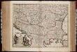
Nova totius Hungariae, Transilvaniae, Serviae, Romaniae, Bulgariae, Walachiae, Moldaviae, Sclavoniae, Croatiae, Bosniae, Dalmatiae, maximaeq[ue] partis Danubii fluminis, descriptio / emendata a F. de Wit
1 : 2600000 Annotatie: Tekst impressum in het Nederlands; Rechtsboven: 21; Kaart toont Hongarije, omliggende landen en een belangrijk deel van de loop van de Donau; Origineel is Blad 129 in atlas factice; Annotatie geografische gegevens: Schaalstok linksonder cartouche: Milliaria Germanica communia 15 uni gradui = Gemeene Duytsche Mylen van 15 in een graedt Frederick de Wit 1630-1706 Amsterdam : gedruckt by Frederick de Wit inde Kalverstraet by den Dam inde Witte Pascaert
Composite: Europaischen Turkei.
1 : 1580000 Handtke, Friedrich H.
Libération et agrandissements successifs des états Balkaniques
1 : 14000000 Balkanhalbinsel Südosteuropa Unabhängigkeitsbewegung
Karte von der europäischen Türkey
1 : 4200000 Evropa jihovýchodní Mollo, Tranquillo T. Mollo