Maps of Ganges Plain
The East Indies, with the roads (northern section).
1 : 2600000 Jefferys, Thomas
Magni Mogolis Imperium [Karte], in: Novus Atlas, das ist, Weltbeschreibung, Bd. 2, S. 266.
1 Karte aus Atlas Blaeu, Joan Blaeu, Willem Janszoon
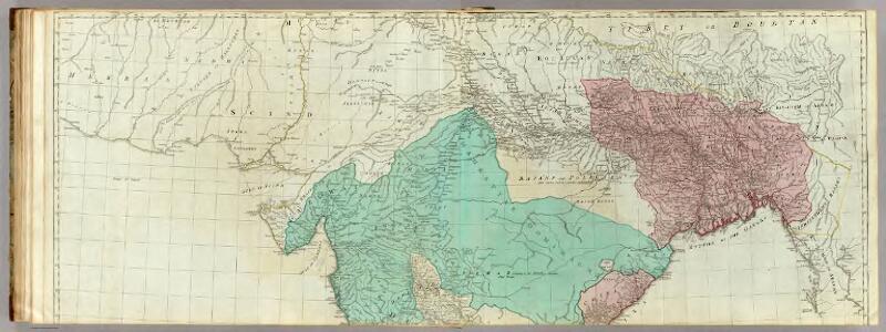
MAGNI | MOGOLIS | IMPERIVM.
[Amsterdam : Joan Blaeu]
Magni Mogolis imperivm
1 : 6900000 Annotatie: Met opdracht door Joh. en Corn. Blaeu aan Johannes Huydekoper; Origineel is Blad 187 in atlas factice; Annotatie geografische gegevens: Met schaalstok: 45 Milliaria Germanica communia (=5 cm) Joan Blaeu 1597/98-1673; Cornelis Blaeu ca. 1610-1645 [Amsterdam : J. en C. Blaeu]
(Hindoostan north)
1 : 2500000 Robert Laurie & James Whittle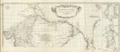
Carte de l'Inde. (Northern section).
1 : 3100000 Anville, Jean Baptiste Bourguignon d, 1697-1782
137-138. North India, Nepal, East Pakistan. The World Atlas.
1 : 5000000 USSR (Union of Soviet Socialist Republics).
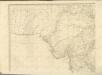
Northern India Including The Presidency of Calcutta.
1 : 9000000 Tallis, J. & F.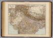
India North.
1 : 6000000 Andree, Richard; Times (London, England)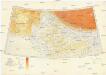
Karte von Europa und Westasien
1 : 4000000 Asie západní Ravensteins Geographische Verlagsanstalt und Druckerei
N. Hindostan.
1 : 4400000 Thomson, John
Map of the East Indian Railway


Gangetic Hindoostan or the countries occupied by the Ganges and the branches
1 : 7000000 Cary, John, ca. 1754-1835 J. Cary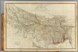
N. Hindostan.
1 : 1480000 Robert Laurie & James Whittle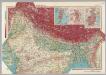
India - North. Pergamon World Atlas.
1 : 5000000 Polish Army Topography Service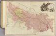
Bengal, Bahar, Oude, Allahabad.
1 : 1480000 Rennell, James, 1742-1830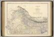
India N.
1 : 4457000 Johnston, Alexander Keith, 1804-1871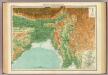
India - north-eastern section.
1 : 4000000 John Bartholomew & Co.
Central division of Hindoostan
1 : 7000000 Cary, John, ca. 1754-1835 J. Cary
Sheet A [North West India], uit: Road map of India
1 : 2027520 titelvariant: North West India; Central & North India; North East India; South India; Annotatie geografische gegevens: De bladen overlappen elkaar gedeeltelijk; Elk blad met bladoverzicht van de hele serie [S.l. : India Tyre & Rubber Company]
Church Missionary Atlas: Part of the Bombay Presidency

Sheet C [North East India], uit: Road map of India
1 : 2027520 titelvariant: North West India; Central & North India; North East India; South India; Annotatie geografische gegevens: De bladen overlappen elkaar gedeeltelijk; Elk blad met bladoverzicht van de hele serie [S.l. : India Tyre & Rubber Company]
Sheet B [Central & North India], uit: Road map of India
1 : 2027520 titelvariant: North West India; Central & North India; North East India; South India; Annotatie geografische gegevens: De bladen overlappen elkaar gedeeltelijk; Elk blad met bladoverzicht van de hele serie [S.l. : India Tyre & Rubber Company]
Provinces of the Lower Ganges.
1 : 2000000 John Bartholomew & Co.
Beloochistan and Sinde.
1 : 3380000 Sharpe, J.
The Province of Bengal and Assam
India Office reference collection of maps Survey of India
Bengal Etc.
1 : 3380000 Sharpe, J.