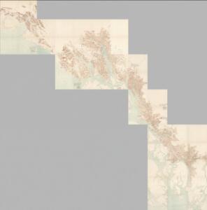
Maps of Alexander Archipelago

Composite: Sheets No. 1-24. Alaskan Boundary Tribunal. (Volume 3). Atlas of Award.
1 : 160000 Alaskan Boundary Tribunal
Facsimile: Portland Channel and Vicinity (portion).
1 : 175000 Scott, Robert N.
Facsimile: Herbert's Colonial Manuscript Southern Alaska (portion).
1 : 3200000 Herbert, L., Senior
Facsimile: S.E. Alaska British Commission Map.
1 : 1280000 Canadian Boundary Commission
Facsimile: Southeastern Alaska.
1 : 2350000 U.S. Coast and Geodetic Survey
Facsimile: Southeastern Alaska with Four Boundary Lines.
1 : 2350000 U.S. Coast and Geodetic Survey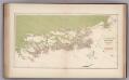
Facsimile: Southeastern Alaska.
1 : 1320000 Canadian Boundary Commission
Facsimile: U.S. Coast Survey Southeastern Alaska (portion).
1 : 2350000 U.S. Coast and Geodetic Survey
Ethnographische Karte des südöstlichen Alaska
1 : 2265000 Aljaška Krause, Aurel Hermann Costenoble
Facsimile: U.S. Coast Survey Southeastern Alaska (portion).
1 : 2350000 Emmons, G.T.
Facsimile: Russian Map Numbered 5 (portion).
1 : 4925000 Alaskan Boundary Tribunal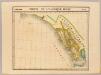
Partie, l'Amerique Russe. Amer. Sep. 23.
1 : 1641836 Vandermaelen, Philippe, 1795-1869
Facsimile: Vancouver's Chart of Coast of Northwest America.
1 : 1180000 Vancouver, George
Cote NO, l'Amerique 5.
1 : 1550000 Vancouver, George, 1757-1798
The Coast of N.W. America.
1 : 825000 Vancouver, George, 1757-1798
Facsimile: Canada (portion).
1 : 1960000 Canadian Department of Railways & Canals
Facsimile: U.S. Map, Tracing Certified by J.S. Dennis
U.S. Coast Survey
Facsimile: Canada and the United Ststes (portion).
1 : 3743000 Genest, F.X.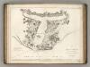
Port des Francais.
1 : 50600 La Perouse, Jean-Francois de Galaup, comte de, 1741-1788
Facsimile: From Vancouvers Atlas - Part of Chart No. XII; Part of Chart No. VII.
1 : 710000 Vancouver, George
Facsimile: Russian Chart.
1 : 880000 Alaskan Boundary Tribunal
Facsimile: Cordova Bay to Cross Sound. Part of British Admiralty Chart. No. 2431.
1 : 530000 British Admiralty
Facsimile: British Columbia and Northwest Territory (portion).
1 : 2850000 Dawson Brothers
Skagway
1 : 250000
Skagway
1 : 250000
Skagway
1 : 250000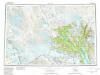
Skagway
1 : 250000
Atlin
1 : 250000
Atlin
1 : 250000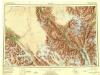
Skagway
1 : 250000
Skagway
1 : 250000
Skagway
1 : 250000
Skagway
1 : 250000
Atlin
1 : 250000