Maps of Alps

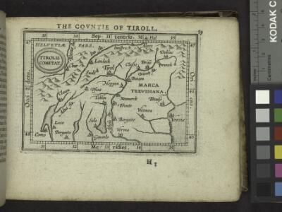
The Countie of Tiroll.
from Abraham Ortelius his epitome of the theater of the worlde / nowe latlye ... renewed and augmented ... by Micheal Coignet, mathematitian of Antwarpe.
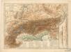
Alpenland
E. von Sydow's Schul-Atlas in sechs und dreissig Karten Sydow, Emil von bei Justus Perthes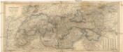
Die Alpenlaender
1 : 1900000 Alpy-oblast Köke, Friedrich Eduard Hölzel
Carta noua accurata del paßagio et strada dalli Paesi Baßi per via de Allemagna per Italia et per via di paesi Suizeri a Geneua, Lione et Roma per seruizio delli marchanti et viagianti in gen[n]ale ad instanza
1 : 2060000 Itálie Danckertsz, Cornelis Cornelio Dancherts
Germany.
1 : 6600000 Lampson, Mary E.
Alpenlander.
1 : 1250000 Berghaus, Hermann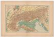
Carta delle Alpi / dir. G. Garollo ; Francesco Vallardi
1 : 2500000 G. Garollo Francesco Vallardi
Süddeutsche Bundesstaaten
Evropa střední
Süddeutsche Bundesstaaten
Evropa střední
Süddeutsche Bundesstaaten
Evropa střední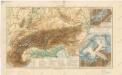
Alpy
Physikalische Karte der Alpen und ihrer Vorlande

Südwestliches Deutschland und Schweiz
Schul-Atlas über alle Theile der Erde nach dem neuesten Zustande, und über das Weltgebäude Stieler, Adolf Justus Perthes
[Kaart], uit: Stanford's map of North Italy & surrounding countries : including Rome, Paris & Vienna
1 : 1750000 London : Edward Stanford
Permanente und feldmässige Befestigungen
Mannheim (Německo) K.k. Generalstabes
Germania benedictina qvae in illa sunt monasteria ord. S. Benedicti monstrans
1 : 2400000 Itálie severní Homannianos Heredes


Carta Nova accurata del Paßagio et strada dalli Paesi Baßi per via de Allemagna per Italia et per via di Paesi svizeri à Geneva, Lione et Roma per servizio delli Marchanti et ...
Wit
Alps. Pergamon World Atlas.
1 : 2500000 Polish Army Topography Service
17-19. Alpi fisiche.
1 : 1500000 Touring club italiano

Alpenländer
Atlas der Geologie Zittel, K.v. ; Berghaus, Hermann Justus Perthes
Geologische Übersichtskarte der Alpen
1 : 1000000 Noë, Franz Ed. Hölzel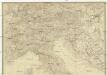
Italien
Itálie severní
Austro-Hungarian Monarchy (western sheet).
1 : 1642000 Johnston, Alexander Keith
Strassen Karte der Alpen und des nördlichen Apennin
1 : 1850000 Alpy (pohoří) Berghaus, Hermann Justus Perthes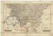
Südwestliche deutsche Bundesstaaten
1 : 2500000 Německo jižní Huber, D.
Der Oesterreichische Kreis
1 : 1340000 Rakousko (1526-1804) Güssefeld, Franz L. Liesganig, Joseph bey Homannischen Erben