Maps of Alps

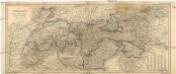
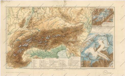
Alpy
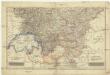
Physikalische Karte der Alpen und ihrer Vorlande

Germany.
1 : 6600000 Lampson, Mary E.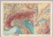
Alps. Pergamon World Atlas.
1 : 2500000 Polish Army Topography Service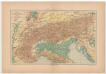
Carta delle Alpi / dir. G. Garollo ; Francesco Vallardi
1 : 2500000 G. Garollo Francesco Vallardi
Alpenland
E. von Sydow's Schul-Atlas in sechs und dreissig Karten Sydow, Emil von bei Justus Perthes
Alpenlander.
1 : 1250000 Berghaus, Hermann
Carta noua accurata del paßagio et strada dalli Paesi Baßi per via de Allemagna per Italia et per via di paesi Suizeri a Geneua, Lione et Roma per seruizio delli marchanti et viagianti in gen[n]ale ad instanza
1 : 2060000 Itálie Danckertsz, Cornelis Cornelio Dancherts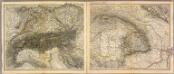
Alpen- u. Donaulaender.
1 : 1900000 Stein, Christ. Gottfr. Dan.
Austro-Hungarian Monarchy (western sheet).
1 : 1642000 Johnston, Alexander Keith
Süddeutsche Bundesstaaten
Evropa střední
Süddeutsche Bundesstaaten
Evropa střední
Süddeutsche Bundesstaaten
Evropa střední
Permanente und feldmässige Befestigungen
Mannheim (Německo) K.k. Generalstabes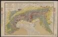
Geologische Übersichtskarte der Alpen
1 : 1000000 Noë, Franz Ed. Hölzel
Austria.
from Abraham Ortelius his epitome of the theater of the worlde / nowe latlye ... renewed and augmented ... by Micheal Coignet, mathematitian of Antwarpe.

Danubii fluminis (â fontibus prope Doneschingam usq. Posonium urbem designati) pars superior
1 : 1982000 Bavorsko (Německo) Homann, Johann Baptist Ioh. Bapt. Homano
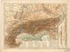
Alps.
1 : 2500000 Andree, Richard; Times (London, England)
Südwestliches Deutschland und Schweiz
Schul-Atlas über alle Theile der Erde nach dem neuesten Zustande, und über das Weltgebäude Stieler, Adolf Justus Perthes
17-19. Alpi fisiche.
1 : 1500000 Touring club italiano
Danubii fluminis (à fontibus prope Doneschingam usq[ue] Posonium urbem designati) pars superior
1 Karte : Kupferdruck ; 46 x 54 cm Homann Johann Baptist Homann
Danubii fluminis (à fontibus prope Doneschingam usq[ue] Posonium urbem designati) pars superior
1 Karte : Kupferdruck ; 46 x 54 cm Homann Johann Baptist Homann
Alpenländer
Atlas der Geologie Zittel, K.v. ; Berghaus, Hermann Justus Perthes
Südwestliche deutsche Bundesstaaten
1 : 2500000 Německo jižní Huber, D.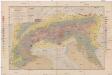
Geologische Übersichtskarte der Alpen
1 : 1000000 Alpy (pohoří) Noe, Franz Suess, Eduard Ed. Hölzel's geographisches Institut
Sprachkarte der Alpen
1 : 2000000 Wäber, Adolf ; Leuzinger, Rudolf [Verlag der Expedition des Jahrbuches des S.A.C.]
Carta Nova accurata del Paßagio et strada dalli Paesi Baßi per via de Allemagna per Italia et per via di Paesi svizeri à Geneva, Lione et Roma per servizio delli Marchanti et ...
Wit