Maps of Alps

[Kaart], uit: Stanford's map of North Italy & surrounding countries : including Rome, Paris & Vienna
1 : 1750000 London : Edward Stanford
Carte des confins de la France et des principales postes, de Paris aux païs estrangers
1 Karte : Kupferdruck ; 43 x 44 cm Placide de Sainte Hélène; Duval chez M.elle Du-Ual sur le quay de l'orloge prés le coin de la rüe de Harlay a l'ancien buïs
Die Alpen
Plastischer Schul-Atlas über alle Theile der Erde : in 24 Karten Woldermann, G Verlag von P. Eckerlein
Carta Noua accurata del Paßagio et strada dalli Paesi Baßi per via de Allemagna per Italia et per via di Paesi svizeri à Geneua, Lione et Roma
1 : 2100000 Mollova mapová sbírka Danckertsz, Cornelis Danckerts, Cornelis I.
Carta Noua accurata del Paßagio et strada dalli Paesi Baßi per via de Allemagna per Italia et per via di Paesi svizeri à Geneua, Lione et Roma
1 : 2100000 Mollova mapová sbírka Danckerts, Cornelis Danckerts, Cornelis I.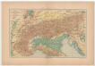
Carta delle Alpi / dir. G. Garollo ; Francesco Vallardi
1 : 2500000 G. Garollo Francesco Vallardi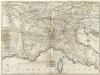
Carte Generale du Theatre de la Guerre en Italie ou sont marquées toutes les Routes que l'on peut tenir tant de France, depuis Paris, que d'Allemagne de puis Vienne en Autriche pour allere a Milan, a Venise, a Florence a Rome a Naples et autres Villes considerables sur ees Routes
1 : 3800000 Mollova mapová sbírka Nolin, Jean-Baptiste Nolin, Jean Baptiste
Carta delle poste e stazioni militari per le provincie d'Italia
1 : 7550000 Itálie
Carta delle poste e stazioni militari per le provincie d'Italia
1 : 7550000 Itálie
Carta delle poste e stazioni militari per le provincie d'Italia
1 : 7550000 Itálie
Carta delle poste e stazioni militari per le provincie d'Italia
1 : 7550000 Itálie Istituto geografico millitare
Carta delle poste e stazioni militari per le provincie d'Italia
1 : 7550000 Itálie
Strassen Karte der Alpen und des nördlichen Apennin
1 : 1850000 Alpy (pohoří) Berghaus, Hermann Justus Perthes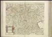
[36][36] Carta nova accurata del Pasagio et strada dalli Paesi Bassi..., uit: Atlas sive Descriptio terrarum orbis
Annotatie: Gedigitaliseerde versie. Amsterdam. Heiloo : Picturae (vervaardiger), 2015. tiff-bestand. Gedigitaliseerd: 07-01-2015; Origineel: Universiteitsbibliotheek Vrije Universiteit (XL.05127.-) ; Netherlands; Titelpagina ontbreekt Wit, Frederik de Amsterdam : Frederick de Wit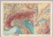
Alps. Pergamon World Atlas.
1 : 2500000 Polish Army Topography Service
Carta noua accurata del paßagio et strada dalli Paesi Baßi per via de Allemagna per Italia et per via di paesi Suizeri a Geneua, Lione et Roma per seruizio delli marchanti et viagianti in gen[n]ale ad instanza
1 : 2060000 Itálie Danckertsz, Cornelis Cornelio Dancherts
Danubii fluminis (à fontibus prope Doneschingam usq[ue] Posonium urbem designati) pars superior
1 Karte : Kupferdruck ; 46 x 54 cm Homann Johann Baptist Homann
Danubii fluminis (à fontibus prope Doneschingam usq[ue] Posonium urbem designati) pars superior
1 Karte : Kupferdruck ; 46 x 54 cm Homann Johann Baptist Homann
Alpenland
E. von Sydow's Schul-Atlas in sechs und dreissig Karten Sydow, Emil von bei Justus Perthes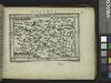
Austria.
from Abraham Ortelius his epitome of the theater of the worlde / nowe latlye ... renewed and augmented ... by Micheal Coignet, mathematitian of Antwarpe.
Das Gebiet der Alpen
Alpy Benecke Bormann, E. Ignaz Fuchs
Exactissima Tabula, qua tam Danubii Fluvii Pars Superior
1 : 2100000 Mollova mapová sbírka Visscher, Nicolaes Jansz. Visscher, Nicolaus
Exactissima Tabula, qua tam Danubii Fluvii Pars Superior
1 : 2100000 Mollova mapová sbírka Visscher, Nicolaes Jansz. Visscher, Nicolaus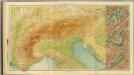
17-19. Alpi fisiche.
1 : 1500000 Touring club italiano
Ober und Mittel Italien

Alpengebiet
Volksschul-Atlas über alle Teile der Erde Lange, Henry Druck und Verlag von Georg Westermann
Alpenlander.
1 : 1250000 Berghaus, Hermann
Ober und Mittel Italien

Alpenländer
Atlas der Geologie Zittel, K.v. ; Berghaus, Hermann Justus Perthes
![[Kaart], uit: Stanford's map of North Italy & surrounding countries : including Rome, Paris & Vienna](https://images-2.georeferencer.com/images/iiif/331151922504/full/,300/0/native.jpg)

