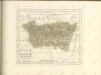
Maps of Haut-Rhin

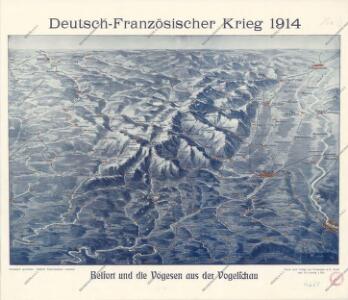
Belfort und die Vogesen aus der Vogelschau

[Exactissima Helvetiae, Rhaetiae, Valesiae ... tabula]
1 : 850000 9 Karten [Kopie von Adrian Braakman] [chez Pierre Schenk et Adrian Braakman], [Amsterdam]
Carte topographique d'Allemagne contenant une partie du duché de Lorraine, d'Allsas et du margraviat superieur de Baaden-Durlach, l'évêcé de Basel, une partie de la Suisse savoir les cantons de Basel et Solothurn, le territoire de Biel, une partie de la Franche-Comté et de la Bourgogne
1 Karte fait par I.W. Iaeger chez l'auteur, Francfort sur le Mein

Notes Gëographiques, uit: [Alsace-Franche-Comté / Bacler d'Albe]
1 : 250000 Backler d'Albe, L. A. G. [Milan : s.n.]
Département du Haut Rhin
1 : 250000 Haut-Rhin (Francie) Chanlaire, Pierre-Grégoire P.G. Chanlaire
Carte topographique d'Allemagne
1 : 224000 Alsasko (Francie) Jaeger, Johann Wilhelm Abraham I.W.A. Iaeger
Carte topographique d'Allemagne
1 : 224000 Alsasko (Francie) Jaeger, Johann Wilhelm Abraham I. W. A. Iaeger
Le Theatre de Bellone :
Mollova mapová sbírka Schenk, Pieter Braakman, Adriaan
Département du Haut Rhin
1 Karte : Kupferdruck ; 48 x 48 cm Houdan au bureau de l'atlas national rue de la Harpe no. 26, et au depôt de cet atlas rue de la Monnoye no. 5
Département du Haut Rhin
1 Karte : Kupferdruck ; 35 x 39 cm Capitaine s.n.
Colmar 140, uit: Special-Karte von Mittel-Europa / nach amtlichen Quellen bearbeitet von W. Liebenow
1 : 300000 titelvariant: W. Liebenow's Mittel-Europa; Annotatie: Titel boven de bladen: W. Liebenow's Mittel-Europa Johannes Wilhelm Liebenow 1822-1897 Frankfurt a. M. : Ludwig Ravenstein
Alsatia tem Svperior, quam Inferior una cum Svndgovia
1 : 120000 Mollova mapová sbírka Homann, Johann Baptist Homann, Johann Baptista - dědici
Colmar 140, uit: [W. Liebenow's Special-Karte von Mittel-Europa]
1 : 300000 titelvariant: W. Liebenow's Mittel-Europa; Annotatie: Titel boven de bladen: W. Liebenow's Mittel-Europa Johannes Wilhelm Liebenow 1822-1897 Hannover : Hermann Oppermann
Freiburg
1 : 200000 1 Karte entworfen und bearbeitet von Woerl ; in Stein gestochen unter seiner Leitung 1831 Herder, Freiburg im Breisgau
Sequani
1 Karte : Kupferdruck ; 39 x 47 cm Sanson; Robert de Vaugondy; Somer chez le Sr. Robert geographe ordin. du roy quai de l'Horloge du Palais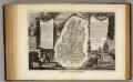
Dept. Du Haut Rhin.
1 : 571000 Levasseur, Victor.
Département du Haut Rhin
1 : 265000 Haut-Rhin (Francie) P. G. Chanlaire et Dumez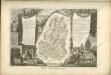


Alsatia tam svperior, quam inferior una cum Svndgovia
1 Karte auf 2 Blättern : Kupferdruck ; 110 x 37 cm Specklin Homännische Erben
Alsatia tam svperior, quam inferior una cum Svndgovia
1 Karte auf 2 Blatt : Kupferdruck ; 110 x 37 cm Specklin Homännische Erben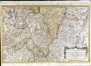
Les prevotez, offices, senéchaussée et comté, qui font partie des balliages de Vosge ou Mirecour et de Nancy
1 Karte : Kupferdruck ; 43 x 68 cm Jaillot Alexis-Hubert Jaillot
Alsatia superior cum Suntgoia &. Brisgoia. [Karte], in: Gerardi Mercatoris et I. Hondii Newer Atlas, oder, Grosses Weltbuch, Bd. 1, S. 250.
1 Karte aus Atlas Mercator, Gerhard und Hondius, Jodocus Jansson, Jan
Cursus Rheni à Basilea usque ad Bonnam III. Sect.
1 : 260000 Mollova mapová sbírka Delisle, Guillaume Homann, Johann Baptista - dědici
Basel 154, uit: [W. Liebenow's Special-Karte von Mittel-Europa]
1 : 300000 titelvariant: W. Liebenow's Mittel-Europa; Annotatie: Titel boven de bladen: W. Liebenow's Mittel-Europa Johannes Wilhelm Liebenow 1822-1897 Hannover : Hermann Oppermann
Les Prevotez Offices Senéchaussée, et Comté, qui font Partie de Balliages de Vosge ou Mirecour et de Nancy, dans le Duché Lorraine les Terres Adjacentes d'Épinal, de Chaté &c. :
1 : 180000 Mollova mapová sbírka Jaillot, Alexis-Hubert Jaillot, Alexis Hubert
Territory Basiliensis Nova Descriptio
1 : 21000 Mollova mapová sbírka Janssonius, Johannes Janssonius, Johannes I
Departement du Haut Rhin
1 Karte : Kupferdruck ; 16 x 14 cm au dépot de l'Atlas national rue de la Monnoye no. 5