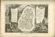
Maps of Lure
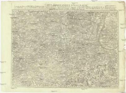
Carte topographique d'Allemagne
1 : 224000 Alsasko (Francie) Jaeger, Johann Wilhelm Abraham I.W.A. Iaeger
Carte topographique d'Allemagne
1 : 224000 Alsasko (Francie) Jaeger, Johann Wilhelm Abraham I. W. A. Iaeger
Sequani
1 Karte : Kupferdruck ; 39 x 47 cm Sanson; Robert de Vaugondy; Somer chez le Sr. Robert geographe ordin. du roy quai de l'Horloge du Palais
Le Theatre de Bellone :
Mollova mapová sbírka Schenk, Pieter Braakman, Adriaan
Basel 154, uit: [W. Liebenow's Special-Karte von Mittel-Europa]
1 : 300000 titelvariant: W. Liebenow's Mittel-Europa; Annotatie: Titel boven de bladen: W. Liebenow's Mittel-Europa Johannes Wilhelm Liebenow 1822-1897 Hannover : Hermann Oppermann
Sequani Partie des Archidconnes de Favernay et de Luxeuil du Dioecese de Besancon
1 : 240000 Mollova mapová sbírka Sanson, Nicolas Somer, Jean Pruthenus Sanson, Nicolas
Territory Basiliensis Nova Descriptio
1 : 21000 Mollova mapová sbírka Janssonius, Johannes Janssonius, Johannes I
Basiliensis Territorii Descriptio Nova
1 : 310000 Mollova mapová sbírka Münster, Sebastian Plantin, Christoph
Département du Haut Rhin
1 Karte : Kupferdruck ; 48 x 48 cm Houdan au bureau de l'atlas national rue de la Harpe no. 26, et au depôt de cet atlas rue de la Monnoye no. 5
Territory Basiliensis Nova Descriptio [Karte], in: Gerardi Mercatoris et I. Hondii Newer Atlas, oder, Grosses Weltbuch, Bd. 1, S. 253.
1 Karte aus Atlas Mercator, Gerhard und Hondius, Jodocus Jansson, Jan
Département du Haut Rhin
1 Karte : Kupferdruck ; 35 x 39 cm Capitaine s.n.
Basel 154, uit: Special-Karte von Mittel-Europa / nach amtlichen Quellen bearbeitet von W. Liebenow
1 : 300000 titelvariant: W. Liebenow's Mittel-Europa; Annotatie: Titel boven de bladen: W. Liebenow's Mittel-Europa Johannes Wilhelm Liebenow 1822-1897 Frankfurt a. M. : Ludwig Ravenstein
Territory Basiliensis Nova Descriptio [Karte], in: Novus atlas absolutissimus, Bd. 4, S. 239.
1 Karte aus Atlas Janssonius Offizin
Basiliensis Territorii Descriptio Nova [Karte], in: Theatrum orbis terrarum, S. 273.
1 Karte aus Atlas Ortelius, Abraham Vrients, Jan Baptista
Basiliensis Territorii Descriptio Nova [Karte], in: Theatrum orbis terrarum, S. 178.
1 Karte aus Atlas Ortelius, Abraham
Belfort, Basel
1 : 100000 1 Karte par Aug. Jaccard et Alb. Muller [i.e. Müller] [Wurster & Randegger], [Winterthur]
Le Theatre de la Guerre Sur le Haut Rhein
1 : 142000 Mollova mapová sbírka Sanson, Guillaume
Topographische Karte der Schweiz
1 : 100000 25 Karten vermessen und hrsg. auf Befehl der Eidgenössischen Behörden ; aufgenommen unter der Aufsicht des Generals G.H. Dufour Eidg. Topographisches Bureau, [Genève], [später: Bern]
Le cours du Rhin de Bâle à Hert près Philisbourg contenant l'Alsace et partie du Brisgau, 1
1 Blatt : 76 x 52 cm Le Rouge
184. Gebweiler, uit: Topographische Uebersichtskarte des Deutschen Reiches / herausgegeben v. d. Kartogr. Abt. d. Königl. Preuß. Landesaufnahme
1 : 200000 titelvariant: Topogr. Übersichtskarte des Deutschen Reiches; Annotatie: Titel boven bladen ook: Topogr. Übersichtskarte des Deutschen Reiches; Annotatie geografische gegevens: Op elk blad twee maatstokken: 10 Kilometer = 5,5 cm; 1 geogr. Meile = 3,6 cm; Legenda onder op elk blad Königlich Preußische Landesaufnahme. Kartographische Abtheilung [S.l : Königlich Preußische Landesaufnahme, Kartographische Abtheilung]
Departement du Haut Rhin
1 Karte : Kupferdruck ; 16 x 14 cm au dépot de l'Atlas national rue de la Monnoye no. 5
Alasatia superior et inferior III. tabulis delineata, 1
1 Blatt : 62 x 62 cm s.n.
Partie de la Haute Alsace le Suntgaw, et le Brisgaw Partie du Canton de Basle et du Cours du Rhein ou sont les Valles de Brisac Fribourg, Colmars Huningue Befort et Basle
1 : 160000 Mollova mapová sbírka Baillieul, Gaspard Bailleul, Gaspard
Alsatia tem Svperior, quam Inferior una cum Svndgovia
1 : 120000 Mollova mapová sbírka Homann, Johann Baptist Homann, Johann Baptista - dědici
Territory Basiliensis nova descriptio
1 Karte : Kupferdruck ; 37 x 48 cm Janssonius; Keere Ioannes Ianssonius excudit
Blatt II: Belfort, Basel, uit: Topographische Karte der Schweiz / vermessen und hrsg. ... unter Aufsicht des Generals G.H. Dufour
1 : 100000 Annotatie: Met plaatsnamenregister (bl. V), bladwijzer (bl. XXI) en hoogteregister (bl. XXV); Voor aanwezige bladen zie overzichtsblad Dufour, G. H. [Bern : Eidg. Topogr. Bureau]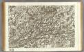
145 Vesoul.
1 : 86400 Cassini family; Cassini, Cesar-Francois, 1714-1784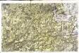
[Vesoul]
1 Blatt : 61 x 92 cm Durand s.n.
Atlas Suisse
1 : 120000 16 Karten levé et dessiné par J.H. Weiss [et Joachim Eugen Müller] aux frais de J.R. Meyer à Aarau dans les années 1786 à 1802 ; gravée [sic] par [Christophe] Guérin, [Matthias Gottfried] Eichler et [Johann Jakob] Scheurmann [Johann Rudolf Meyer], Aarau